Link to the full scale graphic
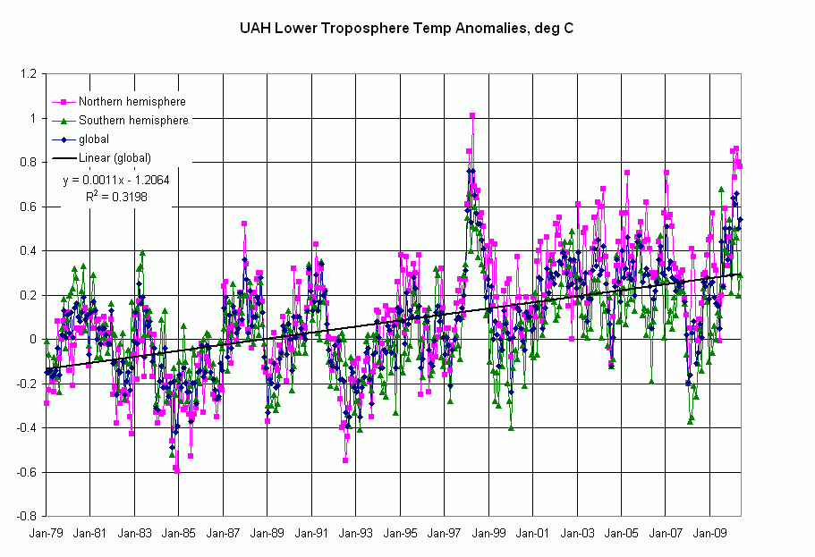
These monthly data are quite noisy, as indicated by this line’s appallingly low R^2 of 0.32. We can quickly create an annual average, which is shown with annual minimum and maximum in the following graph.
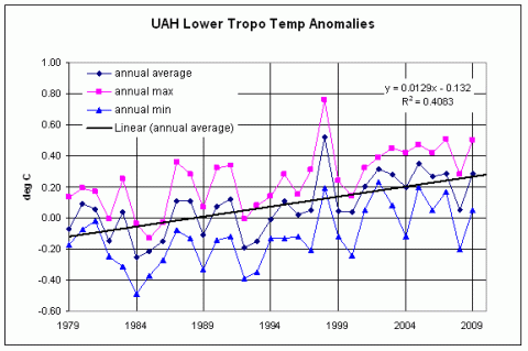
Same trend, but still noisy (if only 1998 hadn’t been so darned hot). But with this trend, it will be 50 years before the temperature anomaly passes through a measly 1.0 degree C.
During the same time period as the UAH temperature data, atmospheric CO2 (MLO, annualized) increased by approximately 50 ppm, representing a trend of 17 ppm/decade. Doubling atmospheric CO2 will supposedly lead to a 3 degree C increase in global temperature, but at this rate, even that won’t happen for another 150 years or so.
It’s all good; we can sip another frozen margarita from the comfort of our inflatable pool chairs.
Side note: In my prior life in the oil exploration business, we often played “trendology”: If you didn’t know anything about a particular oil producing area, you could start by drawing lines between existing oil fields. Sometimes this actually worked and you found a new field “on trend,” but in those days (the late 70s-early 80s), the trends told us that the price of oil would be heading towards $100/bbl by mid1986. In case you weren’t there, it bottomed around $12 that year.
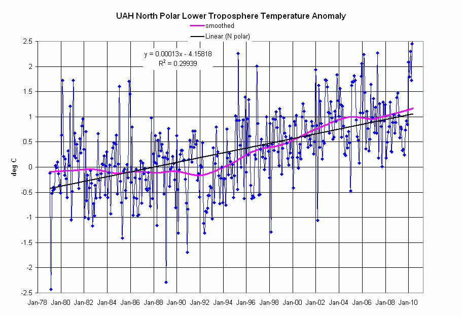
It is in the north polar data (where Official Trend value given in the UAH data file is an unhealthy 0.47 deg/decade), that a different picture emerges.
Link to full size graphic
Link to graph with plus/minus standard deviation overlays
The single best fit line shown, with another appallingly low R^2, matches that Official Trend. The curve shown in pink, however, is a fit obtained by use of the LOESS utility for Excel, available free here. LOESS or LOWESS is a locally-weighted fit utilizing subsets of the data to produce a smooth curve. The smoothing strength is user-controlled. Please note that I haven’t done any comparative smoothings; the pink curve was a first try. Although I haven’t scrutinized the algorithm, it looks similar to what we called “adaptive fitting,” often used in the oil business to generate contour maps from sparse data.
What do we observe from the LOESS curve? For the first 13 years in the data set, the curve is nearly flat. Beginning in 1992 and running for approximately 12 years, there is a sustained slope representing an Alarming Trend of 0.9 deg/decade; after a two year flat spot (approx 2005-07), we’re back on nearly the same trend!
Seasonal Arctic sea ice extent data for the corresponding period are shown below; ignore the curves on this graph for a moment. The minimum ice extent data points from the 1970s to 1990 (points inside the oval) are nearly flat; is the “shoulder” at 1990 the beginning of a real response to this Alarming Trend? Even the deniers realize that there’s some rapid ice melt this year.
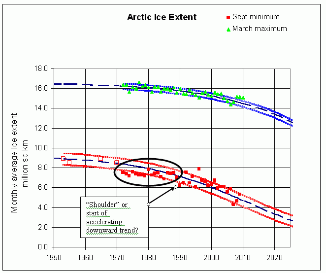
link to the full scale graphic
Is the Alarming Trend, 90% higher than the Official Trend, responsible for the accelerating arctic ice melt documented here and here? These observations beg the following questions, which I pose to the community at large: