
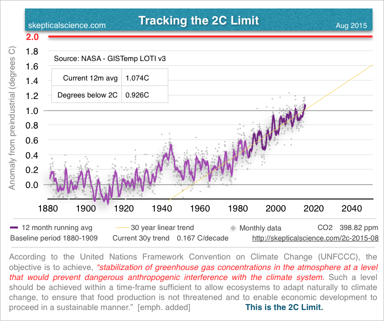
We ticked up this month over last month on the current 12 month average temperature anomaly in the GISS data. In July we stood at 1.060C and August is now 1.074C. Full size image here.
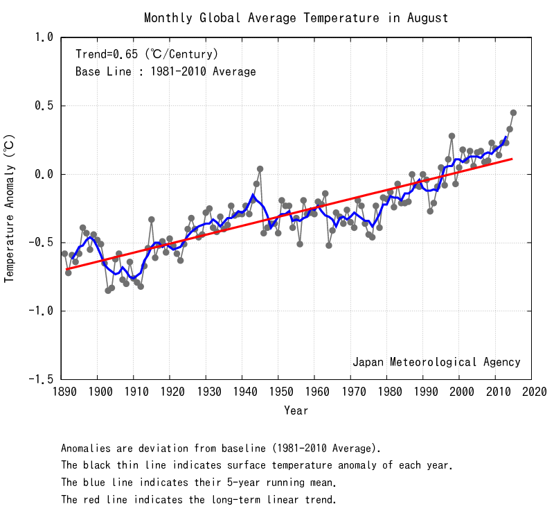
The Japanese Meteorological Agency is showing very strong, rapid warming with August hitting a new high anomaly. This is likely due to the current El Nino starting to express itself in the surface temperature data.
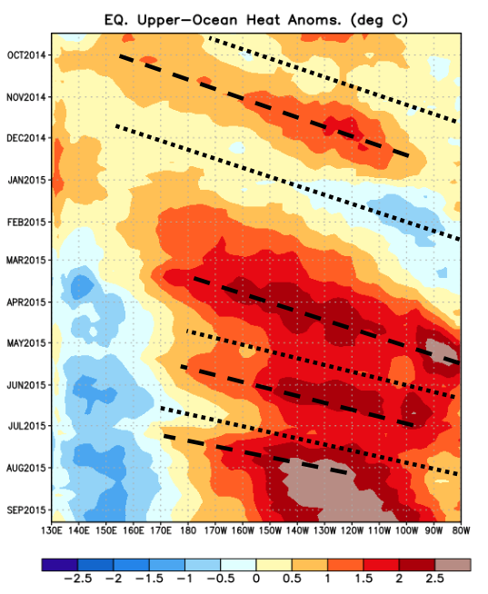
The weekly ENSO report from NOAA shows that the current El Nino is still going strong, but we're about to move into another downwelling phase (dotted line). But that will probably be followed by yet another upwelling phase (dashed line). Overall, you can see quite a lot of heat coming out of the equatorial ocean over the past 6 months.
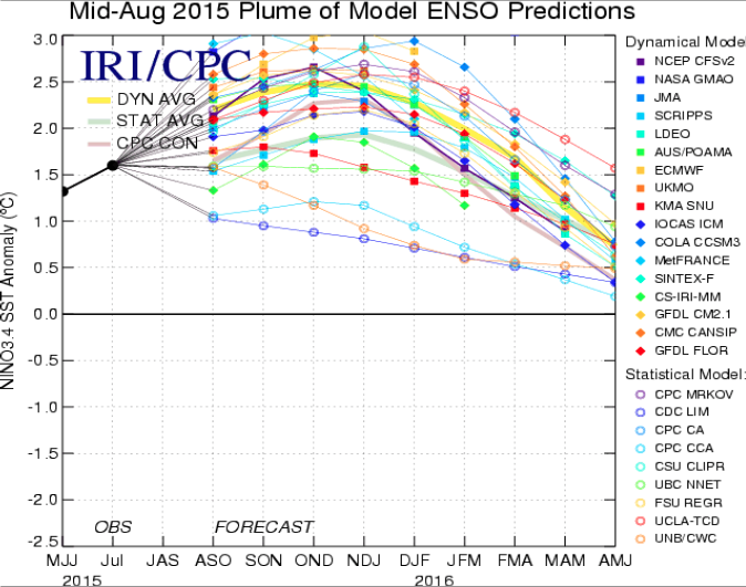
Model predictions suggest the current El Nino is going to persist through the rest of the year, and on into the Spring before subsiding again. Bear in mind, there's a 4-6 month delay between the El Nino and when that heat gets expressed in the surface temperature data.
As things stands, it looks like the rest of this year surface temperature will continue to rise with 2015 showing a strong first place for the warmest year on record. Then, we'll have all of 2016 to watch as the the El Nino pulls back, but the warming continues to into the Summer.
Posted by Rob Honeycutt on Monday, 21 September, 2015
 |
The Skeptical Science website by Skeptical Science is licensed under a Creative Commons Attribution 3.0 Unported License. |