It isn’t that there is no evidence of the crash. In July of last year, a portion of a wing was found near Madagascar and Reunion Island in the Indian Ocean. Since then, other debris has been found in the Western Indian Ocean.
Using the location of where the wing debris were found, oceanographers from University of Santiago de Compostela (Spain), the United States National Oceanographic and Atmospheric Administration (NOAA), the University of Miami, University of Hawaii, and the Commonwealth Science Industrial and Research Organization (CSIRO) in Australia have a lead. Their hypothesis is published in the Journal of Operational Oceanography and can be found here.
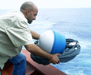
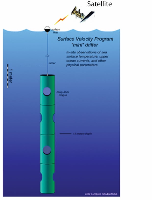
The authors used two sets of data to help track the possible paths of the debris. First, they took advantage of observations from NOAA’s Global Drifter Array. These drifters have a surface float and an anchor or drogue that extend to 15m deep, and a suite of sensors that communicate via satellite their location and parameters like ocean currents, surface ocean temperature, pressure, wind, and salinity. In the Indian Ocean alone, there are approximately 400 of these drifters at any time, providing continuous ocean measurement information. At some point the drifters loose their drogue and these are the ones used in this study as they better simulate debris dynamics.
The authors tracked drifters that were released or that traveled near the search area in the southeastern Indian Ocean. Several of these drifters traveled across the Indian Ocean to the final destination near Reunion Island, very near where the wing debris was found, and the duration it took the drifters to make their trek was similar to that of the debris.
In addition, the authors used a computer model of ocean currents from the University of Hawaii. This model incorporated the surface ocean winds and provided a realistic simulation of ocean currents during and after the plane crash. Using these computer-derived currents, the scientists released thousands of replica drifters to see where they traveled.
By combining the real trajectories from actual instruments with the simulated trajectories, scientists were able to identify the location where a crash was most likely, shown in the image below.
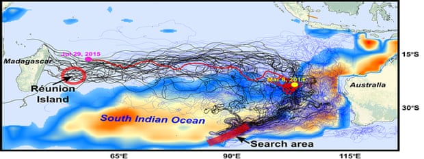
More recent debris discoveries confirm the general westward drift predictions from the computer program and analysis. While the assessments from this study are interesting in that they are related to the MH370 accident, the techniques that the researchers developed can be used for other ocean-debris scenarios and are useful both for basic research as well as more tangible applications for societal benefits, such as search and rescue efforts, oil spills, and fish larval transports.
I contacted author Joaquin Trinanes to ask about the difficulties of this project and its importance. He told me:
