


 Arguments


In Search Of: Himalayan Ice Loss
Posted on 31 May 2012 by mspelto, Daniel Bailey
The lofty mountains at the Roof of the World, the Himalayas, harbor many strange and mythical things. From the Abominable Snowman (myth) to the magnificent Potala Palace (wondrously real), to the far horizon of lost Shambhala (mythical [?] Shangri-La) to the manifold tales of the Vedas (also real), many a fanciful tale emerge to titillate the uninitiated. To this we can add the "fake-skeptic" meme that Himalayan glaciers are growing, as recent scientific assessments belie that unsupported assertion.

Fig 1. Pohtala Palace
In the high mountains of Central Asia, detailed glacier mapping inventories, from GLIMS: (Global Land Ice Measurements from Space), ICIMOD (International Centre for Integrated Mountain Development) and ISRO ( Indian Space Research Organization) of thousands of glaciers have indicated increased strong thinning and area loss since 2000 throughout the region except the Karakoram. The inventories rely on repeat imagery from ASTER, Corona, Landsat, IKONOS and SPOT imagery.

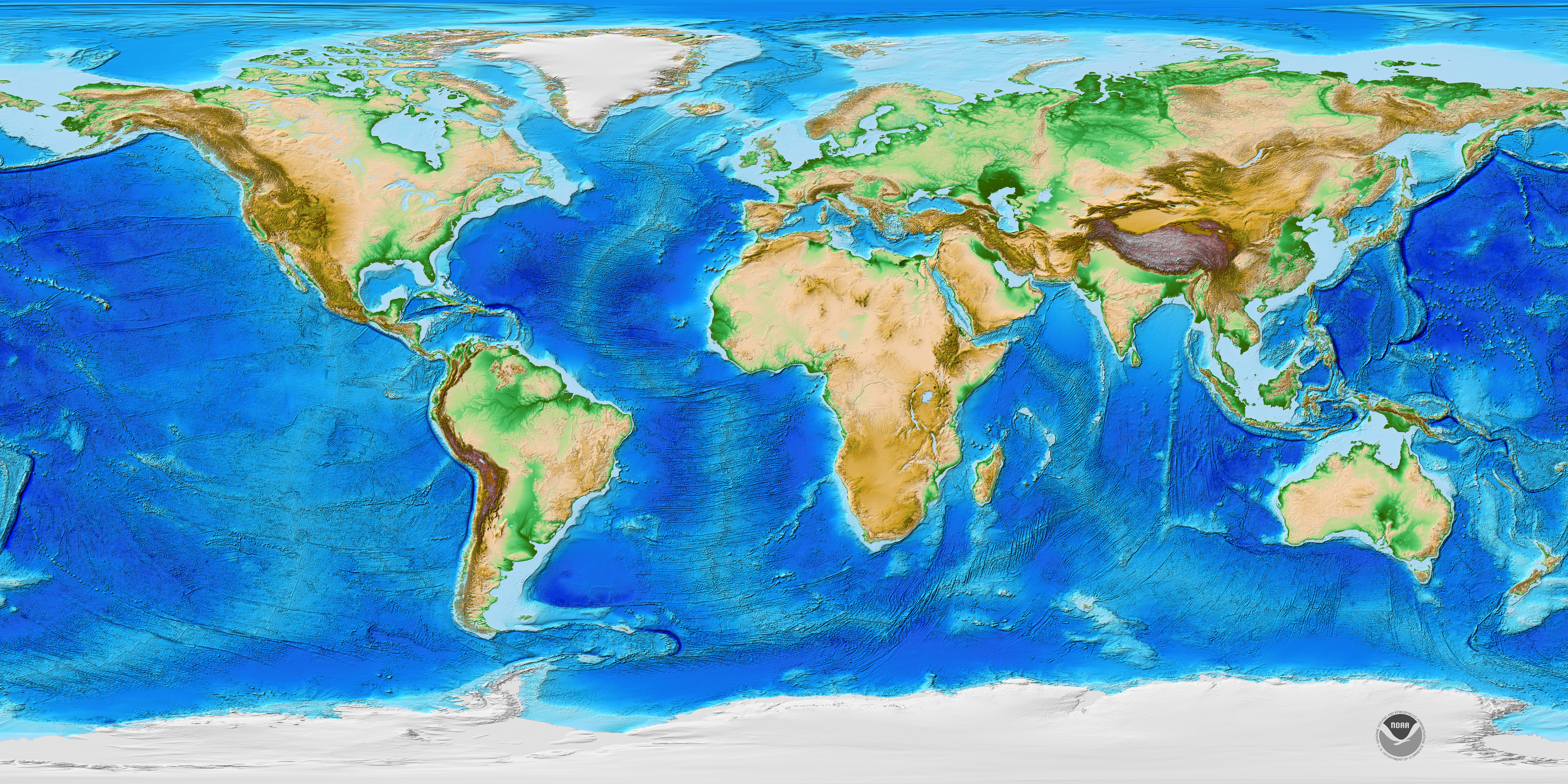
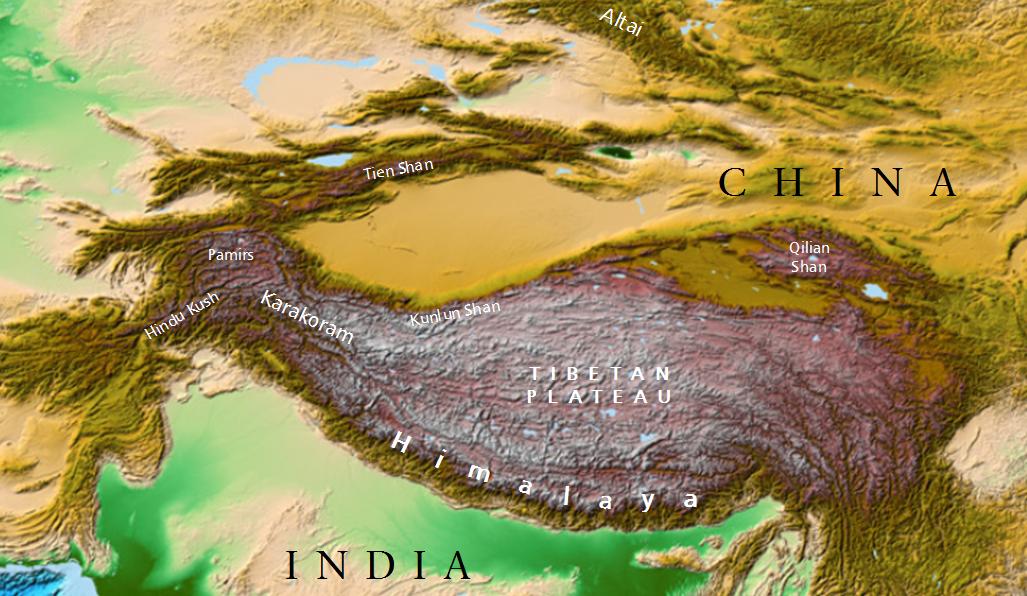
Fig 2. Area of the Himalaya (background image courtesy NOAA, cartography by Daniel Bailey). Really super-big version here.
Glacier change in Himalaya, Altai, Tien Shan, Pamir and Qilian Ranges
In the Russian Altai, mapping of 126 glaciers indicates a 19.7 % reduction in glacier area 1952-2004, with a sharp increase after 1997 (Shahgedanova et al., 2010). In Garhwal Himalaya, India, of 58 glaciers examined from 1990-2006 area loss was 6% (Bhambri et al, 2011). They also noted the number of glaciers increased from 69 (1968) to 75 (2006) due to the disintegration of ice bodies. Examination of 466 glaciers in the Chenab, Parbati and Baspa Basin, India found a 21% decline in glacier area from 1962 to 2004 (Kulkarni, 2007). Glacier fragmentation was also observed in this study, which for some fragments represents a loss of the accumulation area, which means the glacier will not survive (Pelto, 2010). In the Nepal Himalaya area loss from 1963-2009 is nearly 20% (Bajracharya et al., 2011).

Fig 3. Map of the Karakoram and Himalaya showing the major river basins and the locations of measured rates of change in area and of a sample of glacier length change and mass budget measurements (Bolch et al, 2012)
The Langtang sub-basin is a small northeast-southwest elongated basin, tributary of Trishuli River north of Kathmandu and bordered with China to the north. The basin encompasses an area of 554 km2. The basin contained 192 km2 of glacier area in 1977, 171 km2 in 1988, 152 km2 in 2000 and 142 km2 in 2009. In 32 years from 1977 to 2009 the glacier area declined by 26% (Bajracharya et al., 2011). The only published catchment study indicates a 75% loss of ice by 2088 (Immerzeel, 2012).
In the Khumbu region, Nepal volume losses due to thickness changes increased from an average of 320 mm/yr 1962-2002 to 790 mm/yr from 2002-2007, including area losses at the highest elevation on the glaciers (Bolch et al., 2011). The high elevation loss is also noted in Tibet on Naimona’nyi Glacier which has not retained accumulation even at 6000 meters. This indicates a lack of high altitude snow-ice gain (Kehrwald et al, 2008).
The Dudh Koshi basin is the largest glacierized basin in Nepal. It has 278 glaciers of which 40, amounting to 70% of the area, are valley-type. Almost all the glaciers are retreating at rates of 10–59 m/year, but the rate has accelerated after 2001 (Bajracharya and Mool, 2009).
In the Tien Shan Range over 1700 glaciers were examined from 1970-2000 glacier area decreased by 13%, from 2000-2007 glacier area shrank by 4% a faster rate than from 1970-2000 (Narama et al, 2010). An inventory of 308 glaciers in the Nam Co Basin, Tibet, noted an increased loss of area for the 2001-2009 period, 6% area loss (Bolch et al., 2010). Zhou et al (2009) looking at the Nianchu River basin southern Tibet found a 5% area loss, 1990-2005. Cao et al (2010) completed an inventory of 244 glaciers in Lenglongling Range of Eastern Qilian Mountains from 1972 to 2007 and found a 23.5% loss in glacier area. The highest rate of 1% per year of area loss was identified from 2000 to 2007. Pan et al (2011) looking at the Gongga Mountains, China found a 11.3% area loss from 1966-2009.
In the Wakhan Corridor, Pamir Rage, Afghanistan 30 glaciers were examined over a 27 year period, 1976-2003, indicating that 28 of the glacier retreated with an average retreat of 294 m, just over 10 meters/yr (Haritashya et al, 2009).
The consistent picture that emerges is net ice loss in most parts of the Himalaya. Measurements suggest that the rate of loss has increased since about 1995 (Bolch et al, 2012).

Fig 4. The glacier retreat since the mid-19th century is obvious in the Himalaya, with the exception of the glaciers at Nanga Parbat in the northwest (RA, CL). Glaciers in the Karakoram show complex behavior (Bolch et al, 2012).
The Karakoram
The Karakoram is the one range where a mix of expansion and retreat is seen. The anomalous expansions are confined to the highest relief glaciers and appeared suddenly and sporadically (Hewitt, 2005). After decades of decline, glaciers in the highest parts of the central Karakoram expanded, advanced, and thickened in the late 1990s. Many of the largest glaciers in the Karakoram are still retreating, including the largest Baltoro, Panmah and Biafo Glacier, albeit slowly (Hewitt, 2011). Measurements indicate a possible mass-gain from 2002-2006 with a decrease thereafter (Bolch et al, 2012), (Cogley, 2012); the estimated contribution of the glaciers of the Karakoram to sea level rise is lower than previously suggested (Gardelle et al, 2012).

Fig 5. The Karakoram mountains in the western Himalayas as seen from a NASA satellite. New research published in the journal Nature Geoscience is showing that some of the glaciers in the region has experiences small gains in mass in the 21st century (Image courtesy CNN and NASA).
Glacier Runoff Importance
About 800 million people live in the watersheds of the Brahmaputra, Ganges and Indus rivers and rely (to various degrees) upon the water released from glaciers. The glaciers of the Himalaya are natural buffers of hydrological seasonality, releasing meltwater during summer and early autumn, in particular. This meltwater is a major source of stream flow in the Karakoram and the northwest parts of the Himalaya, which receive about two-thirds of their high-altitude snowfall from the westerly cyclones (mainly in winter).

Fig 6. Main wind systems (Bolch et al, 2012)
It is less important in the monsoon-dominated areas, such as the central and eastern Himalaya, which have abundant summer precipitation (during which they receive 80% of their yearly total).

Fig 7. Mean precipitation in January and July (Bolch et al, 2012)
Overall Changes
A new means of assessing glacier volume is the Gravity Recovery and Climate Experiment (GRACE), which cannot look at specific changes of individual glaciers or watersheds. In the high mountains of Central Asia, GRACE imagery found mass losses of -264 mm/a for the 2003-2009 period (Matsuo and Heki, 2010). This result is in relative agreement with the other satellite image assessments, but is at odds with the recent global assessment from GRACE (Jacobs et al, 2012), which estimated Himalayan glacier losses at 10% of that found in the aforementioned examples for volume loss for the 2003-2010 period. At this point the detailed inventories of thousands of glaciers are better validated and illustrate the widespread significant loss in glacier area and volume, though not all glaciers are retreating.
To sum up, Himalayan glaciers supporting hundreds of millions of people are showing consistent loss of ice, even in the Karakoram (but to a lesser degree here for a variety of reasons). When glacier ice is lost in the long-term, the annual water balance is affected.
Summer runoff in the central and eastern Himalaya should be little affected, provided the monsoons still occur in their normal timings and intensities. Runoff in the remainder of the year is expected to decrease as glacial mass continues to decrease. Runoff from the Karakoram glaciers is not expected to diminish before the end of the 21st century, with the Indus River valley the primary beneficiary recipient (Rees and Collins, 2006).
So when you hear someone say "the Himalayas are gaining ice", remember to not check your skepticism at the door with the Yeti coat-check girl...
Recommended Reading
- From a Glaciers Perspective
- Himalaya Glacier Index
- Glacier Index of Posts
- World Glacier Monitoring Service
Note: this has been adapted into the Advanced rebuttal to the myth Himalayan glaciers are not shrinking.


 0
0  0
0


Comments