


 Arguments
Software
Resources
Comments
The Consensus Project
Translations
About
Support
Arguments
Software
Resources
Comments
The Consensus Project
Translations
About
Support
![]()
![]()
![]()
![]()
![]()
![]()
![]()
![]()
![]()
![]()


![]()


Latest Posts
- Skeptical Science New Research for Week #18 2024
- At a glance - Clearing up misconceptions regarding 'hide the decline'
- Pinning down climate change's role in extreme weather
- 2024 SkS Weekly Climate Change & Global Warming News Roundup #17
- Fact Brief - Is Antarctica gaining land ice?
- Simon Clark: The climate lies you'll hear this year
- Skeptical Science New Research for Week #17 2024
- Water is at the heart of farmers’ struggle to survive in Benin
- At a glance - The difference between weather and climate
- India makes a big bet on electric buses
- 2024 SkS Weekly Climate Change & Global Warming News Roundup #16
- EGU2024 - An intense week of joining sessions virtually
- Skeptical Science New Research for Week #16 2024
- How extreme was the Earth's temperature in 2023
- At a glance - Is the science settled?
- What is Mexico doing about climate change?
- 2024 SkS Weekly Climate Change & Global Warming News Roundup #15
- Fact Brief - Did global warming stop in 1998?
- Skeptical Science New Research for Week #15 2024
- EGU2024 - Picking and chosing sessions to attend virtually
- At a glance - The Pacific Decadal Oscillation (PDO) is not causing global warming
- Climate Adam: Is Global Warming Speeding Up?
- 2024 SkS Weekly Climate Change & Global Warming News Roundup #14
- Gigafact and Skeptical Science collaborate to create fact briefs
- Skeptical Science New Research for Week #14 2024
- How can I make my retirement plan climate-friendly?
- At a glance - Global warming and the El Niño Southern Oscillation
- A data scientist’s case for ‘cautious optimism’ about climate change
- 2024 SkS Weekly Climate Change & Global Warming News Roundup #13
- Skeptical Science New Research for Week #13 2024
Comment Search Results
Search for temperature trends
Comments matching the search temperature trends:
- At a glance - Does CO2 always correlate with temperature?
William at 10:05 AM on 12 April, 2024Instead, the correct way to look at temperature trends is to examine them over multiple decades - 30 years is standard in climate science. So to answer the question, "where are we now?", one would look at the temperature record from 1992-2022.
30 years is a tiny sample size - there has been 4.5billion years of weather. The next 100, 1000, or even 10,000 of weather would not necessarily mean anything either way.
It could be 3c colder or warming and still be natural variation . We just don't have the records . We have guess for large periods of milliosn of years - but nothing on any specific period of less than 1000 .
There could have been multiple periods of 100 years whne the temp when up or down by 1.2c. It is statiscally likely there have been . because there have millions of 100 year periods.
- Climate - the Movie: a hot mess of (c)old myths!
Bob Loblaw at 04:38 AM on 1 April, 2024It's also worth noting that the trend values OPOF is providing from the SkS Trend Calculator use 2σ ranges for the uncertainties.
...and if you look closely, none of the trends OPOF mentions are significantly different from 0. So, the "cooling from 1940 to 1970" is really "no significant warming [or cooling] from 1940 to 1970". To argue "cooling", you need to
- ignore the statistical significance of the linear fit
- choose your starting point carefully.
In comment 41, Two Dog makes the point "...then only a few years "blip" in warming must presumably call the theory into question? ". That depends on "the theory" being that CO2 is the only factor causing warming on an annual or several-year basis. As we've been pointing out, this is not "the theory" that climate science is working with.
Two Dog is making the classical logic failure that is discussed in the SkS Escalator.

In fact, Two Dog is also arguing with himself. On the one hand, he is arguing that climate science can't possibly know all factors that might be affecting global temperature, no matter how many factors they have already considered in the relevant scientific literature. And then on the other hand, he is criticizing climate science because any blip in temperature that is not explained solely using CO2 as the only factor "...must presumably call the theory into question?". The two positions he argues are mutually contradictory.
Unfortunately this is a common thing in "skeptical" arguments against well-supported climate science - mutually-contradictory (and often impossible) positions on the subject. It's like the Queen in Alice in Wonderland:
I daresay you haven't had much practice,' said the Queen. 'When I was your age, I always did it for half-an-hour a day. Why, sometimes I've believed as many as six impossible things before breakfast.
- Climate - the Movie: a hot mess of (c)old myths!
One Planet Only Forever at 02:46 AM on 1 April, 2024Note regarding my comments @39 and @45,
In the SkS Temperature Trend calculator the evaluation of 30 years of data from 1940 through to, and including, 1970 is actually done using the End date 1971.
Note the following trends for full 30 year periods:
- 1940 to 1971 is -0.037 +-0.057 C/decade
- 1942 to 1973 is -0.018 +-0.055 C/decade
- 1943 to 1974 is -0.001 +-0.057 C/decade
- 1944 to 1975 is +0.003 +-0.056 C/decade
- 1945 to 1976 is +0.018 +-0.054 C/decade
- 1946 to 1977 is +0.022 +-0.053 C/decade
- Climate - the Movie: a hot mess of (c)old myths!
One Planet Only Forever at 02:26 AM on 1 April, 2024Two Dog @41,
Regarding your persistent belief in the mystery of the 30 years from 1940 to 1970 I will add the following to my attempt to help you with my comment @39.
The SkS Temperature Trend Calculator (link here - again) shows that the temperature trend from 1940 to 1970 was: GISTEMPv4 Trend: -0.043 +-0.052 C/decade. A little bit of investigation of that 30 year period exposes the following facts:
- trend for 1941 to 1970 was -0.038 +-0.063 C/decade
- trend for 1942 to 1970 was -0.026 +-0.066 C/decade
- trend for 1943 to 1970 was -0.021 +-0.070 C/decade
- trend for 1944 to 1970 was -0.013 +-0.074 C/decade
- trend for 1945 to 1970 was +0.009 +-0.075 C/decade
- trend for 1946 to 1970 was +0.025 +-0.078 C/decade
- trend for 1947 to 1970 was +0.026 +-0.083 C/decade
- trend for 1948 to 1970 was +0.032 +-0.090 C/decade
So, within that 30 year data set there appears to be a ‘mysterious or questionable’ trend of the temperature trends. The claim of cooling since 1940 becomes a claim of warming since 1945. What’s up with that?.
Note the following trends for 30 year periods:
- 1944 to 1974 is +0.006 +-0.060 C/decade
- 1945 to 1975 is +0.019 +-0.057 C/decade
- 1946 to 1976 is +0.029 +-0.055 C/decade
Based on your most recent comment, a better question for you to investigate appears to be: What is preventing you from improving your understanding of this issue?
- Climate - the Movie: a hot mess of (c)old myths!
One Planet Only Forever at 13:21 PM on 29 March, 2024Two Dog @32,
Bob Loblaw has provided a good response to your question about the lack of warming from 1940 to 1970. And Eclectic has posed good questions for you.
I have something to add that may help you better understand things.
The SkS Temperature Trend Calculator (link here) can be used to see that the temperature trend for the data set from 1940 to 1970 was indeed negative (GISTEMPv4 Trend: -0.043 +-0.052 C/decade). However, within that time period:
- trend for 1945 to 1965 was positive (+0.017 +-0.108 C/decade)
- trend for 1950 to 1960 was more positive (+0.126 +-0.302 C/decade)
What’s up with positive trends within a negative trend? You may notice that the 2sigma values are significantly higher for the shorter data sets. The 2 sigma for 1940 to 1970 is also quite high. So look at longer data sets.
- trend for 1935 to 1975 is -0.003 +-0.040 C/decade
- trend for 1925 to 1985 is +0.048 +-0.024 C/decade
Factors other than CO2 appear to be the cause of the negative trend for the 1940 to 1970 data set. But within that data set the trend of the temperature was still positive. What’s up with that? A significant part of the explanation is apparent in the Temperature Trend Calculator image for the longer data sets.
The temperatures from 1940 to 1947 can be seen to be unusually high. That set of unusually high temperatures needs to be explained, not the apparent lack of warming through the next 30 years compared to that ‘high set of values' (just like the ‘appearance of cooling for a period of time after 1998’ is explained by the explanation for the unusually high temperature in 1998 - also see the SkS myth/argument “Did global warming stop in 1998, 1995, 2002, 2007, 2010?” which could have included 1944)
I am sure if you put in some effort you could find a reliable source (perhaps you could find such information on this SkS website) that would effectively explain why the 1940 to 1947 set of years were unusually warm (warning: there is an explanation - nothing mysterious or magical happened - warming influence of increased CO2 still happened)
- At a glance - Evidence for global warming
Paul Pukite at 07:31 AM on 7 December, 2023You may be skeptical of the claims, but they're out there and after 5 years no-one has tried to refute, debunk, or falsify the claims. I submitted a presentation to next spring's US CliVar Workshop which they're calling "Confronting Earth System Model Trends with Observations: The Good, the Bad, and the Ugly".
Comparing historical trends in Earth system models with observations to identify and understand where models are performing well and poorly to focus the community on where more work is needed to ensure credible projections moving forward. What are we getting right? What are we getting wrong and why? What have we not yet paid enough attention to and where might surprises lie?
Objectives
For over 40 years, and through several rounds of IPCC reports, the climate science community has made projections of climate change under specific emissions scenarios. While assessments of the fidelity of Earth System Model simulations over the historical period have been performed for basic variables such as near surface air temperature, internal variability and a relatively small signal in a short observational record has made a comprehensive assessment challenging.
My submitted abstract addresses the internal variability part. I don't know yet whether it was accepted for presentation, but I'm confident that it won't be wasting anyone's time.
- At a glance - Evidence for global warming
One Planet Only Forever at 14:11 PM on 3 December, 2023Paul Pukite @23,
I will continue to pursue the points I raised regarding your comment @2.
I am confident that nigelj’s comment about similar trends was regarding ‘a trend like the global average surface temperature data - warming rather than cooling with more significant warming occurring after 1950 than prior to 1950’.
Your comment @2, and later comments except for your latest @23 (sort of), appear to insist that it is not possible to have confidence regarding a warming trend in the NINO 3.4 region (the middle of the equatorial Pacific).
Your comment @2 starts with:
"All these show a similar warming trend." [nigelj’s point]
Not the middle of the equatorial Pacific. (your response)
As my comments should indicate, I learned from and accepted nigelj’s finding of an explanation about the current models indicating a larger amount of warming in the equatorial Pacific (especially the east part) than the actual observations. However, as I commented, that does not alter the incorrectness of your comment @2. But you do appear to have finally accepted your incorrectness (sort of) by ‘seeing’ a warming trend in the NINO 3.4 SST data.
However, I am still confident that it is incorrect to declare that having confidence that ‘the NINO 3.4 SST historical data indicates warming similar to the global average surface temperature data’ requires an accurate explanation for the trend being lower than the current global climate models for that region and it requires that understood influence to be removed from the SST values.
The data is what it is regardless of the mechanisms producing it. Large variations of the temperature data simply requires a longer duration of the data set to have confidence that there is a warming trend. And a lower trend rate will also require a longer data set to establish confidence.
The NOAA presentation of the centered 30-year base periods (linked here) that I provided a link to in my comment @16 helpfully presents the trend of the SST NINO3.4 data set in spite of significant variations in the data values. Each 30-year period contains a substantial variety of the variation. Comparing the 5 year steps for the data starting in 1936 shows that there is indeed a recent trend (more significant after 1950 than before 1950 – consistent with the NINO3.4 chart you included in your comment @23). The 1966 to 1995 values, and all the more recent ones, are clearly warmer than the earlier ones. However, it also shows that the ENSO perturbations in the data are large enough to make the warming trend hard to be confident of, even appearing to potentially be a cooling trend in a shorter data set. The 1981 to 2010 results are not clearly warmer, and may even be cooler, than 1976 to 2005.
Global average surface temperature data evaluations using the SkS Temperature Trend Calculator (linked here) can also provide an example supporting my confidence that the ‘noise’ of ENSO variations do not need to be removed to be able to have confidence regarding a trend.
As I indicated in my comment @17, using the GISTEMPv4 dataset in the SkS Temperature Trend Calculator (linked here) the trend of the data after 1950 is 0.152+-0.018 C / decade (high confidence of a warming trend). I add the following set of shorter recent time periods and the resulting trend and level of confidence (2 sigma value compared to trend value):
Years Trend +- 2 sigma
2016 to 2023 = -0.148 +- 0.513
2015 to 2023 = -0.066 +- 0.428
2014 to 2023 = +0.074 +- 0.379
2013 to 2023 = +0.180 +- 0.331
2012 to 2023 = +0.244 +- 0.289
2011 to 2023 = +0.284 +- 0.249
2010 to 2023 = +0.262 +- 0.220
2005 to 2023 = +0.229 +- 0.129
The longer the time period is the more confidence there is in the evaluated trend. Admittedly the global average surface temperature variation in the evaluations is only about 2 degrees C. So a longer time period would be expected to be required for the NINO SST values because they have larger variation of temperature and a smaller trend. But confidence regarding the trend can still be established without a detailed understanding of the mechanisms at play. And I am confident that the authors of 2012 report you (mis)quoted in your comment @2 had reason to be confident with their evaluation and reporting (repeating part of the quote I had included in my comment @4)
“...While centennial trends are not assessed here, we note that using a reduced period results in more consistent linear trends in SSTs over the 61-year record (Fig. 1), which are significantly positive throughout the tropical Pacific Ocean.”
What the authors of the paper observed and explained, was that the pre-1950 data was not as reliable as the post-1950 data. And since the main interest is ‘warming similar’ to the global average surface temperature which has more significant warming since 1950 than before 1950, the earlier SST values are not that important.
- At a glance - Evidence for global warming
One Planet Only Forever at 13:41 PM on 2 December, 2023Paul Pukite @13,
Your latest comment does not address the questions I raised regarding your initial comment and the ways you have commented regarding this point.
@2 You said “...Not the middle of the equatorial Pacific. The temperature variation there is also not well understood because El Nino & La Nina cycles dominate and these are difficult to predict more than a year in advance.”
I am open to learning (even though I still struggle with right vs left hand). Years ago I learned that the difficulty in ‘predicting the ENSO’ does not affect the ability to evaluate trends in the equatorial Pacific SST. Due to the trend of SST in the Niño 3.4 region (the middle of the equatorial Pacific) NOAA had revised their methodology for the Ocean Nino Index (ONI) values to be relative to a regularly updated baseline.
The following is from the NOAA webpage (linked here) that presents the ONI values identifying the “Cold & Warm Episodes by Season”.
“DESCRIPTION: Warm (red) and cold (blue) periods based on a threshold of +/- 0.5oC for the Oceanic Niño Index (ONI) [3 month running mean of ERSST.v5 SST anomalies in the Niño 3.4 region (5oN-5oS, 120o-170oW)], based on .”centered 30-year base periods updated every 5 years.”\
And the linked NOAA webpage for “centered 30-year base periods updated every 5 years” shows the annual temperature curves for each of the 30-year base periods. In that presentation there is an undeniable warming trend since 1950.
What you will notice is that the NOAA ONI and the related base periods start in 1950. This ties directly to the paper you made the unrepresentative quote from mistakenly believing that it supported your incorrect ‘declared belief’ about the middle of the equatorial Pacific.
In closing I will say that a statistical evaluation of the data points is the proper way to determine a trend in the data. However, when I look at the NINO3 graph you have chosen to share I see a warming trend for the portion from 1950 to 2010. That would be consistent with the more valid evaluation of the data done by the authors of the paper you misrepresented in your comment @2.
- At a glance - Evidence for global warming
michael sweet at 10:43 AM on 1 December, 2023Paul Pukite:
This map shows warming trends for the entire world for the years 2015-2019. It uses a baseline of 1951-1980. I note that most of the oceans have a positive anomaly. You are just not looking. source

- At a glance - Evidence for global warming
Paul Pukite at 09:13 AM on 29 November, 2023"All these show a similar warming trend."
Not the middle of the equatorial Pacific. The temperature variation there is also not well understood because El Nino & La Nina cycles dominate and these are difficult to predict more than a year in advance.
"SST trends in the equatorial Pacific Ocean are especially controversial due to the discrepancy in the sign of the trend in the central and eastern Pacific among various SST datasets (Vecchi et al. 2008; Karnauskas et al. 2009; Deser et al. 2010a)"
https://link.springer.com/article/10.1007/s00382-012-1331-2#Sec5
- John F. Clauser: the latest climate science-denying physicist
TWFA at 06:09 AM on 28 October, 2023It's not that I don't care about surface temperature, I care about whether the models for surface temperature have been applied to predicting temperatures above and below, a perfectly logical query.
If we have a model that can replicate historical data there is a good chance it can predict as well, but if the models have only been devloped using surface data, adjusted to match history, then you should be able to take the exact same model and run it to replicate historical and predicted data for temperatures aloft or level of thermocline below.
Sure the values and rate of response will be different, but the trends should not, and that is what I am looking to see. As you know, any temperature observtions at flight levels would be at pressure altitude and need to be corrected to true altitude. There are decades of oceanic route position reports, I seem to recall it was typically four or five on the North Atlantic tracks, probably there are double that on the Pacific, don't know if that data is in a silo somewhere or integrated into other, but it is historical and of interest to me.
At one site on "the other side" they showed data that indicated temperatures aloft at 200 hPA have NOT been increasing above 1.7 per century but the models predicted 4-4.5, so of course ALL the models are crap.
When I explained to them I would not expect them to if the readings were at pressure altitudes because I know from experience that unless there is a significant diversion from the standard lapse rate, weather, they will not... even if all the forests on earth were afire, at a 200 hPA pressure altitude of about 40,000' I would expect virtually no variation, and at 5,000' without including the world inferno lots of noise in the signal and would want to look deeper at such a data set to make sure it was as closer to standard atmosphere conditions as possible and corrected to AGL.
As you can imagine, I got the same kind of crap there, what does it matter, I don't have a clue, all the studies studying all the models of the other studies show them all to be wrong, etc., etc. Nobody is right all the time, but nobody is wrong all the time either, even if they turn out to be right for the wrong reasons.
So, my search will go on, if there is anybody else here who understands what I am looking for and has something to offer other than, "Get a PhD in climate studies, otherwise believe what we say" I would love to hear from you.
- New report has terrific news for the climate
nigelj at 10:08 AM on 21 October, 2023Fred Torssander @5
"It's great - in a way - to have my suspicions and my amateurish comparisions between reported emissions of GHG and measured atmospheric CO2 confirmed by Washington Post no less!"
Yes although I think we all had those suspicions. However IMO while the under measurement of emissions is very concerning, for our purposes it isn't the big issue, because its been reasonably constant going well back. As I stated the big issue is the trend in emissions whether increasing or declining over time, and that trend is likely to be roughly accurate and the growth in emissions looks like it is nearing a plateau from data I've seen.
"Variations in atmospheric CO2, when and if such changes appear, will be hard or even impossible to claim this as an effect of human political (democratic?!) activity. "
Not really. Fistly atmopsheric CO2 levels have been increasing reasonably steadily except that the trend includes a lot of short term wiggles up and down, but those wiggles only last a year or two. They are a result of such things as the yearly seasonal growth cycle, el nino, and the occasional volcanic activity. But these all have very short term effects and known causes.
Once we see something like a change in this atmospheric CO2 trend that lasts at least ten years we could be pretty confident its because of reducing human emissions. It's very difficult to see what else it could be, because no natural cause of emissions is likely to cause a ten year effect on the trend. And if it did it would have to be massive, unprecedented volcanic / geothermal activity of some sort and we would certainly notice that.
"Even in the case that the figures and charts showing temperature confirmed the good news, they would have a margin of error +23%, -0%(!) depending on what the reporting parties (states/nations) pleases."
Temperatures will not be 100% accurately measured, but I doubt temperatures would be that innacurate as 23% out. Where did you get the number?
However I would say atmospheric CO2 levels would be a bit more accurate than temperatures (or emissions trends) and would be the most compelling proof we have made a difference provided we see a decent 5 - 10 year difference in the trend. CO2 levels are quite accurately measured.
"And worse. The emissions of type iii in my first comment, will be compleatly hidden!"
You mentioned el nino and volcanoes. But el nino is not hidden. It is a well known cycle and we know approximately what effect it has on CO2 emissions and its a very short term effect of a couple of years. El nino does not explain long term (greater than five years) trends in CO2 levels.
And volcanic activity is not hidden. Scientists monitor this activity. Unless there is a massive krakatoa sized eruption it is not a significant generator of CO2. Its more significant related to aerosols.
"Lastly: More power produced by "significant solar and wind power" does not neccesarily result in less power produced by burning fossil fuels.Remember Jevons Paradox!"
Jevons paradox says (roughly) that making energy use more efficient does not decrease total energy use, and this has proven to be true, unless you actively fight against the paradox. Germany has had some moderate success making energy use more efficient and also decreasing total energy use, but its required some tight government lead incentives and programmes. And Germany is very disciplined as a people, so other countries might struggle to emulate their modest success.
Regarding the wind and solar power issue, I'm not sure its strictly a Jevons paradox issue because we are not trying to achieve more efficent energy use "per se". We are substituting renewables for fossil fuels. So far those efforts have only stopped the growth in fossil fuels, but as wind and solar power uptake improves in scale, fossil fuel use will fall in absolute terms and has already done in some places. For example, Paraguay, Iceland, Sweden, and Uruguay and France get something like 90% of their electricity from low carbon sources.
- John F. Clauser: the latest climate science-denying physicist
MA Rodger at 21:25 PM on 7 September, 2023Markp @1+,
I think it is wrong to say that the IPCC is not a scientific body. Certainly the SPMs are edited for the political purpose of obtaining unanimity, but the assessment reports do reflect the whole of the science and thus are scientific. If that science is not being done (and in the case of WG2 & WG3 I fear it probably isn't), it is a problem not of the IPCC's making.
The two examples you provide are worthy of discussion.
☻ Spatt & Dunlop (2018) 'What Lies Beneath; The Understatement of Existential Climate Risk' is a bit of a gallop through the subject and today a little dated. It is the product of a think-tank and, apparently, "is not intended as a 'scientific paper'." Perhaps study of missing threats should become a subject set up as a science; the studying of the cracks within AGW science.
Today the science (and thus the IPCC) is addressing tipping points and if the evidence suggests either of them are still underplaying them, then that should be put on record.
And the 'fat tail', our inability at nailing down ECS and partcularly the top end of possible ECSs; if that does continue to remain elusive, isn't that because the 'fat tail' acts so slowly? And if it is slow and also temperature induced, presumably we should be able to dodge it before it arrives.
☻ The second example you cite is a downloadable undergrad thesis and the climatology bit of it is about the rather dated 'Arctic melt-out' warnings of two-decades back. At the time the basis for these warnings was the period of increased melt 2000-07 which saw previous trends in annual Arctic minimum SIE rise from -0.06M sq km/y to -0.24M sq km/y. The idea that the thinning ice would disappear with a rush was at the time** not unfounded but it hasn't been borne out with 2007-on only showing a slow downward trend in the Arctic SIE minimums.
(** I remember at the time the widespread incredulity given to 'official' projections which were suggesting ice-free Arctic summers would arrive more slowly, sometime 2027-50. We are now not far off from the start of that period and no ice-free event yet.)
The other bit of criticism of in the undergrad thesis looks at economic forecasting. This is perhaps off-topic (the numpty Clauser is the topic here & he is a science guy) so I'll try not to wax too lyrically.
I don't think the thesis really scratches the surface in its descriptions of what I consider ligitmate criticism of the pretty awful work in this field. The idea that timely AGW mitigation would (according to denialists) crash the global economy and pauperise the less-developed world but AGW itself would do no more than slow economic growth marginally (global growth reduced by just a third under +4ºC AGW in the doomiest projection here) I find utterly unbelievable. (My usual example is to imagine Madagascar melted into the sea. The loss to global economy would be 0.014% but would the 30M souls who live there just go down with the ship?)
But with the numpty Clauser as the topic here & he a science guy, economic forecasting is not on-topic here. - It's cooling
Rob Honeycutt at 06:54 AM on 5 September, 2023CORK... "But this is not incompatible with a cooling at geological time scales."
What's important to understand is that warming or cooling, on whatever scale, is due to physical processes, most of which are at least fairly well understood by researchers.
The Escalator graphic is demonstrating there are inherent variations in the surface temperature trend. This makes sense when you understand that short term changes surface temperature is a function of energy going into and coming out of the earth's oceans.
The Escalator graphic is presented to explain how "skeptics" will use very short trends in global temperature to claim the "globe" has stopped warming, when nothing could be further from the truth.
The earth, on the whole, is rapidly warming primarily due to increasing atmospheric concentrations of greenhouse gases. That fact is true regadless the short term rate of warming at the surface.
- A Frank Discussion About the Propagation of Measurement Uncertainty
Bob Loblaw at 05:07 AM on 30 August, 2023...and, to put data where my mouth is....
I claimed that using anomalies (expressing each temperature as a difference from its monthly mean) would largely correct for systematic error in the temperature measurements. Here, repeated from comment 49, is the graph of error statistics using the original data, as-measured.

...and if we calculate monthly means for each individual sensor, subtract that monthly mean from each individual temperature in the month, and then do the statistics comparing each pair of sensors (1-2, 1-3, and 2-3), here is the equivalent graph (same scale).

Lo and behold, the MBE has been reduced essentially to zero - all within the range -0.008 to +0.008C. Less than one one-hundredth of a degree. With MBE essentially zero, the RMSE and standard deviation are essentially the same. The RMSE is almost always <0.05C - considerably better than the stated accuracy of the temperature sensors, and considerably smaller than if we leave the MBE in.
The precision of the sensors (small standard deviation) can detect changes that are smaller than the accuracy (Mean Bias Error).
Which is one of the reasons why global temperature trends are analyzed using temperature anomalies.
- Ice age predicted in the 70s
Bob Loblaw at 22:57 PM on 17 August, 2023Frankly, Don, you are now reaching the point where you are just spouting bull$#!^.
I challenged you in comment #113 to provide two things:
- State clearly what you think the "both sides" are.
- State clearly who you think was a well-known climate scientist that was on "both sides".
You have not done this. You have just engaged in a game of "Look! Squirrel!" to jump to some other rhetorical talking point. You are playing games of "maybe this, maybe that" with no actual demonstration of understanding the physics of climate and what is likely or even reasonable possible. You have done selective quoting, and taking those quotes out of context, in order to try to show some grand disagreement or lack of understanding that does not exist.
The "abrupt about-face/reversal of opinion" that you are hanging your hat on is only "abrupt" if you refuse to look at the actual history of climate science and refuse to learn about the well-understood physics that explains the different observed trends and supports our understanding/interpretation. There is a term for that sort of refusal to look at the information available.
As Rob Honeycutt explains in #122, there has been no "reversal" in our understanding of orbital mechanics and long-term trends related to glacial/interglacial cycles. There has been no "reversal" in our understanding that CO2 is a greenhouse gas, and that greenhouse gases have a significant effect on global temperatures. There has been no "reversal" in our understanding that atmospheric aerosols (dust, soot, etc.) cause reductions in global surface temperatures.
What has changed is which of these factors is playing a dominant role in current temperature trends. CO2 is "winning", and it is winning rapidly.
You will probably come back with some sort of quip about "Oreskes said this". Well, the anti-evolution crowd is fond of claiming that Darwin said that evolution could not produce the eye. No, he didn't, and you are using the same rhetorical ploy in quoting Oreskes out of context.
You have now switched to shouting "hiatus!" from the treetops. Guess what? Climate science is interested in what factors affect these short-term variations in global temperatures. So, they study them in greater and greater detail (because instrumentation improves) each time they happen. And they happen on fairly regular intervals. So regular that you can track them by how often the contrarians need to update their "no warming since..." myths. Pretty soon, we're going to have to start to rebut "no warming since 2023", since 1998 2016 won't work any more:

We even have a term for these "hiatus" events: we call it The Escalator. The graphic is in the right-hand margin of every SkS page, but here it is in full glory:
You keep saying "isn't this interesting?". No it is not interesting, it is tiresome. This site exists because some people refuse to learn the science and understand it. The "hiatus" was yet another temporary pause in one metric of global climate, and does nothing to reverse our expectations of future warming as CO2 continues to increase.
Your continued use of ":)" at the end of your comments suggests that you are now just trolling. (Gee. Isn't speculation without evidence just so much fun?)
- Wildfires are not caused by global warming
Scott at 02:48 AM on 31 July, 2023Eclectic @14 /Bob Loblaw @13 You are correct, I assumed the diagram was from the IPCC, it isn't, and the increase it shows has very little to do with global warming. In that respect it is extremely misleading. The area burnt by wild fires has been decreasing not increasing. You criticised this conclusion as being from 2016 - yet in a 2020 blog post by the Royal Society the authors of the paper were interviewed again to find out whether things have changed since its publication. The answer was basically no. "... when considering the total area burned at the global level, we are still not seeing an overall increase, but rather a decline over the last decades. This has been confirmed in a series of subsequent studies, using data up to 2017 or 2018."
royalsociety.org/blog/2020/10/global-trends-wildfire/
From: 'Large Variations in Southern Hemisphere Biomass Burning During the Last 650 Years' Z. Wang,1 J. Chappellaz,2 K. Park,1 J. E. Mak1 (Science Vol 330 17 December 2010)
"These observations and isotope mass balance model results imply that large variations in the degree of biomass burning in the Southern Hemisphere occurred during the last 650 years, with a decrease by about 50% in the 1600s, an increase of about 100% by the late 1800s, and another decrease by about 70% from the late 1800s to present day."
[For some reason images are not showing in the preview but the source is correct]
The same picture is repeated globally. In 'Climate and human influences on global biomass burning over the past two millennia' by J. R. MARLON et al. (Nature Geoscience 1, 697–702; published online: 21 September 2008), they measure sedimentary charcoal records spanning six continents to document trends in both natural and anthropogenic biomass burning for the past two millennia. From this they obtain the following graph - again showing a very clear 20th century decline.
All this begs the question of why there has been such an increase in fires in California.
"Autumn and winter Santa Ana wind (SAW)–driven wildfires play a substantial role in area burned and societal losses in southern California. Temperature during the event and antecedent precipitation in the week or month prior play a minor role in determining area burned. "
"Models explained 40 to 50% of area burned, with number of ignitions being the strongest variable. One hundred percent of SAW fires were human caused, and in the past decade, powerline failures have been the dominant cause. Future fire losses can be reduced by greater emphasis on maintenance of utility lines and attention to planning urban growth in ways that reduce the potential for powerline ignitions."
See 'Ignitions explain more than temperature or precipitation in driving Santa Ana wind fires' by Jon E. Keeley et al. Science Advances 21 Jul 2021 Vol 7, Issue 30
In 'Nexus between wildfire, climate change and population growth in California' by Jon E. Keeley and Alexandra D. Syphard (Fremontia vol 47 Issue 2 2020) is a detailed analysis of wildfires in California. A distinction is drawn between fuel dominated and wind dominated fires.
Population increase leading to urban expansion, accompanied by expansion of the electric power grid, increasing the chances of a powerline failure was a significant cause of wildfire. (The 2021 Dixie fire at 389,837 hectares was caused by a tree falling onto a powerline and could have been prevented had the power company acted promptly - see California Department of Forestry and Fire Protection, Investigation Report Case Number: 21CABTU009205-58). General poor maintenance by utilities has caused many wind dominated wildfires.
Fuel-dominated fires are mostly forest fires in lightly populated regions and so tend to result in less property damage. A century of fire suppression has led to a huge accumulation of fuel at ground level. As a result a low intensity surface fire can easily become a high intensity crown fire.
How 100 years of a misguided policy outlawing controlled burns has left California vulnerable to wild fires
www.theguardian.com/us-news/2019/nov/21/wildfire-prescribed-burns-california-native-americans
In conclusion, the total area burnt has been decreasing globally and in California where it has increased this is largely due to misguided policies of forest management and poorly maintained, overloaded power infrastructure. (Urban planning which doesn't adequately address fire hazard doesn't help either). I think linking wildfires to global warming is misguided and likely to backfire when it is revealled to be the least important factor.
- How big is the “carbon fertilization effect”?
Bob Loblaw at 06:06 AM on 14 July, 2023Yes, Daniel, Mr Burton certainly is consistent in wandering off topic in his comments. At least in this case he followed it off the Hansen post, but now he is mixing in CO2 fertilization and drought.
He is also showing his years of experience in picking cherries.
So many of the "CO2 is plant food" argument depend on studies in greenhouses, etc, where other limiting factors are not limited. The SkS post "Plants cannot live on CO2 alone" provides background. That may be a better place to continue this discussion.
As for his drought comments, he has picked a global diagram (figure 5 out of the Hao et al paper he references) that contains absolutely no regional information at all.
Figure 2 from that paper (available online) shows some examples of the regional droughts as detected by their methodology, but the paper does not provide any information about regional trends. The figure (below) does indicate that "global" really is rather global. I suspect that changes in the desert zones (look at the Sahara) or high latitudes have little effect on agricultural productivity.

Mr. Burton's U.S. drought trend also suffers the same failure: ignoring regional trends. It is also purely a precipitation-based wet/dry analysis - not looking at the important temperature effects on drought. And each classification of "very wet/very dry" is solely an indicator of whether each region is wetter or drier than its own regional value - which tells us very little about drought. Quoting from the original source:
Climate divisions with a standardized anomaly in the top ten percent (> 90th percentile) of their historical distribution are considered "very warm/wet" and those in the bottom ten percent (< 10th percentile) are classified as "very cold/dry".
A normally very wet area that is only seeing precipitation in its bottom 10 percent will in all likelihood still be getting more precipitation than a normally dry area that is in its top 10 percent. The student that typically gets 85-95% on exams and score 85% on this one still gets a better grade than the student that typically gets 65-75% on exams and scores 75% on this exam.
If you start to look at regional patterns, other features begin to emerge. SkS had a re-post of a 2018 Carbon Brief article that looks at specifics. It gives a good explanation of the factors other than precipitation that need to be considered. When it comes to agriculture, even the "correct" amount of precipitation can be bad if it is at the wrong time. Fields that are "too wet to plough", crops ready for harvest that are rotting in the fields and can't be harvested, etc.
As usual, Tamino does an excellent job of taking data and picking out regional patterns. He did one in 2019, looking at "The West Burns and the East Drowns - so it averages out, right?". Spoiler alert: the two regions show different trends. Borrowing two of his images:


Tamino also had a post in 2018 about US drought patterns. Again, there are major regional differences, with the west (especially the southwest) getting drier, and the northeast getting wetter.
The sort of analysis that Mr. Burton is presenting is the kind of argument that leads one to conclude that the average person has one testicle and one breast.
Follow-ups on the drought discussion should probably be removed from this thread and posts on the 2018 Carbon Brief article repost.
- 2nd law of thermodynamics contradicts greenhouse theory
Bob Loblaw at 11:19 AM on 13 June, 2023Continuing to look at likeitwarm's links.
As Rob Honeycutt points out, looking at peaks is not good practice. The second link provided in comment 1550 actually provides linear trends for all three datasets they display, and all are within agreement of climate model predictions. The temperature series with the greatest amount of short-term variation is the UAH one - which is not surface temperature. It is satellite-derived tropospheric temperature.
Looking at the peaks and seeing "flat spots" is a classic error. So classic that Skeptical Science produced a graph call The Escalator. It has recently been updated. You can read about that update on this blog post.
For convenience, here is the graphic in that post (and you can always see it in the right margin of each web page here.)
- CO2 lags temperature
Bob Loblaw at 23:27 PM on 18 May, 2023Ron @ 648:
I am not sure exactly what you are looking for, or what you want to compare. The post here (check out all three of the basic, intermediate, and advanced tabs, plus the extra information that is posted below the comments) talks about some of the complexities of comparing ice core CO2 data to temperature. There is also a good post here at SkS about ice core data.
Ice core "temperature" is not global - it's more local or regional, as it is based on oxygen isotope ratios in the core. This is affected by the temperature at which the precipitation is formed. See this page or this page for more details. When comparing CO2 and temperature, careful consideration of the source of temperature data is needed in order to assess the meaning of the comparison. In addition, estimating age in ice cores involves complexities of glacial flow, how long it takes gas to get trapped, etc.
The figures you link to do not mention the data sources used. The OP here lists some data sources, but unfortunately it looks like some of the links are broken. A quick search finds sources for Dome C data here and here. Those pages include links to other pages, graphs, and original studies. Depending on just what sort of comparison you are trying to do (especially if it is statistical), you may be best off finding original data and making your own graph. At least then you know exactly what data you are getting.
The Intermediate tab here also has a section pointing out that later studies have revised some of the timing interpretations of the ice core data. Read down to section 4 "This myth is based on old data".
- Arctic sea ice has recovered
Albert at 09:57 AM on 20 April, 2023"BL] In the absence of an argument from you that short-term variations actually indicate a departure from long-term trends, there is nothing to challenge."
You keep misinterpreting the point I am making is that Arctic ice thickness and volume stopped shrinking at least 11 years ago, I made no other claim.
What do you mean by a "long term trend"? the Satellite measuring of Arctic ice and global temperatures started in 1979 and we know that global temperatures reduced from about 1940 until the mid 1970s and we know that Arctic ice is sensitive to global temperature so it is logical to believe that Arctic was low in 1940.
I will find some evidence that scientists believed Arctic ice was low in 1940 but I suspect that even if I did, you wouldn't acknowledge it
- The Big Picture
Bob Loblaw at 10:31 AM on 16 March, 2023Gordon @ 3:
No.
The only "warming estimate" for the future that is presented in this blog post is "We know that the climate sensitivity to a doubling of atmospheric CO2 from the pre-industrial level of 280 parts per million by volume (ppmv) to 560 ppmv (at the beginning of 2023 we are at 420 ppmv) will cause 2–4.5°C of warming."
There is no time frame in that estimate. It refers to an unspecified future time where CO2 has doubled. It does not say when it expects us to reach that CO2 level - or even assess a probability that we will.
Scenarios such as RCP8.5 generate an expected timing of the rise of CO2 and other greenhouse gases, and you need to apply a climate model to those atmospheric composition scenarios to get an estimate of temperature rise over the period of the scenario. This blog post does not do that.
And the estimates of 2-4.5°C of warming for doubling of CO2 are largely unaffected by the temporal pathway to reach 2xCO2.
The only other use of the term "estimate" in the blog post is to do with historical values of global temperature, based on observations. Different groups use different analysis methods to "estimate" the global temperature trends, using measurements. This is not dependent on any of the climate models that are used to "estimate" future climates.
So, unless you are thinking of some other "warming estimate" that is not actually presented here...
- It's Urban Heat Island effect
Philippe Chantreau at 12:11 PM on 25 January, 2023A quick addition for the sake of clarity:
HamletsGhost mentions land breezes. A land breeze is kind of the opposite phenomenon of a sea breeze. In land breeze conditions, the land surface cools down and reaches a lower temperature than the adjacent sea surface. They are usually stongest in the morning, when the temperature gradient is the largest. As a result, air flows from the land toward the sea, where air rises by convection. Although some sea breezes are known to reach far over land (it's relative, the farthest reaches identified are about 200 miles in tropical regions), land breezes are usually weaker and seldom reach beyond the 30 miles range off the coast.
In any case, it is worth emphasizing that a land breeze brings cooler air from the land over the sea surface. A sea breeze occurs during the day, when the land surface heats up quicker than the water and reaches a higher temperature. Air then rises over land and cooler air comes from the sea. These local patterns have been studied.
There is research suggesting that increased urbanization plays a role in decreasing trends in sea and land breezes, although no clear trend appears to be identifiable on a larger, global scale.
- Settled Science - Humans are Raising CO2 Levels
Bob Loblaw at 06:44 AM on 13 January, 2023A follow-up to my comment @ 69, which was a response to EnderWiggin @ 68.
On Tuesday, I did a search for the title and author (Salby) that EnderWiggin provided. I was able to find parts 1 and 2 on a site hosted at scc.klimarealistene.com - but by Wednesday, that domain name had disappeared and could no longer be reached.
klimarealistene.com does still exist, but has no signs of the papers. A bit of searching on their web page found a link to scienceofclimatechange.org. Eventually, the two papers were found on this page (Volume 1.2 December 2021).
A bit of background. Klimarealistene is a well-known Norwegian climate "science" contrarian group. The "journal" Science of Climate Change is their creation. I suspect the change in web location has to do with reorganization of the journal's online pages. The old "scc" portion of the klimarealistene link was undoubtedly short for Science of Climate Change.
On the main SCC page, they say:
4 November, 2022
The journal Science of Climate Change was funded by Klimarealistene in Norway in September 2020, and the first issue appeared in August 2021. Several additional articles have been published in 2021 and 2022, but due to a heavy work load on the Editor they have not been collected into Volumes before now. A few articles have also been delayed in being published. The Scientific Council of the Norwegian Climate Realists is at the moment working on a plan for the management of the journal from 2023. In the mean time I have stepped in as Editor to handle the backlog…
The list of authors on their Volumes and Issues page reads like a who's-who of climate science contrarianism in Norway. Standard names such as Salby, Humlum, Harde, and Solheim dominate.
So, the "obscure" journal, as EnderWiggin refers to it, looks like it is basically just a mouth-piece for Klimarealistene, so they can "publish" stuff and make it look like a journal. Credibility factor approaching zero.
The two CO2 papers in question are co-authored between Salby and Hermann Harde. Interestingly, Salby is listed with an affiliation of "Ex Macquarie University" -a university he was fired from in 2013, after only 5 years. Not an inaccurate claim - he's clearly no longer there - but rather reeks of resume padding. (Of course, Salby is now "Ex Earth", having passed away in 2022.)
Part 1 basically looks at C14 fluxes and argues that it can be used to estimate carbon uptake rates. Part 2 follows to look at recent (nothing older than 1956) variations in CO2 and temperature, to claim that anthropogenic contributions to the rise in CO2 are negligible.
I didn't try to evaluate their math in detail, but basically it looks like yet another case of taking the short-term variation in CO2 concentrations and temperature, and making erroneous statistic correlations that mislead them about long-term trends. Same dog, same old tricks.
In my comment above, the most applicable debunking is probably the one in this SkS post:
- IPCC overestimate temperature rise
MA Rodger at 01:43 AM on 10 January, 2023pbarcelog @67,
The Rutger snow cover data is not the easiest data to rattle out the impacts of climate change. While the arguments of your "retired engineer" may be something else, the point I would make is that snow cover is not necessarily a good measure of rising tempertures alone as it also requires snowfall which can also be a big variable. And we do have perfectly good instrument for actually measuring temperature, these being called thermometers.
The basics is that it is only the months March to June which show big trends in snow cover. See Rutgers monthly graph webpage and toggle through the months. There are also trends in July and August but through these months snow cover is almost max'ed out. Through the autumn & winter months, the trend is for more snow so more snow cover.
I did a while back write out a few paragraphs on the trend in snow cover and its illusiveness. It's posted about halfway down this webpage.
- Models are unreliable
Bob Loblaw at 12:33 PM on 6 December, 2022That is one weird analysis presented by Spencer. I read the blog post OPOF pointed to, and the one linked in it that points to an earlier similar analysis.
I really cannot figure out what he has done. Figure 1 refers to "2-Station Temp Diff.", but there is no indication of how many stations are included in the dataset, or exactly how he paired them up. Is each station only paired to one other station, or is there a point generated for each "station 2" that is within a certain distance? He talks about a 21x21km area centered on each station - but he also mentioned a 150km distance limit in pairing stations. Not at all clear.
There are also some really wonky statements. He talks about "operational hourly (or 3-hourly) observations made to support aviation at airports" and claims "...better instrumentation and maintenance for aviation safety support." He clearly has no understanding of the history of weather observations in Canada. Aviation weather historically was collected by Transport Canada (a federal government department), and indeed the Meteorological Service of Canada (as it is now known) was part of that department before the creation of Environment Canada in the early 1970s. Even though MSC was in a different department, it still looked after the installation, calibration, and maintenance of the "Transport Canada" aviation weather instrumentation. This even continued (under contract) for a good number of years after the air services were moved out into the newly-created private corporation Nav Canada in 1996. The standards and instrumentation at aviation weather stations was no different from any other station operated by MSC. Now, Nav Canada buys and maintains its own instruments, and MSC has ended up going back to many of these locations to install their own instrumentation because the Nav Canada "aviation" requirements do not include long-term climate monitoring. (Nav Canada data still funnels into the MSC systems, though.)
What has changed over time is levels of automation. Originally, human observers recorded data and sent it into central collection points. Now, nearly all observations are made by fully-automated systems. A variety of automatic station types have existed over the decades, and there have been changes in instrumentation.
As for the 3-hour observing frequency? Not an aviation requirement - but rather the standard synoptic reporting interval used by the World Meteorological Organization.
So, reading Spencer's analysis raises large numbers of questions:
- What stations?
- How many?
- Which ones are paired together?
Without this information, it is very difficult to check the validity of the comparisons he is making. Figure 1 has a lot of points - but later in the post he mentions only having four stations in "SE Alberta" (Edmonton, Red Deer, Calgary, and Cold Lake). Does figure 1 included many "within 150km" stations paired to each individual station in the list? Does this mean that within an area containing say 5 stations, that there are 4x3x2 "pairs"? That would be one way of getting a lot of points - but they would not be independent. We are left guessing.
Spencer links to this data source for weather data. I managed to search for stations in "Alberta", and found 177 active on January 1, 2021. It contains six stations with "Edmonton" in the name. Which one is Spencer's "Edmonton" is important. It is almost certainly the International airport south of the city (often jokingly called "Leduc International Airport because of its distance from the city proper), but the downtown Municipal airport is also on the NOAA/NCEI list. The difference in urbanization is huge - the Leduc one has some industrial areas to the east, but as you can see on this Google Earth image, it is largely surrounded by rural land. The downtown airport would be a much better "urban" location. The Leduc location only has "urbanization" to the east - downwind of the predominant west-east wind and weather system movements.
My number of 177 Alberta stations is an overestimate, as the NOAA/NCEI web page treats "Alberta" as a rectangular block that catches part of SE British Columbia. I also only grabbed recently-active stations - the number available over time changes quite a bit. The lack of clarity from Spencer about station selection is disturbing.
As MAR has pointed out, Spencer's four "SE Alberta" stations of Edmonton, Red Deer, Calgary, and Cold Lake make for an odd mix. The first three are all in a 300km N-S line in the middle of the province. Edmonton is 250km from the mountains; Red Deer about 125km, and Calgary about 65km. (For a while, I had an office window in Calgary where I could look out at the snow-capped mountains.) Cold Lake is about 250km NE of Edmonton, near the Saskatchewan border. The differences in climate are strong. Spencer dismisses these factors as unimportant.
Spencer's Table 1 (cities across Canada) suffers from the same problems: not clearly identifying exactly which station he is examining. At least here he says "Edmonton Intl. Arpt".
He does not clearly explain his method of urban de-trending. I followed his link to the earlier blog post that gives more information, but it is not all that helpful. As far as I can tell, he's used figure 4 in that blog post to determine a "temperature difference vs urbanization difference" relationship and then used that linear slope to "correct" trends at individual stations based on the Urbanization coefficients he obtained from a European Landsat analysis for the three times he used in his analysis (1990, 2000, and 2014). Figure 4 is a shotgun blast, and he provides no justification for assuming that an urbanization change from 0 to 10% has the same effect as a change from 80-90%. (Such an assumption appears to be implicit in his methodology.) In fact, many studies in urban heat island effect have show log-linear relationships for UHI vs population of other indicators (e.g., Oke, 1973). Spencer's figure 4 in that second blog post is also for "United States east of 95W". No justification as to why that analysis (with all its weaknesses) would be applicable in a very different climate zone such as the Canadian prairies (Alberta).
His list of 10 Canadian cities also has some wildly different climate zones in it.
- Saskatoon? Regina? Both cities of about 200,000 people. Both cities where the airport is to the west of the built-up area. Both areas where most of the weather systems move west to east, so "upwind" is rural.
- Grande Prairie? Population about 63,000. What a booming metropolis!
- Abbotsford? In the Fraser Valley east of Vancouver. Air masses funnel between the mountains into the valley. No local effects to see here! (NOT!)
- St. John's NL Airport? A coastal city. Airport is located on a rocky peninsula about 15-20km wide (E-W), with huge variations in microclimate. Great place to assume nothing else affects "urban heat island". Easy to see on Google Earth. (HTML really badly needs a "sarcasm" tag.)
Spencer should be embarrassed by this sort of analysis, but I doubt he cares. He has the "result" he wants.
- Models are unreliable
Bob Loblaw at 07:31 AM on 29 November, 2022Eddie et al (comments 1314-1417) on Spencer's video and blog post.
Thanks, MAR, for the link to Spencer's blog post. I followed his link to the NOAA data source, and looked at the numbers. If I grab the June, July, and August monthly values (the standard climatological "summer"), I get the same results: about 0.26C/decade. That checks out. A few things that Spencer does not mention:
- The overall trend is not particularly linear.
- The r2 value is rather low.
- The standard error on the slope esitmate is 0.04 C/decade.
Here is a graph of the data:

The uncertainty on the trend covers some of the model range he provides in the blog post. Two sigma range places the observed trend between 0.17 and 0.35 C/decade.
The model trends also include a level of internal variability. The observations follow a specific pattern of "unforced variations" related to cycles such as El Nino, etc., while individual model runs and models will have different patterns within a specific model run. Over shorter periods, and smaller areas, you need to consider this in making any comparisons. For models, they often get an "ensemble mean" of many runs with different variability - but the observations are still a "single roll of the dice" that can fall anywhere in the range of the collection of model runs and still be consistent with the models.
I see that you have already found the Great Global Warming Blunder post at RealClimate. They also have a couple of other relevant posts:
This one talks about how unforced variability affects model runs.
This one talks about things to consider in comparing models and observations.
Tamino's blog is also a useful place to look whenever statistical stuff comes up. In this post, he points out several aspects of the use of the continental US for data. He covers the non-linearity of trends, the variations in trends in different parts of the US, and points out that the continental US represents 1.6% of the global area (ripe for cherry picking).
In general, Spencer tends to get more wrong than he gets right.
P.S. The preferred abbreviation for SkepticalScience is SkS (for obvious reasons).
- Models are unreliable
MA Rodger at 20:38 PM on 27 November, 2022EddieEvans @1314,
The 3-minute video clip linked @1312 in turn referrs to this blogpost by Spencer. The agrument put forward by Spencer is that the summer trend in AGW over the contiguous USA 1973-2022 as measured by NOAA is +0.26ºC/decade, a value he confirms with his own analysis of temperature records (although Spencer also suggests this result may be impacted by the presence of that fantastical archipelago 'The Urban Heat Islands' even though his analysis fails to note their location within the contiguous USA).
Spencer then compares this US summer trend with that of 36 modelled trends** and finds a bit of a mismatch. The models are all showing far more warming for this particular measure according to Spencer. If correct (and that is a big 'if' because Spencer is involved), these modelled trends are sitting in the range +0.28ºC/decade to +0.72ºC/decade and averaging perhaps +0.45ºC/decade.
And so Spencer concludes:-
Given that U.S. energy policy depends upon the predictions from these models, their tendency to produce too much warming (and likely also warming-associated climate change) should be factored into energy policy planning. I doubt that it is, given the climate change exaggerations routinely promoted by environment groups, anti-oil advocates, the media, politicians, and most government agencies.
This all seems a bit of a leap into the realms of purile nonsense rather than the sort of stuff a grown-up climatologist should be doing. I note in Spencer's comment thread somebody says they "checked NOAAs summer temperature for Europe 1975-2022 and got 0.53 deg.C/decade." So if there is "far more warming" showing in these models, for Europe that modelled warming must show a steep trend indeed.
** Spencer doesn't explain his analysis of these models but points to this web engine which might have done it for him, or confused him enough to make his blunderful grand finding. A quick go on the web engine for Tas & SSP2-4.5 (as per Spencer) yields a summer global land model average of +0.33ºC/decade which is pretty close to the NOAA NH summer land average trend (1973-2020) of +0.31ºC/decade. - 2022 SkS Weekly Climate Change & Global Warming News Roundup #42
scaddenp at 05:34 AM on 3 November, 2022scvblwxq1 - why dont you look at the actual temperature trends for those cities which your source helpfully provides that as well as deviation from long term average? You seem to missed showing that in what you posted.
- Arctic icemelt is a natural cycle
MA Rodger at 20:04 PM on 23 October, 2022stranger1548 @76,
The climate system is a complex beast and because of this it is possible to have issues like the Arctic climate change where there are not just contradictory findings yet-to-be-resolved, but also apparently contradictory findings but which, when examined in detail, are not actually contradictory but looking at slightly different aspects of the same thing.
Thus the 'Intermediate' OP here quotes Notz & Marotzke (2012) 'Observations reveal external driver for Arctic sea-ice retreat' which says there is no correlation between PDO & Arctic SIE while, for instance, this 2016 CarbonBrief post by Screen & Francis says the PDO does impact the Arctic warming.
But digging into the research, Notz & Marotzke are looking at long-term trends in summer Arctic SIE while Screen & Francis (2016) 'Contribution of sea-ice loss to Arctic amplification is regulated by Pacific Ocean decadal variability' are looking at oscillations (so not long-term trends) and winter Arctic climate (so not summer) and are interested in the winter Arctic temperatures and how the PDO impacts temperature at differening SIE levels.
That is not to say that there are contradictory findings in the literature, but if there are such findings they need to be addressed on a paper-by-paper basis.
- No, a cherry-picked analysis doesn’t demonstrate that we’re not in a climate crisis
Bob Loblaw at 06:13 AM on 9 October, 2022Eric:
From the first paragraph of the link to the COOP web page you provide (emphasis added):
COOP data usually consist of daily maximum and minimum temperatures, snowfall, snow depth, and 24-hour precipitation totals.
Next question:
How did your analysis determine 1-hour and 6-hour totals from that data?
Hint: the COOP network involves manual reading of data. Temperature from a max/min thermometer (once per day), and precipitation total from a rain gauge that sits and collects rainfall for 24 hours, and is emptied manually and the quantity measured (once per day).
Side note: this is the network that requires the time of day adjustment for temperature trends.
- It's the sun
MA Rodger at 22:04 PM on 3 August, 2022cgfree59 @1301,
The best initial assessment of any work by the Connolly brothers or Willie Soon is to assume it is yet another pile of their usual nonsense (I was much surprised recently seeing an NSIDC blog actually citing one of their papers for real!!) and given the lengths they go in obfuscating and misdirecting folk, this is not entirely a falacious use of an ad hominem argument.
There are responses to this particular serving of nonsense Connolly et al (2021) 'How much has the Sun influenced Northern Hemisphere temperature trends? An ongoing debate' (thus a layman's efforts or a reply from the numpties themselves to a criticism of press coverage of their paper) but I do not see anything here at SkS.
The conculsions of Connolly et al (2021) are to assert that the IPCC is premature with its conclusions as it ignores certain estimates of TSI and thus solar forcing which provide radically different results to the global warming attribution reached by the IPCC.
"Different TSI estimates suggest everything from no role for the Sun in recent decades (implying that recent global warming is mostly human-caused) to most of the recent global warming being due to changes in solar activity (that is, that recent global warming is mostly natural)."
You could expend time and effort trawling though Connolly et al (2021), picking out the obfuscation and misdirection they employ but the crux of it is the crazy method they use. That is they the employ blind curve-fitting of their preferred solar-caused climate forcing onto some crazy NH temperature estimates and only after this first-step into the lunatic asylum do they then get to attributing the left-overs of any temperature trends to anthropogenic forcings.
So the results are pure nonsense.
Further a rather telling observation is that of these TSI estimates which they claim are being ignored (TSI High Variability Estimates all plotted out in their Fig 3), only two would allow any naive correlation between rising global temperature with TSI through the all-important "recent decades."
One of these two exceptional TSI estimates was scaled from a postage-stamp-size graphic in Ammann et al (2007), a paper which contradicts the muppets in that it concludes:-
"Although solar and volcanic effects appear to dominate most of the slow climate variations within the past thousand years, the impacts of greenhouse gases have dominated since the second half of the last century.
The second is cherry-picked TSI estimate is from yet another tiny graphic (Fig 5b of Egorova et al 2018) in turn the trace being based on Muscheler et at (2016) which employs proxy data to create estimates of TSI, so not a precise method you would want to put much faith in.
The numpties offer no comment on such an obvious problem with their grand thesis, that it has such a narrow and less-than-reliable basis for the singularly important calculation within their account. Such an omission is a sign that you have strayed from reasonable analysis and entered the lunatic asylum. - Taking the Temperature: a dispatch from the UK
Fixitsan at 18:40 PM on 1 August, 2022ONE PLANET
"Thank you for accepting that averaging larger amounts of data provides a clearer indication of long-term trends like the impacts of increasing CO2 levels.""
That is a deliberate misrepresentation of my words. I did not indicate any relationship between temperature and CO2 levels at all
- SkS Analogy 7 - Christmas Dinner and the Faux Pause
Bob Loblaw at 22:43 PM on 26 July, 2022plicoin24:
Air temperatures are strongly linked to ocean temperatures, so although they are more variable, they are useful. We also have air temperatures - especially over land - for much longer periods than we have good deep ocean data. As such, air temperature trends can be determined much further into the past than ocean temperatures.
Air temperatures are not "wrong", but it is correct to say that ocean data is better for global trends - if it is available. Climate science benefits from having both.
- Taking the Temperature: a dispatch from the UK
Fixitsan at 18:52 PM on 26 July, 2022Bob wrote
""And he returns to the CET temperature trend as if local variabilty disproves global trends.""
Actually if you had comprehended what it is about that record which is curious it is int's INVARIABILITY, and not it's variability, which is distractive
- Taking the Temperature: a dispatch from the UK
One Planet Only Forever at 08:17 AM on 26 July, 2022Fixitsan @42 (and other comments),
Thank you for accepting that averaging larger amounts of data provides a clearer indication of long-term trends like the impacts of increasing CO2 levels. That understanding leads to awareness that the surface temperature impact of increased CO2 in the atmosphere is best seen by the trend of the global 30-year moving average (the global version of the one for CET presented on the Wikipedia page I linked to @40). Also, the 30-year ‘global average’ is understandably the better indication of the trend than any regional 30-year average.
I have more to share regarding CO2 and temperatures. But the following will hopefully help explain the comments I will make.
We appear to agreed that many people appear to be uninterested in putting the effort into pursuing the most logical explanations for the ever increasing evidence of what is going on. Learning requires a willingness to change your mind based on ‘new information and evidence’. It can require giving up on developed (status quo) beliefs and actions (no matter how popular, profitable or enjoyable they are).
The following 6 minute BBC Reel item “The psychology behind conspiracy theories” is informative. Watch it. Think about it. Then watch it again. Then seriously consider the possibility that you are resisting learning for some reason(s).
When there is a lot of evidence, as there is regarding climate science (especially since the first IPCC Report in 1990), the understanding still improves as additional evidence is obtained. But the fundamental understanding developed by 1990 is very unlikely to change ‘statistically significantly’ due to new evidence. And the observations you make regarding CET are not ‘new evidence’ (btw, Why is your focus on anything other than what the CET 30-year average trend since 1990 indicates?)
Many other comments have been helpful (they really are), but I will only refer to a few of them.
Bob Loblaw @47 provides a great overlay of the history of CO2 levels and global average surface temperature (GAST). But the 30-year moving average temperature line looks even more like the CO2 line.
You can use the SkS Temperature Trend Calculator to see the 30-year GAST trend for the GISS v4 (the temperature dataset Bob Loblaw used). Choose GISTEMPv4 and set the follow: Start date = 1880; End date = 2023; Moving average = 360 months (30 years). The GISTempv4 30-year moving average increases between 1920 and 1950, and after 1965 (note that there is no ‘levelling off’ in a 600-month moving average). What is happening in the CET is similar. But local conditions can be understood, and expected, to vary relative to the global trend. The term ‘vary’ leads to the next points.
Many variables affect the GAST. It isn’t just the CO2 levels. Increased CO2, primarily due to fossil fuel use, is known to be ‘the major factor’. However, additional variables affecting GAST are already well understood (with more being learned – because – well that’s science for you). They include:
- Aerosols (see nigelj @45)
- Other ghgs in the atmosphere, not just CO2
- ENSO (el Nino, la Nina)
- Solar radiation levels
- Milankovitch (Orbital) Cycles
In addition to variables affecting GAST, there are other factors affecting local climates including:
- ENSO (it affects regional climates as well as being large enough to affect the GAST)
- Atlantic meridional overturning circulation AMOC
The AMOC is weakening due to Global Warming. That could mean cooler winters in the CET region even with increased Global Warming due primarily to increased CO2, due primarily to human activity (primarily fossil fuel use).
So ... it is not wrong to say “Increased CO2 = increased GAST”. All that needs to be understood is that CO2 due to fossil fuel use is only the primary part of the 'increasing GAST and resulting Climate Change' problem.
Closing with a brief bit about the future of the Maldives due to increasing GAST. Reviewing the Climate Central Map of “Land projected to be below annual flood level in 2050” (a detail you missed or misunderstood when commenting about bridges near Edinburgh) you can see that only ‘most of the Maldives’ will be expected to be annually flooded by 2050 (using the default settings). More of the Maldives would be annually submerged in subsequent decades. Mind you, with the default settings, even by 2100 there are still little bits of the Maldives above the annual flood level. A related understanding is that people playing marketplace games can make 'very bad bets'.
A related understanding is that people playing marketplace games can make 'very bad bets', like investing in fossil fuelled pursuits, or buying in the Maldives (like the unfortunate people on Kona, the Big Island, Hawaii who chose to buy property and live in areas that are now under lava).
- Taking the Temperature: a dispatch from the UK
Bob Loblaw at 23:50 PM on 25 July, 2022Oh, my. And while I was preparing comment #47, Fixitsan has posted #46, where again he fails to recognize that CET is not the UK, fails to realize that his eye-crometer view of trends is off (refer to the Tamino post I linked to earlier), repeats his grossly-inaccurate characterization that rising CO2 must cause constantly rising temperatures, fails again to actually look at when the CO2 rise is happening...
...and goes off on another tangent about sea level somewhere else in the world.
- Taking the Temperature: a dispatch from the UK
Bob Loblaw at 23:34 PM on 25 July, 2022...and Fixitsan is back to his bogus argument that rising CO2 must create temperatures that are "always undoubtedly more warming". Is Global warming still happening? is #5 on the list of most common myths. Does CO2 always correlate with temperature? is #47 on the list of most common myths.
And he's picked the cherry of the 1970s cooling. Why did climate cool in the mid-20th century? is #49 on the list of most common myths. Will he chase the squirrel of early 20th century temperatures next? That is #52 on the list of most common myths.
And he's justifying going off topic for this blog post ("Taking the temperature: A Dispatch from the UK") because he seems to be incapable of using the search function (top left of every page at Skeptical Science) to find a post where sea level rise is on topic. Oe perhaps he simply does not understand that the link between sea level rise and global temperatures is the result of the slow overall rise in global temperature, not the week of record-high temperatures in a small part of the world (the UK). Given his repeated failure to understand the global vs local relationships for temperature, it seems quite likely that he is equally-poorly-informed about the causes of sea level rise.
And he returns to the CET temperature trend as if local variabilty disproves global trends. (He's still wrong.) And he goes into the pre-1900 period (part of the "Industrial Revolution") as an example, seemingly unaware that CO2 rise is largely a 20th century phenomenon - and mostly the latter half of that century.

I need to correct an earlier misunderstanding on my part. Fixitsan is not playing "look, squirrel!". He's playing Climate Myth Bingo. Which square will he call out next?
- Taking the Temperature: a dispatch from the UK
One Planet Only Forever at 02:49 AM on 25 July, 2022One more (last) poke at how hard it is to misunderstand what the HadCET dataset shows:
- The following webpage "Met Office Hadley Centre observations datasets: HadCET", is the page linking to downloads of the dataset. The dominant feature on that page is a graphic presentation of each year's 'Mean Temperature difference from 1961-1990 average'. What it shows is hard to misunderstand.
- The Wikipedia page for Central England Temperature has a section called "Trends revealed by the series" includes a graph of the 10-year and 30-year moving averages. That shows that prior to 1950 there was only a brief period (around 1735) when the 30-year average was close to being as warm as the coolest values since 1950. And since 1990 the 30-year average has consistently 'statistically significantly' increased. It also shows that the current 10-year averages are warmer than any 10-year averages before 1990. And it also shows that the annual data points cover a broader range than the 10-year average, which has a broader range of values than the 30-year average. That should lead to understanding that the monthly values would have a larger range than annual values, with daily values having an even larger range of values.
- Taking the Temperature: a dispatch from the UK
Bob Loblaw at 03:57 AM on 24 July, 2022Wow. Fixitsan sure has a wild game of "look, squirrel!" going on.
From an original claim that a long list of temperaure records from the Central England Temperature series represented UK "national" values, he's gone into full retreat. No longer calling it "national" (he must have run out of "national"s in his keyboard, having used it nine times in his first post), he's backed down to calling it "regional" (not unreasonable), and then local, and finally (in comment #24) saying "We are definitely only talking about a single location on the planet which continually monitors the temperature, unlike most locations on the planet."
His game-killer statement? "But there is clearly 1 location on the earth where that is not true." (He's talking about places with record highs.)
Now, if he had looked at (and understood) the figures provided in the article, he would see that the rise in temperatures across the globe is not uniform. Here is the original figure, copied again:

Notice how the maps show a range of colours? The dark red ones are the hottest (relative to their normal temperature), and the blue ones represent locations that were colder than normal, with a range of colours in between. And Fixitsan seems to think that this is news - and devastating to the science of climate change. Of course, it is not. It's just a variation on the myth "It's freaking cold!" that Skeptical Science already has a page on.
If he understood anything about weather, he would also know that "climate" includes variations about the averages. Gradual warming does not mean that we'll never see cold again (see above link about "it's freaking cold!"), and it also does not mean that we'll never see record cold temperatures set. What we do see is records highs being set a lot more frequently than record lows - as would be expected in a warming climate. It turns out that Skeptical Science has a post about that, too.
https://skepticalscience.com/Record-high-temperatures-versus-record-lows.html
So, Fixitsan still hasn't said anything that is actually new, or that goes against our understanding of climate and climate change. He's just repeating myths that have been around for years - and debunked many times.
His closing comments on temperature seem to be: "...the question needs to be asked about how many other areas do not align with the global trends, and therefore apparently challenge the notion that global warming is not global (affecting everywhere) at all."
Guess what? Some areas are warming less than (or more than) other areas, and some may even show some cooling, but none of this represents any challenge to climate science. In fact, observations such as increased warming at the poles, regional variations in warming, etc. are all things that were predicted by climate theory. Fixitsan's "show stoppers" are actually confirmation of the science.
Then, running out of myths to retreat to on temperature, Fixitsan has jumped the shark to start going on about sea level rise. He's not doing any better on this. All he seems to have is some newpaper headlines and misinterpretations of same.
I'm not sure exactly what sea level rise has to do with temperature records, but I guess the discussion is a least on topic with the UK slant of the blog post.
Having seen his sea level "gotchas" torn to shreds, will we see Fixitsan jump to chase another squirrel? There are lots to choose from. Check out Skeptical Science's Most Used Climate Myths, choose your favorites, and place your bets!
- Taking the Temperature: a dispatch from the UK
MA Rodger at 09:44 AM on 23 July, 2022Bob Loblaw @17,
The CET is described as "representative of a roughly triangular area of the United Kingdom enclosed by Lancashire, London and Bristol." That would give it a centre somewhere near Stratford-on-Avon and only the western edge of your red area sitting within that triangle which extends mostly to the south. One problem with using early daily data (or even monthly data) from CET is that it is not using standardised thermometer hosuings. The Met Office do give ranked regional, national and UK-wide monthly averaged data for max min & mean temperatures but only go back to the start of use of the Stevenson Screen in the 1860s. These at least would be "sticking with national averages" which as described by Fixitsan @2 indeed would be "a better guide to what is happening in terms of trends over a larger sample area," although advice apparently then ignored.
These UK-wide top-rankers come in:-
Max Temp - Jan 1916, Feb 2019, Mar 2012, Apr 2011, May 2018, Jun 1940, Jul 2006, Aug 1995, Sep 1895, Oct 1921, Nov 2011, Dec 2015, Winter 1989, Spring 1893, Summer 1976, Autumn 2006, Annual 2014.
Mean Temp - Jan 1916, Feb 1998, Mar 1938, Apr 2011, May 2008, Jun 1940, Jul 2006, Aug 1995, Sep 2006, Oct 2001, Nov 1994, Dec 2015, Winter 1989, Spring 2017, Summer 2018, Autumn 2006, Annual 2014.
But single months and even single years ar subject to a lot of noise so listing out these top-ranked months etc and reflecting on the length of time thay have maintained that top-rank is doing little more than examining randomness. Even for annual means, this UK-wide data provides a randomness spread of +/- 0.9ºC (2 sd) and the rankings will be latching on to even rarer events than 1-in-20.
So the argument set out up-thread by Fixitsan is baseless.
Added to that, the statement @2 that "most of the CO2 was produced before 1989" is wrong. In terms of FF emissions, more has now been emitted since 1989 and in terms of the rise in atmospheric CO2 levels, 1989 sit at about halfway from pre-industrial, but not forgetting the poor old climate system does need a decade or more to get its reaction to climate forcing working significantly.
- Taking the Temperature: a dispatch from the UK
Fixitsan at 07:51 AM on 23 July, 2022I understand your reservation about a single day in a single month, we need to compare a longer spell, like a while month in a year.
We have that data too in the CET, managed by Hadley Centre for Climate Change
Hottest January, 7.5C in 1916
February, 17.9C in 1779
March, 9.2C, 1957
April, 11.8C, 2011
May, 15.1C, 1833
June, 18.2C, 1846
July, 19.7C, 2006
August, 19.2C, 1995
September, 16.8, 2006
October, 13.3C, 2001
Novemeber, 10.1C, 1994
December, 9.7, 2015
Well now there are more warmer average months being declared in recent years, but has there really not been a warmer February since 1779 ?
All of the CO2 produced since 1779 failed to produce a warmer February than that year. WHat was so unusual about that year I wonder which made it the hottest ever even before any manmade climate change had begun.
May 1833, and June 1846 ? We haven't had a hotter May or June since before 1850, yet month after month, apparently, 'everything just gets hotter'
Regarding the regional/local aspect of one single temperature record, if it doesn't reflect the trend of the global patterns of temperature anomalies, the question needs to be asked about how many other areas do not align with the global trends, and therefore apparently challenge the notion that global warming is not global (affecting everywhere) at all
- Taking the Temperature: a dispatch from the UK
Fixitsan at 00:15 AM on 23 July, 2022As a UK resident I have a vested interest in the situation we just experienced, although, being located 15 miles of Edinburgh I note that the rain we had on the hottest day of the year stood no chance of being reported as anything unusual, given the hysteria bias trending towards bad news selling better than good.
I awoke today to an outside temperature of 13 Celsius, so that was summer then, eh ?
The strength of reporting on local temperature highs always seems to be given more importance then another useful metric, the national average temperature.
Perhaps it goes without saying that nobody would be surprised to hear that on the 19th July 2022, when we saw our national record peak temperature occur (37.3 recorded by the Met Office, which does not include RAF airports as data sources) , we also saw a new record in the national average temperature being broken, at 28.1Celsius (for the whole of the UK covered by the national temperature monitoring service)
This all relates to the recording of temperatures by the Met Office at Hadley Centre, who maintain the worlds longest running instrumental temperature record which began in 1659, known as the Central England Temperature record, CET, meticulously maintained by them, and data from which is at the core of many climate models.
So it was a record July for both peak and average temperatures. Regardless of whether you include an RAf station or not. Fair enough
Of course the data is still only temporally corelated to reality. Nobody knows for sure if last year we had the hottest peak temperature on record occuring between two measuring stations, hence why a high peak recorded temperature isn't quite as reliable as the national average, (although the press certainly seem to think there is more newsworthiness and therefore £'s creation potential in scary news about high peaks, disregarding averages in the process)
Therefore, sticking with national averages and not instantaneous single location peak temperatures seems a better guide to what is happening in terms of trends over a larger sample area, nationally, than a single point reading at an airport somewhere can be relied on for.
In turning to the data of the well regardied CET record now, for a look at other national daliy average (mean) temperatures the next month August was hottest in the year 2020. With 25.2C on 12th August 2020 (The highest peak for any August day, recorded by CET, is 33.4C on 3rd August 1990
This means if we use averages then we can see that the two months discussed so far have their record average tempertures occuring in just the past 2 years, eliminating all doubt that warming is occuring. Hopefully
So having shown the effectiveness of using a daily national average temperature, instead of an instantaneoud peak value, lets consider the other highest peaks
Highest average for any January on record ? That was 13.6C on 23rd Jan 1834. That's right, the most recent hottest January average temperature in the UK was at a time when Marie Antoinetter was consort to Prince Louis and Charles Babbage was still working on the design for the analytical engine
The highest February average ? 12.8C on 4th Feb 2004, anpother quite recent one
Hottest March ? 15.2C on 30th March 2017, more confirmation of recent warming here
Hottest April ? Bear in mind the story is that the industrial revolution is the cause of all global warming, it seems strange that both April and May highest averages both occur before 1800, arguably before the indurtial revolution really got going. How come all of the CO2 from the industrial revolution has yet to produce a hotter April or May average than a date before the revolution itself happened ? Very odd, but all reliable data nonetheless from the Met Office and the worlds longest running reliable instrumental temperature record
Hottest June ? 22.9C 3rd June 1947, the year the cold war began. Hasn't global warming made a hotter day than that in June during the past 75 years ? It appears not
July and August I've already mentioned
September ? 22.3C on 2nd September 1906. Cars had wooden wheels back then. Have all the emissions from all the cars made since then not made Septembers any warmer than in 1906 ? Definitely not !
October ?, more recently again, 20.1C on 1st October 1985. It's the year of Live Aid. But still, 37 years of death inducing global warming since then still hasn't given us a hotter October, yet
November ? 15.5C on 5th November 1938, 11 months before the start of WW2 in Europe. Didn't all the munitions emissions, and emissions from cars, and all the flights in aircraft and ships since the start of WW2 produce a hotter November than one before WW2 ? No !
December ? 12.7C on 12th December 1994. This means that every person born in Britain since 1994 have yet to experience a hotter December average temperature than the one in the year they were born, 28 years ago (but yet they might well be the ones which think it just keeps getting hotter month after month, given that they've also had the most exposure to the 'it's always getting too hot' paradigm, which is produced if you only look at randomly produced peak temperatures, and not averages
So to recap, lets recall the amount of serious messaging about climate change which probably dates back to 1989, when Mrs Thatcher addressed the UN and stressed the importance of a worldwide commitment to reducing CO2. Anything since then is a year in an era when it has been fine to suggest we might only have ten years left to live, or only a few days left before doomsday due to climate change, and recall how most of the CO2 was produced before 1989, so how come that of the 12 months in every year, only 5 of those months have been hottest since 1989, and 2 were hottest before the start of the industrial revolution (which apparently causes global warming, except not in April or May)
- It's cooling
anika.ag at 02:44 AM on 5 April, 2022Global warming is definitely still happening, and there are many factors that show this. Saying that the earth is “cooling” does not make any sense, due to the many indicators that it is such as snow covers, ice melts, and the temperatures over the land and ocean. I really like the quote: The question of global warming stopping is often raised in the light of a recent weather event...For climate change, it is the long term trends that are important; measured over decades or more, and those long term trends show that the globe is still, unfortunately, warming.” I think it sums up the entire argument well and makes it very simple for people who still may be confused to understand.
- It's cooling
Sun at 14:51 PM on 4 April, 2022if you want to measure trends in temperature there is no reason to weigh land temperatures differently from sea surface temperatures. There was also no reason for you to exclude a third of the Earth's surface from your "logical and mathematical approach". There was also no reason to exclude 21% of the data in time. Including the data from 1871 to 1899 shows that the pattern you claim only have detected in a single cycle does not mean the same go for other periods.
- Video series: The science of Cranky Uncle
One Planet Only Forever at 07:58 AM on 25 February, 2022This set of 3 videos is a great presentation of the problem of misinformation and effective solutions.
When dealing with a person claiming that 'global warming isn't happening because it is cold' I like to try to further than pointing out the fallacy of believing that since it is cold somewhere at some time during the year global warming is not occurring. I like to ask them if they are aware of how much 'average global surface temperature warming' has been measured in the past century (today vs the 1910s). The answer is that the warming has been about 1 degree C through the past 100 years. That leads to the question "Would 1 degree C warmer be expected to mean there would be no more cold days anywhere?"
The SkS Temperature Trend Calculator is very helpful if the person questions, or is unsure of, this point. It shows that:
from 1910 to 1920 the global data sets indicate an average of about -0.4C with variations ranging from -0.1C to -0.5C.
from 2010 to 2020 the global data sets indicate an average of about +0.75C with variations ranging from +1.1C to +0.6C.
If they let me show them the SkS Temperature Trends, I also point out that the trend of temperatures during 1910 to 1920 is a significantly slower increase than 2010 to 2020. Which is consistent with the knowledge that human activity was causing global warming impacts at a slower rate 100 years ago. And the atmospheric CO2 levels support that understanding. And if they are willing to learn more I show them the NOAA Global Monitoring Laboratory website CO2 Animation ... and that can lead to more learning about ghgs.
- It's albedo
MA Rodger at 23:33 PM on 20 February, 2022blaist @121
I had the impression the Order of the Day set out @111 was "small bites" but @121 you appear to be serving up a giant five-course meal.
You seem to be proposing a driver of AGW with a mechanism initiated by (1) a decrease in surface albedo due to the spread of urban areas leading to (2) a rise in surface temperature which in turn leads to (3) reduced relative humidity which leads to (4) reduced cloud cover which then amplifies the warming due to (5) a reduction in cloud albedo. Do correct me if I have misunderstood your proposed mechanism.
Yet if this suggestion is to hold water, how does it reconcile with the 'Amazonia report' you cite, Costa et al (2007) which (as you describe) "showed that in despite of an increase in albedo from rain forest to crop/pasture, the temperature increased." And this increase in surface albedo with land-use-change is global and has been on-going since 1700 according to your other citation Ghimire et al (2014) whose Fig 2 is pasted below showing a cooling radiative forcing (inset rising albedo).

So if there is an increase in surface albedo, what is it causing the increasing global temperature and thus kicking-off your proposed mechanism, (1) to (5) above? Why would we be experiencing warming if globally surface albedo has been increasing since 1700? - It's albedo
nobodysknowledge at 21:28 PM on 12 February, 2022Thank you for your presentation of the Dübal and Vahrenholt 2021-paper blaisct. I think there is a good overall agreement to the CERES data presented by Loeb et al 2021. I have commented this at Science of Doom.
The Dübal and Vahrenholt paper, Radiative Energy Flux Variation from 2001–2020, have got some attention. And for good reason. It is an important discussion. But there are some problems with some of the claims that are made.
«Radiative energy flux data, downloaded from CERES, are evaluated with respect to their variations from 2001 to 2020. We found the declining outgoing shortwave radiation to be the most important contributor for a positive TOA (top of the atmosphere) net flux of 0.8 W/m2 in this time frame.»
According to the CERES data they present (TOA all sky), the trend is LW out 0,28 W/m2/decade (cooling), SW out -0,70 (warming), and solar reduction 0,03 (cooling), wich gives a TOA warming trend of 0,39 W/m2/dec. So far so good. And in good agreement with Loeb et al 2021. EBAF Trends (03/2000-02/2021) 0.37 + 0.15 Wm-2 per decade.
«The declining TOA SW (out) is the major heating cause (+1.42 W/m2 from 2001 to 2020).»
Trend SW out all sky -0,70 W/m2/dec withsolar reduction included (0,70 W/m2/dec TOA warming). Gives 1,40 W/m2 over 20 years. This major heating is composed of SW clear sky heating trend of -0,37 W/m2/dec and a SW cloudy sky heating trend of -0,78 W/m2/dec. In the TOA radiation energy bridge-chart (figure 14) this is shown as SW clear sky increase of 0,15 W/m2 and SW cloudy areas increase of 1,27 W/m2. And the solar change impact is -0,17 W/m2 for 20 years. A great difference between trend and energy bridge-chart.
Loeb et al has a SW TOA heating of 0,63W/m2/dec through albedo change, with clouds increasing absorbed SW Flux 0,44W/m2/dec and surface increased absorption 0,19W/m2/dec. In good agreement with Dübal and Vahrenholt. EBAF Trends (03/2000-02/2021) 0.68 + 0.12 Wm-2 per decade.
«It is almost compensated by the growing chilling TOA LW (out) (−1.1 W/m2).»
But as we have seen, the trend is only 0,28 W/m2/dec. This is composed of LW TOA flux clear sky 0,04W/m2/dec and LW cloudy sky 0,35 W/m2/dec. How can they claim so big «chilling» longwave cooling? It looks like they use the startpoint and endpoint of a graph, and that the «chilling» cooling at TOA was for the year 2020 relative to 2001. In the TOA radiation energy bridge-chart (figure 14) this is shown as LW clear sky increase of 0,46 W/m2 and LW cloudy areas increase of 0,64 W/m2. I think what is presented in the bridge-charts is close to cherrypicking.
Loeb et al EBAF Trends (03/2000-02/2021) -0.31 + 0.12 Wm-2 per decade
The Dübal and Vahrenholt calculations for cloudy areas are clearly showing how thinning of clouds is the greatest component of global warming for the last 20 years, and probably for 40 years when we read the papers of M Wild and other cloud scientists. So when some say that the AGW is the cause of all global brightening or of all increase in water vapor, they are not taking the attribution problem serious. Increasing surface and atmospheric temperatures is contributing a lot, but there is a great complexity behind all this.
- It's albedo
MA Rodger at 23:36 PM on 10 February, 2022blaisct @115,
And concerning your second question - "If all the global warming, GW, came from CO2 radiative forcing alone would not a graph like @111 be flatter...?"
The 'graph @111' is Fig 3 of Dübal & Vahrenholt (2021) and specifically shows a quite-dramatic reduction in albedo 2001-20 with a trend of -0.70Wm^-2/decade. Fig 1 shows a reduction in solar of -0.03Wm^-2/d. Thus Figs 1 & 3 matches Loeb et al (2021) Fig 2d with Absorbed Solar 2002-20 given as +0.67Wm^-2/d. Loeb et al Fig 2d also presents an attribution of this increased absorbed solar warming 2002-20, ☻ 60% cloud albedo, ☻ 7% water vapour, ☻ 4% GHGs, ☻ 26% surface albedo, ☻ 3% aerosol. And note also that Loeb et al Fig 2a shows this 'quite-dramatic' effect occurs almost totally 2013-20.
To explain this attribution; if 4%+7% of this increase-in-Absorbed Solar (decrease-in-albedo) is attributed to GHGs, this means additional GHGs+water-vapour is directly preventing solar being otherwise reflected away and instead directly absorbed by the increased GHG+water-vapour. The underlying cause for the water vapour increase is of course AGW.
Your question implies that you consider there is something other than AGW and increased CO2 driving a significant part of this increase-in-Absorbed Solar (decrease-in-albedo) 2002-20. I don't think I could agree.
Loeb et al does identify the geography of the various components of the net EEI, mapping them out in Fig 3 and pointing to the Surface effect being "greatest in areas of snow and sea-ice, where significant declines in coverage have been observed in recent decades." It is, of course, easy to see that the ice-loss is due to AGW.
And for the biggest component, Cloud, Loeb et al says "Regional trends in net radiation attributable to changes in clouds are strongly positive along the east Pacific Ocean, while more modest positive trends occur off of the U.S. east coast and over the Indian, Southern, and central equatorial Pacific Oceans." Is this the finger print of AGW? If it isn't, it would require an alternative causation.
If AGW is the cause, note that the increase-in-Absorbed Solar (decrease-in-albedo) 2002-20 is mainly occuring 2013-20 which matches the global temperature record showing 70% of the 2002-20 warming occurred in the period 2013-20.
So without further explanation, I see no reason to expect a "flatter" slope from CO2-forcing alone, the slope being presumably all down to AGW.
- The 1.5 degrees goal: Beware of unintended consequences
Hal Kantrud at 08:46 AM on 13 January, 2022So did burning fuels create most of the greenhouse gas blanket? I would guess there are significant lag times but are there long-term temperature data that generally follow the long-term increase in atmospheric CO2? If they increase together, the recent spikes look small compared to the long term trends.
- It's albedo
MA Rodger at 09:45 AM on 17 December, 2021blaisct @108,
You talk of a "correlation in figure 2(f) CERES 20 years 2 (aka Loeb et al 2021)" which I find most odd as I see no correlation there. The figure 2(f) simply presents an attribution of the increasing IEE 2005-20, the sum of the attributions presented in figs 2(d) & 2(e). I thus fail to see any "conflict" between Fig 2(f) & fig 1. The total of the attributed components presented in fig 2(f) (+0.41Wm^-2/decade) is also the trend for the data shown in fig 2(c), CERES data which differs from fig1 only in that it covers a slightly extended period. I am thus not seeing any "conflict".
And do be aware that the "in situ" (data which is in the main Ocean Heat Content data) is presented as a check on the CERES net values. If there was not a good fit between the OHC & CERES data, the CERES data would be seen as le robust with its use within the analysis thrown into some doubt. So the view that CERES should show less trend than "situ data if GHGs were a significant effect" doesn't stack up at all.
Loeb et al (2021) is saying that CERES shows an increasing trend in downward radiation of +0.65Wm^-2/decade, part balanced by an increasing trend of +0.24Wm^-2 upward radiation, yielding a net downward EEI trend of +0.41Wm^-2. And a 'Partial Radiative Perturbation Analysis' attributes this net EEI trend almost entlrely to factors directly or indirectly resulting from AGW, these factors being:-
+0.25Wm^-2/decade due to cloud albedo (which will comprise a reduction in cloud fraction and an indirect aerosol effect which presumably will be negative through this period).
+0.31Wm^-2/deacde due to increasing water vapour (this due to global warming).
+0.22Wm^-2/decade due to "other" effects (dominated by increased GH gases as well as a small solar variation which would have been negative through the period).
+0.18Wm^-2/decade due to secreasing surface albedo (this shown in polar and mountain ragions and thus again a product of global warming reducing ice/snow cover.
+0.01Wm^-2/decade due to a reduced direct aerosol effect.
-0.53Wm^-2/decade due to a warmer planet increasing outward radiation.
I do not see any correlation between albedo and global temperature, certainly not in Loeb et al (2021). Perhaps you could explain where you see it.
These EEI trends acting since 2005 have collectively added some 0.7Wm^-2 to the EEI over the period to a start-of-period EEI of 0.4Wm^-2. Finally there is a concern that these 2005-20 trends are perhaps not representitive of the long-term trend. One factor not addressed by the analysis is the potential for significant short-term effects due to the situation prior to the period (thus the start-of-period EEI of 0.4Wm^-2 may be a poor start point). Loeb et al do consider short-term effects acting during the period 2005-20 that may abate long-term, specifically the PDO.
- It's albedo
blaisct at 05:08 AM on 15 December, 2021Once again thanks for your comment (MA Rodger and the editor) and the additional papers on the subject. I will try to do better with the links.
The earlier data I was referring to was earthshine 10 years and CERES 10 years which showed that the data for the earths albedo was very noisy and flat. The flat part was what was expected for anthropogenic greenhouse gas , AGH, global warming. My initial understanding of AGH radiative forcing was that AGHs absorbed radiation (got hot) and that the higher the AGH concentration (at constant radiation) the more heat it could hold back thus the temperature would increase but the energy in vs out of the zone where this occurred would be the same (albedo would be flat). My understanding has been expanded to include: AGHs hotter temperature will reduce humidity and thus reduce cloud cover, expose more earth surface to the sun thus reduce earths albedo; therefor, albedo vs time for AGHs may not be flat.
The new (new to me) data I sited Earthshine 20 years showed a decrease albedo from both earthshine and CERES data – my only interest is this report was the agreement with earthshine an CERES data. The editor’s link CERES 20 years 1 and another link CERES 20 years 2 provided a lot more CERES data with different analyses. These three papers are the first time I have seen data showing a decrease in albedo (increase in TOA radiation) vs time. If all climate change was due to AGHs this graph would be flat. Using the CERES 20 years 2 graph for TOA radiation out. (of the three links I chose this one because it has the In Situ data (earth surface temperature)) one can see the good correlation between In Situ data and CERES data

Figure 1
“Comparison of overlapping one-year estimates at 6-month intervals of net top-of-the-atmosphere annual energy flux from the Clouds and the Earth's Radiant Energy System Energy Balanced and Filled Ed4.1 product (solid red line) and an in situ observational estimate of uptake of energy by Earth climate system (solid blue line). Dashed lines correspond to least squares linear regression fits to the data.”
. If there was any AGH global warming mixed In with the TOA (red) data it would have a slope lower than the In Situ data. The report CERES 20 years 1 did look for the AGH flat line signal and found it in the “Clear Sky” LW (long wave) data but nowhere else (1 of four graphs).
Two of these reports put a lot of emphasis on clouds decrease (new to me). (Decrease in cloud cover increased surface exposure to suns radiation and heats the earth more.) The report CERES 20 years 2 also found correlation to Water vapor, trace gases, surface albedo, as well as clouds. Both of these reports express doubts on the current understanding of climate change and make recommendation to further understand what is causing cloud cover to change.
While this new data is interesting and worth following up on it is still very noisy (low R^2) and another 20 years would be better.
I recognize that AGH global warming would promote other forcing including reduce clouds, reduced ice, reduced snow cover all exposing more surface to direct rays of the sun. Other man-made albedo changes can do the same thing. Here are two examples that may relate to the new papers.
Let’s start with the “heat island effect”, UHI. While the global warming from UHI’s lower albedo is small it does have observable effect on cloud formation, CERES 20 years 2.

“Figure 3
Attribution of Clouds and the Earth's Radiant Energy System net top-of-atmosphere flux trends for 2002/09–2020/03. Shown are trends due to changes in (a) clouds, (b) surface, (c) temperature, (d) combined contributions from trace gases and solar irradiance (labeled as “Other”), (e) water vapor, and (f) aerosols. Positive trends correspond to heat gain and negative to loss. Stippled areas fall outside the 5%–95% confidence interval. Numbers in parentheses correspond to global trends and 5%–95% confidence intervals in W m−2 decade−1.”
When air rises from a UHI it is hotter than the incoming air without a source of moisture to saturate it; so, it leaves as dryer air. This air generally rises and moves to the east. Look at figure 3 (a) and see the lower cloud formation change off the coast of east USA, Tokyo, and downwind Europe. With time (1880-2021) the UHI does not get hotter but it gets bigger thus the volume of low moisture air gets bigger. I am not going to argue the significances of the albedo part of UHI other than to recognize it is lower than 1 W/m^2 but not zero. What UHI is not given credit for is what happens downwind to this hotter low humidity air. Does it cool the ocean, reduce the snow line, melt ice, or reduce the cloud cover down wind, since this hot dry air should rise the clouds should be the first target. I can also see a chain of events: Hot low moisture air (from AGHs, UHIs, or other land changes) rises and go downwind, reduces cloud cover, over water the sun heats the ocean, the hotter ocean currents circulate to the poles, and melt some ice.
I’ll leave the quantification of this observable (figure 3 (a)) new (to me) correlation to others. A new UHI contribution to GW will be the albedo effect + the lower cloud effect + any other.
Second, is land use changes such as forest to crop or pasture land or grass land to crop land. Albedo decrease in grass land to crop land change is documented in Grass to Crops. Forest to crop land change increase in albedo is documented in Forest to Crops. Over 205 years the paper Global albedo study calculates that all the pluses and minuses add up to little change in albedo from land use changes. It is assumed (by me) that decreased albedo of a parcel of land means an increase in temperature and vs/vs. The study Amazonia Forest to Crops shows that increasing albedo does not always mean cooler temps. This report shows that when rain forest was replaced with crop land that the temperature increased, the rain decreased, and the cloud cover decreased. The Figure 3 (e) above shows bright red spot for “water vapor” (I assume that is change to lower humidity) in Amazonia. This is not an uncommon effect from replacing forest with crop or pasture land. The report Forest study observes that forests vs crop/pasture conversion gets warmer as the conversion gets south of 35’N latitude.
This unintuitive (to me) observation that an increase in albedo does not always result in a decrease in temperature can be explained by moisture. The resulting temperature depends on a constant enthalpy (total heat in the air= gases + moisture). Enthalpy is usually determined by the albedo (higher albedo lower enthalpy vs/vs); therefore, land exposed to the same albedo (enthalpy) can have a wide range of temperatures depending on the moisture (relative humidity) of the albedo (enthalpy). This relationship has been captured in a psychrometric chart,
(Sorry for the poor quality of this chart)
Example of a rain forest conversion to crop land: Start out with a rain forest at 25’C (bottom scale) go straight up to 90% humidity curve; this is our hot humid rain forest. If we convert this rain forest to crop land with a higher albedo, we move to a lower enthalpy line (anyone will do). The constant enthalpy line run diagonal (upper left to lower right). If the moisture is maintained at 90% the temperature will drop as expected for the higher albedo. Following the same enthalpy line (same albedo) go to a lower humidity curve that may result (and does in Amazonia) and one will see the temperature will increase (even to above the starting rainforest temperature at very low humidity).
A concern is how NASA and the IPCC pair surface temperature data with relative humidity and albedo. The three all connected in enthalpy. A misunderstanding of climate change could occur if Amazonian (rain forest to crop land) high albedo, high temperature, lower humidity type data was included in correlations with Canadian (forest to crop land) lower albedo, cooler temperatures, high humidity, type data. Does anyone know if this has been looked at? The report CERES 20 years 1 has looked at ocean enthalpy correlations. I have not seen any land enthalpy data. - 2021 SkS Weekly Climate Change & Global Warming News Roundup #31
One Planet Only Forever at 15:03 PM on 3 August, 2021Checked Dr. Roy Spencer's update for the July UAH global average.
He has a new twist for presenting data to make it appear as though the current numbers as not unusually high. He has shifted all the data to be lower relative to the zero line. And he helpfully provides the following:
"REMINDER: We have changed the 30-year averaging period from which we compute anomalies to 1991-2020, from the old period 1981-2010. This change does not affect the temperature trends."
If the change does not affect the presentation of the temperature trends then - Why was it done? Probably to try to make things appear more like he wants them to appear.
- Analysts dissect historic Pacific Northwest ‘heat dome’
Bob Loblaw at 23:54 PM on 10 July, 2021Now, regarding the brief description you give of your methodology, Eric. If I go directly to the image you provided in comment #5, it is a little easier to read the text than it is here on the narrow SkS web page.
https://followthedata.dev/wx/temp/trends/LILLOOET.png
You also say a few words on your use of monthly maxima in comment #7.
The distrbution of temperature involves a lot more than just the extreme values, so you are not looking at the full picture when you restrict the data set that way. Restricting it to monthly maxima is even further limiting. In examining climatological data, it is better to look at all the data and apply a frequency distribution, then use the fitted distribution to assess extreme values. That distribution may be a normal gaussian curve in the case of temperature, but will be something else for other parameters. For instance, precipitation events are not at all described by a normal distribution, so other statistical distributions are used.
In comment #7, you finish with:
The bottom line is with the 98% criteria I can usually get 100 or more years of data. I consider that a minimum for rare events but obviously inadequate for very rare events. We will never see those.
It is erroneous to assume that an extreme temperature with a 100-year return interval is the highest temperature in a 100-year period of record, and it is erroneous to think that a shorter record will not contain these extreme values. A 100-year record may not include a 100-year return interval event, or it may contain several, and it may contain a 1000-year event. These are probabilities, not certainties.
Take the case of Lytton. Is the extreme measure in June 2021 (which is an all-time Canadiane record) a 100 year event? A 1000 year event? Neither? Even if the Lytton station only had data available starting in 2021, that temperature would be an extreme event even though the period of record is short. The classification "extreme event" is essentially independent of the length or record. Our abiity to assess that classification does require more data - but we need to keep a clear distinction between "is it extreme?" and "how do we know it is extreme?". If an event is extreme, it is extreme whether we know it or not.
In order to assess the 100-year/1000-year question, what is needed is enough data to properly assess the distribution of temperatures, which can be done with a lot less than 100 years of data, and involves including more than just the extreme data. In particular, the dsitribution within a region can be assessed using many different stations throughout the region, and determining that the behaviour is similar across the region.
In short, assessing the likelhood of extreme events is a little more complicated than it initially looks.
- Analysts dissect historic Pacific Northwest ‘heat dome’
Eric (skeptic) at 10:37 AM on 9 July, 2021Bob, I used this link climate.weather.gc.ca/historical_data/search_historic_data_e.htmland then type a town. I noticed in most cases observation locations have changed. When I used NCDC, these are my steps: followthedata.dev/wx/temp/trends.html Although the US stations that result from that search may show as complete from 18XX to present, there may in fact be observation location changes over that stated time period.
My impression with the Canada search results is that location changes are all explicit. Elevation changes are obviously likely in the terrain in the parts of BC I looked at which can create obvious discontinuities.
The main reason I used the highest temperature for each month in the trend is to avoid having to homogenize. The highest temperature for the month has a very low chance of being double counted from the previous month (high temp on last day of previous month counted on first day of next month). I basically avoid one problem (observation time with min/max reset) that homogenization may solve.
As for Lillooet it is actually missing the temperature data but has some precipitation, e.g.
"-121.93","50.70","LILLOOET","1114620","1958-01-21","1958","01",
"21","","","","","","","","","","","","0.0","","13.2","","13.2","","","","","","",""
So I assumed the temperature was not recorded and those particular gaps (all with the same station ID) are not resulting from station moves which would have completely missing data. I believe I used 955 and 27388 but I no longer have the shell script in my shell history so I don't know for sure. Here is a line from the recent data:
"-121.93","50.68","LILLOOET","1114619","2021-01-13","2021","01","13","","5.5","","-0.2","","2.6","","15.4","","0.0","","","\
","","","","M","","","","M","","M"
On my US maps I used a 90 year minimum to include the 1930's (source code is linked). My station selection process (described at the link) is to download the first 3-4 stations with 98% or more completeness with current data and earliest start date. Some states have limited records so I settled for as low as 96% in some cases. But I also am downloading any long-record station that achieve new all-time highs. I have not done past mid-June so I do not have all of the PNW heat wave stations (started this before the PNW heat wave).
The bottom line is with the 98% criteria I can usually get 100 or more years of data. I consider that a minimum for rare events but obviously inadequate for very rare events. We will never see those.
- Analysts dissect historic Pacific Northwest ‘heat dome’
Eric (skeptic) at 06:45 AM on 9 July, 2021Thanks for fixing my link, and thanks for the questions. I found one long record station that continues to the present in SW Canada:

The trend is clearly up but due to the lack of data lacks statistical significance. I have the code on that website and can provide data if anyone wants to validate. The bottom line is that the first possibility in the top line of the paper is the most likely:
There are two possible sources of this extreme jump in peak temperatures. The first is that this is a very low probability event, even in the current climate which already includes about 1.2°C of global warming — the statistical equivalent of really bad luck, albeit aggravated by climate change. [versus climate nonlinearity]
They also point out the possibility of a combination. But charts from the US PNW are clear, a mostly flat trend in the highest monthly temperature followed by an extreme outlier. Bob, short record stations can't show the trend. Homogenization may or may not be a factor, and only in the single Canadian example, New Westminster. They said the 2020 homogenized and raw matched exactly. But that doesn't guarantee that extreme temperatures were not moderated by homgenization in prior years.
Phillippe said: "For Portland, OR in 1872. For Seattle, WA in 1891" They used Portland Int AP which starts in 1938 and SeaTac AP which starts in 1948.
- SkS Analogy 22 - Energy SeaSaw: Part II
Bob Loblaw at 05:59 AM on 30 May, 2021Good post, Evan.
The idea that a complex variation (in this case, temperature versus time) is the sum of components of predictable simple variations is fundamental to science and statistical analysis. A very useful technique.
In this case, you have used a linear trend versus time, summed with a sinusoidal variation over time, and it is clear from figure 3 that this simple variation of two types can closely match observations.
There are still squiggles left, and these could be "matched" by adding more cycles. You don't want to go to far without some physical reasons to expect cycles at different intervals, though.
Although it is purely curve-fitting, you can do a sine that repeats once in the time period, then add a sine that repeats twice in the time period, then a sine that repeats three times, then four, then five, etc. Keep adding cycles, and you can match a very complex set of observations.
Sound odd? No, it's called a Fourier series, and by comparing the amplitude of all those cycles you can use it to identify the important frequencies/periods of repeating patterns in your data.
Overuse it, and you can always say "it's cycles". Read How Curve-fitting can ignore physics. A common thread in the Anything But CO2 crowd is to fit cycles and claim you don't need CO2 to explain recent global temperature trends. (Spoiler alert: they are wrong.)
Where else do we see this? Ptolemy's geocentric model of planetary motion used cycles this way. But it wasn't based in physics, just math. A better model - simpler, and more in tune with our knowledge of the physics - is the Heliocentric model.
Cyckes are a very useful tool for exploring data, and helping us see what is there. Physics is an even more useful tool for explaining data, helping us understand why it is there. A good scientist uses it all.
- What Does Statistically Significant Actually Mean?
Philippe Chantreau at 04:50 AM on 20 May, 2021The trend over the length of the record is statistically significant. 10 years may not be enough data to extract significance but that is irrelevant, since there are much more data than is needed to assess a real trend. Such analysis will likely show that, not only there is a significant warming trend, but that it also is accelerating.
https://tamino.wordpress.com/2019/11/08/global-temperature-update-6/
https://www.climate.gov/news-features/understanding-climate/climate-change-global-temperature
Excerpt from the NOAA page: "the combined land and ocean temperature has increased at an average rate of 0.13 degrees Fahrenheit ( 0.08 degrees Celsius) per decade since 1880; however, the average rate of increase since 1981 (0.18°C / 0.32°F) has been more than twice that rate."
Considering the observed increase in decadal trends, and considering the physical reasons for the trend to continue, Ado's remark doesn't have much value.
Some of SkS contributors made a bet with the No Tricks Zone deniers and of course, they won, because the trend is unmistakeable. I have no doubt the same bet will yield the same result for the next decade. It will most likely be very close to 0.2 degC/decade, Ado's uncertainty notwithstanding.
- SkS Analogy 22 - Energy SeaSaw
One Planet Only Forever at 12:42 PM on 11 May, 2021Evan, I try to learn as I try to help other people understand what is happening. I appreciate your attention to my comments, and your feedback.
I have a few more suggestions for your consideration starting with the last point you made in your comment @16 (potentially only my comments “Regarding 10 years of temperature data being a sufficiently long time to provide a degree of technical rigour” affect what you have presented in your See-Saw item).
I find it helps to expose people to the fuller record of basic data like CO2 levels and Global Average Surface Temperature. That can help them see how unusual or unnatural the recent values are and that CO2 and Temperature are related. That is why I recommend looking at the history of Temperature and CO2 data:
- back to 1880 for the surface temperature which shows that one of the biggest See-Saws was a warm bump in the 1940s that many “global warming - climate change” doubters mistakenly believe was Globally warmer than now because it was very warm in parts of the USA (And some people experienced that or knew someone who was alive back then similar to your “Winter recollections”).
- back to 1979 for the satellite data (to see that, though satellite temperatures are not the surface temperature, the pattern of temperature is similar)
- and back 800,000 years for CO2 levels, like the animation by NOAA that allows the details of recent decades to be seen along with the final full length record. It shows that:
- several 100 to 120 ppm changes happened in the previous ice-ages
- the high level of CO2 of 300 ppm was only reached once in all that time, until recently
- for the past 4000 years the CO2 level has been between 270 and 280 ppm.
- CO2 levels are now at 420 ppm, 140 above the pre-industrial level of 280 ppm, and continues to increase, and indeed an increase of 100 ppm since 1960.
The higher recent rates of warming do indeed over-whelm the impressions of the See-Saw. However, the magnitude of the warming is more important. Even if the decade rate was only 0.10 degrees C, eventually the warming would be clear in spite of the larger swings of the See-Saw.
Regarding how people will perceive a message
There is a diversity of awareness, understanding and perspective. Not everyone will see things the way you intend.
You asked: “Many people feel a difference in winters now than during their childhood (1970's or earlier). Can you tell how old I am? :-)”
What I can tell is how far North you likely live. You are likely part of the small portion of humanity who live north of, or near to, 60 degrees N latitude. The arctic regions have warmed faster than the rest of the global surface. People may legitimately recollect that Northern winters were different decades ago. But global average warming since the 1960s is far less than 1 degree C with non-arctic areas warming less than the average (and there is more warming at night than the daytime. So, people in non-arctic areas may not recall a difference. I was born before 1970 and have lived between 50 an 55 degrees N. In spite of my bias of being aware of the warming and climate change that has occurred, I cannot claim a clear recollection that winters were significantly different when I was younger. So there are likely many people who do not have a legitimate recollection that winters were different decades ago.
Regarding 10 years of temperature data being a sufficiently long time to provide a degree of technical rigour
I do agree you may want to reconsider what you say about the adequacy of a 10 year set of temperature data.
As KR suggests, unless the data has had significant variable influences like ENSO and volcanic impacts scrubbed out of the data, which raises questions about how those impacts are “scrubbed out”, temperature data sets longer than 20 years may be needed to avoid unintended interpretations.
I spent a little time learning about “decades of temperature data using the SkS Temperature Trend Calculator. I looked at the Trend values for sets of 10 years in the GISTEMPv4 and UAHv6.0 TLT data starting in 1979 (everyone can do this to verify the results):
- The Satellite data set shows a negative trend for the decades starting in 1987, 1998, 2000, 2001, 2002, 2003, and 2004.
- There are also many decades where the Positive Trend is less than 1/10th of the 2 sigma range of variability starting in 1980, 1986, 1997, 1999, and 2005 (decades with almost no clear warming, like the set starting with 1997 being 0.015 +- 0.445 degrees C per decade meaning a value range from -0.430 to +0.460, or 2005 being 0.005 +- 0.376 meaning -0.371 to +0.381).
- In the Surface Temperature data set only the decade starting in 1987 had a negative trend. There were no decades with a positive trend that was less than 1/10 of 2 sigma.
This may explain why the likes of Dr. Roy Spencer focus on their satellite data manipulations and try to claim the superiority of that data over surface temperature data. That run of values from 1997 through 2005 was a long period of being able to claim that the warming had appeared to have ended even though CO2 levels continued to increase (the UAHv6 data set trend for the 19 year period of 1997 to 2015 is negative. In the UAHv5.6 data set the longest negative Trend was for the 11 years 1998 – 2009, and in the RSSv4 TLT data set the longest negative trend is the decade starting with 2003). So shorter sets of data, rather than the fuller story, can be the “Friend” of the likes of Dr. Roy Spencer (and updated manipulations of the data can also be “Friendlier to the likes of Dr. Roy Spencer.).
A final point about presenting decade averages
I do like the presentation of the averages of the 70s, 80s, 90, 2000s, 2010s when a graph cannot be shown. And I agree that such a presentation is not improved by adding earlier decades. But I also consider a “moving average” presentation to be better, but it needs to be Graphed (referring to the SkS Temperature Trend Calculator works). The moving average values can’t be described in words the way the decade averages can be. However, the discrete decade averages are a 120 month "moving average" with the data points being every 10 years (on a graph the decade averages would be points in the middle of each decade). As you can see from the investigation I summarized above, any set of 10 years of data can be a Decade average. And when those averages are done for each new month of data the series of points will look like a line (note that Dr. Roy Spencer presents a 13 month moving average because that makes it easier to present the data points. They go on the middle point of the data set – no need to set the graphic up to present a 12 month average between the middle two months of a 12 item data set).
- SkS Analogy 22 - Energy SeaSaw
Evan at 23:30 PM on 6 May, 2021Thanks for the clarifications Bob.
So my question to you and KR is this. Is there any reason to direct people to observe a temperature record longer than 10 years, or are we on sufficiently solid ground directing casual readers to consider 10-year atmospheric temperature trends as indicative of what the climate is doing?
- SkS Analogy 22 - Energy SeaSaw
Evan at 22:28 PM on 6 May, 2021KR thanks for your comments. Because I am not a climate scientist, but I am a chemical engineer, my role is to understand what the experts are saying and then find ways to communicate that message effectively and accurately to non-technical people. One of my goals is to be as consistent as possible with the messaging I hear from the professionals, which you also appear to be.
Whereas I agree technically with what you're saying, what I heard James Hansen say in 1988 is that the warming signal had emerged from the background noise, which was still present in the early 1970's. I hear you saying that James Hansen was able to make his statements because he knew how to remove from the temperature signal the effect of transients, such as ENSO, PDO, volcanoes, ect. I concede that point, but to the casual observer, what they hear is that the 80's were hotter than the 70's. What we commonly hear now is that since the 1970's each successive decade has been hotter than the previous decade. This is the message that I think resonates with people who are really trying to understand what's happening, and not just endlessly argue the points. Considering that globally averaged atmospheric temperatures are increasing about 0.2C/decade, and that the effect of ENSO is to create a transient with a maximum of about 0.2C over a few years, 10 years seems like a suffiiently long time to provide a degree of technical rigour, yet short enough that people can grasp the immediacy of the problem. I can only assume that this is why we hear reports of the trends of decadal, average temperatures
If I try to present all of the nuances, then the presentation also becomes more difficult to follow. Therefore, whereas I concede the point you're making, materially I think it is accurate and consistent with the messaging from climate scientists that the warming signal is clearly seen if we look at the decadal temperature trends.
- We're heading into cooling
Philippe Chantreau at 04:08 AM on 2 May, 2021Climate Buddha, you should be more specific and provide evidence.
Antarctic land based ice has been shown to decrease by multiple studies, threads devoted to this subject can be found on this site. Antarctic sea ice has a lot of variability and, unlike Arctic sea ice, shows only modest trends that are dwarfed by the error bars: For April extent +1.4% per decade +-2.6%, which does not allow to rule out negative trend. In contrast the April Arctic trend is -2.6%/decade +-0.5%: All months in the. Arctic show statistically significant negative trends.
https://nsidc.org/data/seaice_index/compare_trends
For global temperatures Gisstemp, HadCrut anb other sources all converge toward an upward trend of 0.18 deg C/decade, even 0.2 in more recent times. Can you present the evidence you alluded to?
- SkS Analogy 22 - Energy SeaSaw
One Planet Only Forever at 14:55 PM on 27 April, 2021Nice presentation. There are many possible examples but the sea-saw idea should be familiar to most people.
I just have one minor concern and suggestion.
The following statement at the end of the opening para under the Climate Science sub-heading could be misunderstood to mean that we need to wait until 2030 to see if the warming trend is continuing.
"To estimate the magnitude of global warming typically requires looking at atmospheric temperature trends from one decade to the next."
It may be clarified by ending it "... looking at temperature trends from one decade to the next, of by looking at the change of a 10 year moving average, or longer, as each new data point, typically each month, is obtained."
The SkS Temperature Trend Calculator can be used to see how this works. The default "Moving Average" is 12 months. For any chosen Start and End Date the appearance of the red line for the 12 month moving average can be compared to the appearance of the 120 month (10 year) or longer moving average.
There is no need to wait for the next decade to be completed to see what happened with the temperature trend.
- Skeptical Science New Research for Week #9, 2021
MA Rodger at 19:51 PM on 14 March, 2021SunBurst @20,
When you ask about "New Research" (a term used in these SkS pages to denote research new this week), I asume you are simply trying to coin a perjorative term to troll onto this thread. So I assume you are actually asking about all what Rob Honeycutt @23 terms the "old research" which has been rattling round for yeras if not decades. Note this week's 'new research' is fresh-off-the-boat and needs a bit of time to be checked out, a checking process achieved with 'old research'.
You take a giant leap in conceding at least that there is reason to consider the possibility that you are entirely wrong about temperature trends. Well done you!!
However, I struggle to see the connection between, on the one hand, the contribution of CO2 to the "total greenhouse effect" and the percentage change wrought by AGW on that "total greenhouse effect" which you ask respondents to "remember", and on the other hand, attribution of the causes of the global warming you now see as worth assuming?
The"total greenhouse effect" contributes roughly +33ºC to planetary temperature and, while assessments of the direct mechanism of the GH-effect (eg Schmidt et al (2010) - note the date = 'old research') shows CO2 contributing 20% to "total greenhouse effect" , note also that CO2 is an esential requirement for the other main contributor to the GH-effect H2O making CO2 the principle control knob governing Earth's temperature (Lacis et al 2010 - note the date ='old research').
The actual question you ask is addressed by Bob Loblaw @22 but note that assessing the contribution of CO2 to AGW is not straightforward as the various gases have differing residence times and CO2 is particularly long-lived. But perhaps contributions cab be best simplistically measured using the NOAA AGGI which shows CO2 alone contributing a little under 60% of today's AGW (positive) forcing. Do note that all the other contributions are like CO2 anthropogenic in origin.
- Skeptical Science New Research for Week #9, 2021
Bob Loblaw at 13:06 PM on 14 March, 2021Sunburst @ 18: "...he made in 2006 that New York City would be flooded within ten years..."
He didn't. Unless you can provide a reliable reference of where he did.
https://skepticalscience.com/al-gore-inconvenient-truth-errors.htm
Sunburst @ 19 "...then changed to global warming in by the middle 1980s"
It didn't.
https://skepticalscience.com/ice-age-predictions-in-1970s.htm
Unless you are just looking at observed temperatures and trying claim that nothing byut CO2 is affecting temperature trends. In that case, you are applying the phrase "global warming" to two different phenomena. The early 20th century rise, the mid-20th century cooling, and the current rapid warming since the 1980s are not caused by the same thing.
https://skepticalscience.com/global-cooling-mid-20th-century.htm
You need to find some better sources of information.
- Skeptical Science New Research for Week #9, 2021
SunBurst at 12:37 PM on 14 March, 2021Question: Assuming you all are 100 percent correct in the temperature trends you are stating, does any of your "New Research" turned up a plausible explanation as to how we know that human carbon dioxide emissions are the cause? Remember that CO2 accounts for only about 20% of the total greenhouse effect, and less that 10% of that is caused by humans.
- Skeptical Science New Research for Week #9, 2021
nigelj at 07:26 AM on 14 March, 2021Sunburst @12
"You must, however, consider the Big Picture in that "global warming" really isn't global unless the upward temperature trends are happening everywhere, and I have pointed out several regions where exactly the opposite is happening."
No. The world doesn't have to be warming at every place for the world to be warming as a whole. All that has to happen is the planets average temperature goes up. This is self evidently possible even if some small areas are cooling. By analogy a simple traditional wood fire could be getting hotter and hotter measured with temperatures in the chimney even if you spilt your iced drink on a small part of the fire causing one corner of the fire to cool for a little bit. I've already explained all this @7 and you havent disproven it with any data. You have pointed out a couple of regions where you allege without hard evidence theres cooling but you neglect the many more regions that show warming. You provide no proof that areas of your alleged cooling are greater than areas of warming. And as people point out you confuse a warming trend with weather so you havent demonstrated any actual cooling trend anywhere at all on the planet.
---------------------------------
Sunburst @13
"Well, you are free to believe whatever you want. But I'm sure that most Americans who have seen skyrocketing heating bills and frozen water mains for the past 5-10 winters would tend to say it's a cooling trend and not just cold weather. "
Or is it because electric companies are simply charging more money for other reasons? Maybe they are building new infrastructure. Maybe they are getting greedy. Maybe there is maineinance work. Again you provide no reliable evidence of why prices are skyrocketing or even "if" they are sky rocketing.
And 10 years does not constitute a climate change trend. Its generally accepted we need 30 years of data to be certain the climate has changed in a fundamental way and its not just short term natural cyclical variability. This is why it was only decided in about the 2000s that burning fossil fuels was definitely causing climate change. So even if the global climate WAS cooling for 5 -10 years (it isn't) this doesnt prove very much.
" At any rate, it would simply be wrong to deprive those people (including myself) of the fuels they need in order to get them through the winter seasons despite all of the "global warming" we are experiencing."
Strawman. Nobody is depriving anyone of fuel.
- Skeptical Science New Research for Week #9, 2021
SunBurst at 04:55 AM on 14 March, 2021MA Rodger, nigelj, John Seers, David Kirtley, Rob Honeycutt
You all seem to be stuck on using global averages as your only way of characterizing global temperature trends. You must, however, consider the Big Picture in that "global warming" really isn't global unless the upward temperature trends are happening everywhere, and I have pointed out several regions where exactly the opposite is happening. This is especially true in the case where the warming is caused by the CO2 greenhouse effect since CO2 is non-condensing and therefore stays in the atmosphere long enough to become more or less evenly spread. In this case, would it not be much more logical that the greenhouse warming would also be evenly spread instead of some regions showing great warming and other regions showing great cooling? You miss this sort of thing by relying only on global average temperatures.
- Skeptical Science New Research for Week #9, 2021
nigelj at 13:21 PM on 13 March, 2021Starburst @6
"I agree in that we would not expect perfectly uniform warming, but when temperatures show a downward trend in some regions that is equally as strong as the upward trend in other regions, it definitely raises doubts about global warming. As I stated in my first posting, global warming means warming over the entire global, which certainly isn't happening."
My understanding is most regions of the world show warming. The few regions showing cooling or no change do not have enough cooling to offset the warming in the regions with warming. This means the world as a whole is warming. This is commonsense. Scientists measure all these things and take it all into account because they are basic things. The heat energy content of the entire planetary system has also increased in the last several decades. Again scientists look into these things because its what they are trained to do.
If you still dont understand or agree, please provide a list of all countries in the world and its oceans as well, and their warming rates and cooling rates (if there are any) over the last 50 years and we shall see which dominates, - warming or cooling. Until you do this in detail, with links to all your data, and making sure you are comparing like with like, you have got nothing worth me considering.
"For people in these regions, global warming is not the problem and fossil fuels are necessary for making a living, or even just surviving. These people simply cannot afford governments imposing additional taxes (or "cap and trade") for their use of fossil fuels. "
I sympathise with the challenges people face, but these comments about what they can afford are just empty assertions. On what basis with what facts? What expert study says this? Even if they had difficulties affording this you can have carbon tax and dividend schemes which are financially gentle on people (google it).
Many expert reports like the Stern Report find we can mitigate the worst of climate change at a cost of approximately 2% of global gdp per year. This is very roughly equivalent to 2% of peoples incomes. I suggest all but very poor people can afford that, and poor people can be given finanical assistance by governmnet so they can cope or could be excluded from carbon tax schemes. At least some countries do this sort of thing. I dont have time to list them all but this sort of thing is eassily googled.
"Finally, with the failed prediction track records of Al Gore and other pro-AGW politicians,..."
You provide no evidence of these alleged failed predictions. But its not relevant anyway , because the IPCC reports about climate change are not based on anything Al Gore said. The IPCC and climate scientists make their predictions based on science, and so far warming trends are very close to predictions made decades ago. Refer:
www.realclimate.org/index.php/archives/2020/01/update-day-2020/
- Models are unreliable
gzzm2013 at 13:50 PM on 24 January, 2021Dayton
2 and 3. So let's put it this simply, let us draw an analogy. Many so called sciences like economics claim that they have economic "models" , which model complex systems, but the fact remains that the economics science is not able to predict the next global financial crisis in magnitude or timing or nature.
Yet people are claiming that the climatic models are reliable and can actually predict future climate (but long term trends only). I would like to hear from the best model, you chose it, name it, locate it, say who programmed it, who maintains it, who financed it (the onus is on the claimant, not me) and say what is the sea level (however they define it) in year 2025, 2030, 2035, 2040, and so on until year 5000. Also change in global temperature (however they define it, give the formal unchanging definition). We of course don't know what the sun is going to do, or volcanoes. So the prediction is contigent of factors that are unforeseable, so the predictions are a function of different combinations and series and progressions of multivariable values. I want to see the data. Should not be hard for a proven theory, right?
4. New topic. Where is the proof that CO2 is driving the climate and not a third exogenous variable, like solar energy. Please post the evidence that proofs undeniably this supposed fact. Remember that correlation does not mean causation.
- 2021 SkS Weekly Climate Change & Global Warming Digest #1
nigelj at 06:13 AM on 12 January, 2021Dr. S. Jeevananda Reddy @8, lets summarise your response to date. You talked @3 about solar and wind farms allegedly causing a warming effect. I asked you @4 for evidence of how much if any solar and wind farms would affect global temperature trend, you responded @5 by saying look at the article you posted, I couldnt find anything @7 and asked you to provide a copy and paste. You responded @8 but havent provided this information, so the information obviously just doesnt exist.
Instead you shift the goalposts to some very debatable rant about warming trends, and water vapour. So you havent proven anything much about solar and wind power, and I am going to conclude the effects of soalr and wind power on contribting to warming are neglegible as I suspected and which is obvious, until somene can actually provide somethiing more than empty waffle.
Thank's for you views on nuclear power, but the fact is it emits far less greenhouse gases than coal fired power so easily comes out way ahead of coal fired power just as renewables do. Have a nice day.
- Climate's changed before
Daniel Bailey at 00:29 AM on 29 October, 2020Since we are discussing sea level rise, recent sea level rise is unprecedented over the past 2,500 years (Kopp et al 2016):

Anthropogenic forcing dominates global mean sea-level rise since 1970 (Slangen et al 2016):
"the anthropogenic forcing (primarily a balance between a positive sea-level contribution from GHGs and a partially offsetting component from anthropogenic aerosols) explains only 15 ± 55% of the observations before 1950, but increases to become the dominant contribution to sea-level rise after 1970 (69 ± 31%), reaching 72 ± 39% in 2000 (37 ± 38% over the period 1900–2005)"
Causes of sea level rise since 1900, from NASA and Frederikse et al 2020:

Takeaways:
1. Glacier-dominated cryospheric mass loss has caused twice as much sea-level rise as thermal expansion since 1900
2. The acceleration since the 1970s is caused by the combination of thermal expansion and increased Greenland mass loss
3. Ocean mass increases from land-based ice losses dominated the early 20th and 21st Century sea level rise record; ocean heating was the dominant component from 1970-2000
4. The closure of the 20th-century sea-level budget derived here implies that no additional unknown processes, such as large-scale deep ocean thermal expansion or additional mass loss from the Antarctic Ice Sheet are required to explain the observed changes of global sea level
Additionally, new research (Miller et al 2020) affirms modern sea level rise is linked to human activities, and not to changes in Earth’s orbit:
"Surprisingly, the Earth had nearly ice-free conditions with carbon dioxide levels not much higher than today and had glacial periods in times previously believed to be ice-free over the last 66 million years, according to a paper published in the journal Science Advances.
“Our team showed that the Earth’s history of glaciation was more complex than previously thought,” said lead author Kenneth G. Miller, a Distinguished Professor in the Department of Earth and Planetary Sciences in the School of Arts and Sciences at Rutgers University-New Brunswick. “Although carbon dioxide levels had an important influence on ice-free periods, minor variations in the Earth’s orbit were the dominant factor in terms of ice volume and sea-level changes — until modern times.”
Sea-level rise, which has accelerated in recent decades, threatens to permanently inundate densely populated coastal cities and communities, other low-lying lands and costly infrastructure by 2100. It also poses a grave threat to many ecosystems and economies.
The paper reconstructed the history of sea levels and glaciation since the age of the dinosaurs ended. Scientists compared estimates of the global average sea level, based on deep-sea geochemistry data, with continental margin records. Continental margins, which include the relatively shallow ocean waters over a continental shelf, can extend hundreds of miles from the coast.
The study showed that periods of nearly ice-free conditions, such as 17 million to 13 million years ago, occurred when the concentration of atmospheric carbon dioxide — a key greenhouse gas driving climate change — was not much higher than today. However, glacial periods occurred when the Earth was previously thought to be ice-free, such as from 48 million to 34 million years ago.
“We demonstrate that although atmospheric carbon dioxide had an important influence on ice-free periods on Earth, ice volume and sea-level changes prior to human influences were linked primarily to minor variations in the Earth’s orbit and distance from the sun,” Miller said.
The largest sea-level decline took place during the last glacial period about 20,000 years ago, when the water level dropped by about 400 feet. That was followed by a foot per decade rise in sea level — a rapid pace that slowed from 10,000 to 2,000 years ago. Sea-level rise was then at a standstill until around 1900, when rates began rising as human activities began influencing the climate.
Future work reconstructing the history of sea-level changes before 48 million years ago is needed to determine the times when the Earth was entirely ice-free, the role of atmospheric carbon dioxide in glaciation and the cause of the natural fall in atmospheric carbon dioxide before humans."
From the source paper, Miller et al 2020:
"High long-term CO2 caused warm climates and high sea levels, with sea-level variability dominated by periodic Milankovitch cycles.
Sea level rose in the Early Pliocene ca. 4.7 Ma, reaching highs that had not been consistently seen since the MCO. From a sea-level perspective, the Pliocene is marked by three intervals with sea level well (~10 to 20 m) above modern: 4.6 to 4.1, 3.9 to 3.3, and 3.3 to 2.85 Ma.
GMSL higher than 12 m above modern requires loss of ice sheets in Greenland, West Antarctica, and sensitive areas of East Antarctica, the Wilkes, and Aurora Basins. This interval is of keen interest, because global temperatures were >2°C warmer than today at times when atmospheric CO2 concentrations were on the order of those in 2020 CE (~400 ppm), and thus, the equilibrium sea-level state is relevant to ice sheet trajectories in coming centuries. The peaks between 3.9 and 3.3 Ma were even higher, reaching a peak of ~30 m during Gi13, and thus requiring some melting of the EAIS.
The development of a permanent EAIS by 12.8 Ma resulted in a change from responding to precession, tilt, and eccentricity to subdued to absent response to eccentricity and precessional forcing that had previously been strong; the 41-ka tilt cycle dominated ice sheet and sea-level response from ca. 12.8 to 1.0 Ma following the development of a permanent EAIS. During the mid-Pleistocene transition, very large, 100-ka paced LIS were amplified by 100-ka changes in CO2 from ~180 (glacial) to 280 ppm (terminations).
During the last deglaciation (ca. 19 to 10 ka), GMSL rise exceeded 40 to 45 mm/year, providing an upper limit on known rates of GMSL rise. Rates before radiocarbon ages are less certain, although the sea-level rises exceeded 10 mm/year during terminations. Sea-level rise progressively slowed during the Holocene until the late 19th to early 20th century when rates began to rise from near 0 to 1.2 mm/year in the early 20th century to a late 20th and 21st century rise of 3.1 ± 0.4 mm/year.
Sea level follows long-term trends of atmospheric CO2, with high sea levels associated with high CO2 and warm climates. CO2 played an important role with high CO2 maintaining warmth in the Eocene (with values >800 to 1000 ppm; associated with largely ice-free conditions and high sea levels. Generally, decreasing CO2 values during Middle Eocene to Oligocene led to cooling and glaciation, although a secondary CO2 increase at ca. 35 to 36 Ma may be associated with the late Late Eocene warming. The cause of the CO2 decrease over the past 50 Ma has been widely discussed and debated but must be due to long-term (107-year) changes in CO2 sources (e.g., higher CO2 associated with inferred higher ocean crust production rates) or more likely the effectiveness of sinks CO2 (e.g., increased weathering associated with uplift of the Himalayas or exposure of basalts in tropical regions).
Our records that suggest nearly ice-free conditions occurred during the MCO and are thus intriguing if this is an equilibrium state for warming levels that will be attained in this century or the next century under sustained greenhouse gas emissions.
Our sea-level history constrains cryospheric evolution over the past 66 Ma, with ice-free conditions during most of the Early Eocene, MECO, latest Eocene, and possibly the MCO, with ice sheets (up to 40-m sea-level equivalent) in the Middle to Late Eocene greenhouse and with continental-scale Antarctic ice sheets beginning in the Oligocene.
From 34 to 13.8 Ma, the EAIS varied from larger than today (sea-level ~35 m below present) to nearly ice-free (~50 m above present) but became permanent during the MMCT ca. 12.8 Ma."
Miller 2020, Figure 4, rotated once:

And the past 40,000 years, from Miller 2020, Figure 4 above:

- How much has nuclear testing contributed to global warming?
boston745 at 06:27 AM on 27 October, 2020Did nuclear testing cause current warming trends? Stop looking at the energy released and look at the impact of the energy.
https://www.nasa.gov/feature/goddard/2017/space-weather-events-linked-to-human-activity
Simply put, HANT impacted the magnetosphere in ways they are still trying to understand and was classified until recently. There's a reason this has been classified for the last 50 years.
The magnetosphere is weakening folks and maybe accelerating. Thats established science. That means greater amounts of radiation is able to penetrate into the atmosphere. What happens when you increase energy input of an object? It heats up. It also means more potential cloud cover. Clouds were thought to increase cooling, well thats true but clouds can also increase warming. Clouds can work as either a reflective blanket or thermal blanket depending on type. Consider for a minute the desert. It absorbs the most energy heating up. It also releases that energy into space which is why deserts experience biggest temperature swings. Add cloud cover, less energy gets in but also less energy escapes. Studies have shown that we are experiencing surface warming but cooling troposphere which correlates with an effect clouds can do. Hold energy in reflecting incoming energy back to space.
- Climate's changed before
Eclectic at 22:33 PM on 25 October, 2020MA Rodger @847 ,
thanks for that information. Re late Holocene MSL decline, I must confess I was relying on memory of seeing (several years ago) a graph of the Holocene highstand declining by 1-2m during the most recent 4-5000 years, as the global temperature reduced by around 0.7 degreesC. As you say, I might have been rather faultily recollecting something which lacked land "rebound" compensation.
On the other hand ~ a quick googling turns up SE Lewis et al. (2008) showing an eastern Australian fall in MSL of 1-1.5m over the period 7000-2000 BP. Eastern Australia (excluding Tasmania) had very little burden of ice sheet at the last glacial maximum (to rebound from) . . . and Australia has been tectonically relatively stable, as well ~ so it is a useful basis for Holocene MSL trends.
I think I may be misunderstanding your IPCC reference where: "Ocean volume between about 7 ka and 3 ka is likely to have increased by an equivalent sea level rise of 2 to 3 m." If the lagging effect of Holocene warming produced a likely 2-3m MSL rise over the period about 7000-3000 BP . . . is that inconsistent with a 1-1.5m MSL fall in the last 3000 years? [Assuming some fuzziness/uncertainty in the Lewis et al. dating]
As a matter of interest, I did a quick back-of-envelope calculation: indicating that for a 1m fall in MSL, the depth of ice on Greenland/Antarctica would need to increase by about 30m. This ignores oceanic thermal contraction and glacier expansion in non-polar regions.
- Hansen's 1988 prediction was wrong
MA Rodger at 03:58 AM on 4 July, 2020Nylo @62,
It is good to see we make progress, but it is not giant strides.
While you do rush past many aspects of this matter that do require consideration and perhaps have dropped a few beads off the abacus before reaching your assessment that the Hansen et al Scenario A results "seem to be off by approximately 44%", I perhaps would flag up the point that climatologists do use complex climate models for a reason.
On the CH4, I don't find the -200ppb value you arrive at for the 2010-20 difference between Scenario A and 'actual'. And I'm not aure that is a useful measure even if it were correct.
The Scenario A increase from1400ppb at 0.6%, 1% then 1.5% yields roughly the 1500ppb and 1650ppb 1970-80 seen in Lacis et al Table 1. Running forward, that gives 2984ppb for 2019, and an increase over the decade from 2009 of 413ppb. The measured CH4 levels (from ESRL) are 1794ppb and 1867ppb, a 2009-19 rise of 73ppb. Thus 'Actual' - Scenario A = 340ppb. But do also note that the 'actual' CH4 increase 1988-2019 is also similarly less that the Scenario A projection for the two preceeding decades.
And while you might imagine we could put that CO2 assessment to bed as the concentrations projected by Scenario A and 'actual' are entirely similar, the assessment of the resulting forcing from such a CO2 increase has been revised in the years since 1988. As per Fig b1, the 1988 assessment was a non-feedback equilibrium temperature increase for 2xCO2 of +1.2ºC. Yet today that is put at +1.0ºC, a significant difference in the underlying forcing.
To complete this analysis will require an item by item assessment. A quick back-of-fag-packet calculation suggests to me that adding all the forcings from the different GHGs shows the 1988-2019 projections of Scenario A to be 200% of 'actual'. I'm not surprised to see that is roughly what is shown in Fig 4 of the Advanced OP above. So, without considering negative forcings, we should expect Scenario A to be showing a lot more warming than 'actual'.
If you wish, we could work through this assessment. But that does lead to the need to calculate the resulting warming. Climatologists turn to their models at that point. Maybe we can dodge that with a short cut. Yet reaching that objective is, on our past performance, not a quick exercise to see through to a conclusion.
- Models are unreliable
Bob Loblaw at 23:35 PM on 3 July, 2020Deplore_This:
I am still unsure as to exactly what you expect to accomplish with respect to climate models. So far, it looks like you have a pre-conception that something must be wrong, and you are on a search for details to support that position. I think you may experience a bad case of confirmation bias, if your postings here are an indication.
As has been pointed out, climate General Circulation Models (GCMs) are only a small part of climate science. I suggest that you read Spencer Weart's "The Discovery of Global Warming" to learn more about climate science in general.
https://history.aip.org/climate/index.htm
In addition, you seem to be under the impression that GCMs represent a "single" climate model. They do not. A GCM is a collection of many types of climate-related models that are knit together to provide a comprehensive view of climate - much as the science of climatology has many, many areas of specialization that need to be knit togther to form a full picture. Areas that represent distinct sub-classes of "climate" models include (but are not limited to):
- radiation transfer. Much detailed work was done in the 1960s, when the military wanted to make sure that their IR-seeking missiles would hit the intended targets. (HInt: their "target" was not "climate")
- atmospheric dynamics (motions). Especially important for weather forecasting. The general field is "Geophysical Fluid Dynamics" (GFD) and atmospheric motion is only one area of application. The same science is used to model air flow on airplane wings, or fluids in pipes or in-ground oil reservoirs, etc. Each application has its own specific issues, so modelling approaches differ - but there is a lot in common.
- ocean dynamics. Another application of GFD, Oceans have some different issues from atmospheric motions, though.
- Surface energy balance issues. Receipt of radiation, partitioning into evapotranspiration, thermal fluxes (to atmosphere, to soil or water). Effects of surface type, vegetation, etc. Often referred to as "microclimate". (This was my area of specialization when I worked in the discipline.)
- soil heat transfer.
- cloud physics.
- and so on.
And once the climatologists develop their theories, there is the task of finding efficient algorithms to transform the science (usually in some mathematical form) into computer solutions. Generally covered as "Numerical Methods" in the computing science world. Systems of partial differential equations that cah be solved either through finite difference, finite element, or spectral methods. These methods are not unique to "climate science".
No single university course is going to cover the full level of details of every aspect of climate models - or climatology in general. Different groups that develop GCMs make different decisions on which components of which "climate" sub-models will be incorporated, and how they want to code numerical solutions.
These difference approaches lead to different results in detail, but the broad picture is the same: CO2 from fossl fuels plays an important role in current temperature trends.
- 2020 SkS Weekly Climate Change & Global Warming News Roundup #25
MA Rodger at 19:56 PM on 30 June, 2020Given I have criticised Slarty Bartfast for the egregious level of error he achieves, I really should correct an error of my own up-thread.
Due to a spreadsheet error, the table of decadal averages within my comment @29 is entirely wrong, along with the associated result SD=0.14°C. The spreadsheet calculation corrected, I can now concur with Slarty Bartfast on his calculated decadal SD=0.28°C. (I calculate SD=0.287°C.)
The same does not go for other of his calculated SD for the Christchurch NZ monthly raw temperature data, these scaled from the graphic @21 above. (And of course, this data shouldn't be used for any reason in their raw state and and the SD shouldn't be calculated without consideration of the trend.) The comparison runs as follows:-
Av'ged period (months) .. .. My SDs ..... .. His SDs
1 .. ..... ..... ..... ..... ..... ..... 1.58°C ..... ..... 1.06°C
3 .. ..... ..... ..... ..... ..... ..... 1.30°C ..... ..... 0.76°C
6 .. ..... ..... ..... ..... ..... ..... 0.60°C ..... ..... 0.62°C
12 . ..... ..... ..... ..... ..... ..... 0.49°C ..... ..... 0.51°C
24 ' .... ..... ...... ..... ..... ..... 0.44°C ..... ..... 0.43°C
60 . ..... ..... ..... ..... ..... ..... 0.34°C ..... ..... 0.34°C
120 ...... ..... ..... ..... ..... ..... 0.29°C ..... ..... 0.28°C
It is evident that the SD calculation does not yield the straight line that Slarty Bartfast insists they do. And there is a pile of other methodological reasons for not attempting to extrapolate the data to provide an SD for an averaged century-long 1200 month period.
But as Slarty Bartfast does, let us not ignore all those problems.
Instead consider the situation if, as Slarty Bartfast insists is the case, for 1200 month period there were actually SD=0.18°C. What is then easy to demonstrate are the errors in his argument that a +1.0°C increase in global average temperature between two consecutive centuries is "entirely possible" indeed "probable," this "due to natural variations resulting from chaotic behaviour within the climate system," or "mostly" so.
Slarty Bartfast @30 asserts that this SD=0.18°C would have a 95% probability of a 4-sigma fluctuation or "0.7 °C minimum". There are however a couple of fundamental errors in this bold assertion.
Firstly, a 20:1 chance is not what anybody would describe as "probable." Such odds are usually seen as being "improbable."
Secondly, for a normal distribution, the odds of seeing an increase of +0.7°C, or a positive increase equal in size to 4xSD, is not 20:1 but roughly 800:1. It is actually highly improbably. And we have the data to demonstrate this point.
The raw monthly data used by Slarty Bartfast can be averaged over those different periods and so the number of actual occurances of a +4xSD fluctuation can be totted-up. So, how many times do we find the increase between two data points is greater than 4x the calculated SD? Despite over 3,000 attempts, we don't find even one. The best we can do is 3.4xSD (which for a normal distribution is about 10x more likely than 4xSD).
Av'ged period (months) .. .. 4 x SDs ..... .. Dev (& xSD) achieved
1 .. ..... ..... ..... ..... ..... ..... .. +6.33°C ..... ..... +5.16°C (3.26)
3 .. ..... ..... ..... ..... ..... ..... .. +5.20°C ..... ..... +4.44°C (3.42)
6 .. ..... ..... ..... ..... ..... ..... .. +2.40°C ..... ..... +2.06°C (3.44)
12 . ..... .... ..... ...... ..... ..... .. +1.96°C ..... ..... +1.30°C (2.65)
24 . ..... ..... ..... ..... ..... ..... .. +1.74°C ..... ..... +1.18°C (2.70)
60 . ..... ..... ..... ..... ..... ..... .. +1.36°C ..... ..... +0.87°C (2.55)
120 ...... ..... ..... ..... ..... ..... .. +1.15°C ..... ..... +0.43°C (1.51)
As would be expected, the longer the averaged period, the fewer the data points, the smaller the probability of consecutive 4xSD fluctuations between consecutive data points.
So, even if it were correct to use raw data, even if the presence of trends were ignorable, even if the SD for century-long smoothing could be obtained; even if all this were so, we find Slarty Bartfast's chosen data does not show what Slarty Bartfast says.
- YouTube's Climate Denial Problem
nigelj at 11:15 AM on 6 April, 2020dudo39 @8
Your comments are mostly misguided. Sorry about that, you will get over it.
We already know and accept water vapour is a greenhouse gas, but you have to be able to explain why its increased in the atmosphere in recent decades, and the IPCC has determined this is because of the CO2 forcing causing evaporation. The proven underlying thing driving the warming is CO2, with water vapour as a feedback. We know the spectral properties of the water molecule so know how much warming this water vapour causes in comparison to the C02 molecule.
The one area of doubt is the effect of clouds, but most published research finds they have a slightly positive warming effect overall or are neutral. They cannot be sharply negative or there would be no warming.
You do not need one million argo floats to sufficiently sample ocean temperatures. And ocean temperature trends are broadly similar to atmospheric and land based trends which you would expect so this provides evidence there are more than enough argo floats, and that 'drift' is not a significant issue.
The issue with weather stations in northern Russia obviously has little significance for global temperatures, and you provide no link to back up your assertions about Russia. The urban heat island effect is taken into consideration and temperatures are adjusted downwards where its an issue. And research has determined its not a huge issue anyway.Regarding temperature adjustments, Read this article.
Since you are so conerned about facts, the global temperature dataset as a whole has been adjusted down because of a known issue with ships buoy issues. This is the reality, and is the complete opposite of the false denialist claims that global tempertaures have been adjusted upwards. Read this article.
Now go away and spread your useless, badly informed doubt somewhere else preferably in a hole in the ground.
- How I try to break climate silence
One Planet Only Forever at 02:40 AM on 12 March, 2020Regarding my comment @8,
The following set of links are the specific ones I find are helpful, hard to dispute:
- ... and particularly that increased CO2 from the burning of fossil fuels could become a significant influence: I initially refer to Wikipedia History of climate change science. If there are questions about Wikipedia’s validity, I refer to the SkS History of Climate Science. That is a well-presented alternative to Wikipedia that has matching content and adds reference to “The Discovery of Global Warming” by Spencer R. Weart, and the Timeline webpage on the American Institute of Physics website.
- Evidence of recent increase in levels of atmospheric CO2: NOAA Greenhouse Gas Website (also shows trends for CH4, N2O and SF6)
- Evidence of recent increase of global average surface temperature: NASA/GISTemp data set, (I refer to the SkS Trend Calculator if the person wonders about other temperature data sets, and I discussion the difference between surface temperature data and satellite data)
- Evidence of recent reduction of Arctic, Antarctic and Greenland ice extents and mass: NSIDC, particularly the Arctic Sea Ice News and Analysis page.
- Rising sea levels due to warming of oceans as well as loss of ice, not just Antarctica and Greenland: NASA Sea Level Change.
- Sustainable Development Goals
- UN Department of Economic and Social Affairs DESA
- SDG Knowledge Platform
- 1972 Stockholm Conference page of the history of Sustainable Development (part of the SDG Knowledge Platform)
- How I try to break climate silence
One Planet Only Forever at 12:03 PM on 10 March, 2020A long comment with details added for anyone interested.
My starting point, or foundation, is “Try to Help Others and Do No Harm”, with the awareness that Everybody’s actions combine to become the future. And being aware that compromising on understanding and its helpful application, or compromising on the required corrections, is understandably harmful.
I think it is essential for people to learn to be as helpful as possible and as harmless as possible. That means personally expanding awareness and improving understanding and applying what is learned to help develop sustainable improvements, and helping others do that. And voting helpfully, and helping others vote more helpfully, is a key part of that individual action.
Rather than provide examples of what I do I will share the basics of the approach I try to use to help others expand their awareness and improve their understanding and apply that learning to be less harmful and become more helpful. It is a work in progress, but this is its current form. (A recent example would be my comments on the “Silk Road article”).
A bit of personal Background:
I try to stick to the fundamentals of constantly improving awareness and understanding regarding any issue and applying what I learn to try to help others and avoid harm being done or reduce the risk of harm. I learned that was the foundation of being a Good Engineer. And it was reinforced by my MBA education which I pursued out of interest in expanded awareness and understanding to be helpful, not in order to get richer quicker.
My MBA education in the 1980s, and my engineering career, taught me that misleading marketing can be temporarily effective but eventually fails, so Good Managers should not use it. My MBA education also taught me that there were very few case studies of Businesses that were Helpful Good Ethical participants in society. Seems that the pursuit of popularity and profit can compromise good understanding and helpful intentions.
I live in Alberta, Canada. I often encounter people who don’t get climate science and the required corrections of developed human activity. Many appear to resist getting it because getting it would require them to give up beliefs and actions that they have developed a liking for.
What I try to do when given an opportunity to discuss climate change:
The following is an Idealized outline of my approach to a comment that initiates the opportunity to discuss human climate change impacts. I try to follow it to avoid getting sucked into a foundation-less argument. I also try to not ‘match the attitude’ of the person I interact with if they start to get angry. That can be difficult because mimicking is a good thing in an interaction when we are collaborating, but the Fight side of Fight or Flight seems to wire us to mimic the increased aggressive behaviour of the person we are engaged with.
I Start by establishing that:
- Everyone’s actions add up to become the future. This is key to inoculate against beliefs that Others should act first, especially that totally incorrect but very common demand that the Chinese and Indian populations are the climate change impact problem, rather than understanding that per-person impacts are the point. It also blocks someone from claiming the freedom to believe and do as they please because one person’s actions are no big deal.
- Improved awareness and understanding applied to help develop sustainable improvements and reduce harm done is a Governing Objective. This ties to my primary interest in raising awareness of the Sustainable Development Goals (all of the SDGs), and the key importance of limiting human climate change impacts.
- I see little point in further discussion without this fundamental awareness and understanding being established.
I then try to establish the following points of understanding, based on the source information I refer to (I am careful about referring to the IPCC or SkS. Many people seem to have developed an impulsive dislike of the IPCC and SkS, especially in Alberta):
- In the 1800s there was the initial development of awareness and understanding that GHGs in the atmosphere increase the temperature at the surface of the planet, and particularly that increased CO2 from the burning of fossil fuels could become a significant influence: I initially refer to Wikipedia History of climate change science. If there are questions about Wikipedia’s validity, I refer to the SkS History of Climate Science. That is a well-presented alternative to Wikipedia that has matching content and adds reference to “The Discovery of Global Warming” by Spencer R. Weart, and the Timeline webpage on the American Institute of Physics website.
- Evidence of recent increase in levels of atmospheric CO2: NOAA Greenhouse Gas Website (also shows trends for CH4, N2O and SF6)
- Evidence of recent increase of global average surface temperature: NASA/GISTemp data set (I refer to the SkS Trend Calculator if the person wonders about other temperature data sets, and I discussion the difference between surface temperature data and satellite data)
- Evidence of recent reduction of Arctic, Antarctic and Greenland ice extents and mass: NSIDC, particularly the Arctic Sea Ice News and Analysis page.
- Rising sea levels due to warming of oceans as well as loss of ice, not just Antarctica and Greenland: NASA Sea Level Change.
If I get agreement on those fundamentals, I bring up the Sustainable Development Goals and the understood need to achieve all of them through individual action, particularly getting individuals to vote for parties that will try to achieve the SDGs, all of them. And I point out that stopping climate change impacts of human activity is a major helpful action, because more significant human caused climate change makes it harder to achieve almost all of the SDGs.
I then return to discussing the fundamental objective of learning to help develop sustainable improvements and learning to stop harmful actions, tied to knowing that Everybody’s actions add up to the future (negatives if they are harmful). And I try to make the point that there is no neutral position. There is no harmless bystander. Harm is harm. It is not balanced by doing good. A rare exception is trying to help an individual in a way that may harm them – the medical intervention dilemma. Aside from that type of rare Ethical dilemma all other considerations are pretty simple Do No Harm, and Try to Help Others.
How I bring up climate change when given an opportunity to discuss any of the Sustainable Development Goals (there is so much covered by the SDGs that there are many opportunities for this type of discussion):
I use an approach that is similar to the climate change one above:
- Start by pointing out that Everyone’s actions add up to become the future. And Improved awareness and understanding ….
- Raise fundamental awareness and all of the SDGs, and the history of development of awareness and understanding that resulted in the SDGs: WWI – League of Nations (failure) WWII – UN, Universal Declaration of Human Rights (still a battle to have embraced and honoured by all Leadership) – everything since including Millennium Development Goals and SDGs.
- Once agreement of importance of achieving all of the SDGs is established introduce the importance of stopping human climate change impacts because climate change makes achieving the SDGs so much harder.
Regarding how people vote:
I find it challenging to get people I encounter to consider changing their vote. Even if I can get a person to understand and agree that the threat of climate change impacts requires significant corrections of what has developed popularity and profitability, it can be very difficult to get them to change what party they vote for. Many people in Alberta are motivated by the wealth that they have developed a liking for obtaining from the export of fossil fuels combined with the comfort, convenience and enjoyment they can get from using fossil fuels.
The majority of people in Alberta seem to have develop a liking for a certain type of political group based on uncritical identification, particularly just needing to see the Name Conservative or the political position being commented on as Right-wing (that type of party was Alberta’s leadership from 1931 through to 2015, and it returned to power in 2019). The recent time when a non-Conservative party won the leadership happened because there were two well-known Conservative Right-wing parties almost evenly splitting the Conservative/Right-wing votes (though the winning NDP did get a significant number of votes).
And many of those Conservative supporters seem uninterested in investigating the helpfulness/harmfulness of the current set of actions and intentions of the political group they developed a liking for. Their natural inclination is to resist change. And that can be powerful enough to make them resist learning, resist fully correcting or expanding their awareness and understanding. Even getting them to be very concerned about climate change may not be enough to get them to change who they vote for. Some of them seem so ‘identity locked-in’ that they may dislike many of the current actions and plans of the party they developed a liking for, but they will still support it, accepting and making-up poor excuses for the harmful cheating actions and incorrect misleading claims made by Their Party because, well, it is Their Party and they want it to Win, they resist changing their mind (much like sports fans can excuse harmful cheating behaviours by Their Favourite Teams).
I have tried to help them understand that the party they are supporting may have harmfully changed from what they developed a liking for. It may have moved to embrace the support of harmfully self-interested people and that change will damage the Brand they like to identify with. To be fair, many of them probably like their Party because of a harmful self-interest, but they are unlikely to openly admit it.
Based on reading international political news I am quite sure that this also occurs with Right-wing parties and supporters in other nations. You may get them to understand climate science and the identified required corrections, but you are unlikely to get them to vote for a party that is not Conservative/Right-wing. And good luck getting them to succeed in pushing Their Correction Resistant Party to disappoint a significant portion of the Party’s dedicated motivated relied-on voter pool – all those who have a self-interest in personally benefiting as much as possible from the actions of the Party they support, especially the really rich supporters.
- Australia's wildfires: Is this the 'new normal'?
Mark Thomas at 09:26 AM on 20 February, 2020Nigelj@19, I was thinking along very similar lines. Comparing temperatrure trend over time against deforrestation rates and global warming trend, humidity and rainfall.
Forest Hydrogeology and impacts of deforestation evidence points to big contributions to climatic change, at much more than a localised climate. Articles I have refered so far in this thread have many references within (I can if people want a list). I mean now that I think about this it comes across as common sense. When you visualise Australia, and compare pre-european invasion land cover to the current land cover ... I can see it would drive up temperature, increase arid conditions and reduce moisture. I will further support this idea with references below.
The comparison of an area deforested to forested and moisture and temperature impacts is presented in my first comment (Mark Thomas @3) which shows a regional area in Western Australia before and after measurements. Shows dramatic impact.
Regarding Australia wide...
Available for free online (woohoo!! how all science should be) at AGU100 this paper presents modelling comparions on climate in Australia pre-european and modern day conditions.
'Modeling the impact of historical land cover change on Australia's regional climate' 2007 by C. A. McAlpine J. Syktus R. C. Deo P. J. Lawrence H. A. McGowan I. G. Watterson S. R. Phinn
The report discusses in detail the modelled variability in temperature and moisture. (I am going to try to link in some figures ... this is my first time writing on a science discussion site, )
The report investigation aim (Introduction) "...The question then is ‐ is Australia's regional climate sensitive to land cover change?....."
..."However, the effect of LCC [Land Cover Change] on the Australian climate has been a secondary consideration for climate change projections, despite the clearing of over 1.2 million km2 or ∼13% of the continent since European settlement.
The regions of greatest LCC are southeast Australia (New South Wales, Victoria and South Australia, cleared 1800‐mid 1900s), southwest Western Australia (1920–1980s), and more recently inland Queensland [Australian Surveying and Land Information Group (AUSLIG), 1990; Barson et al., 2000]. Nair et al. [2007], using satellite observational data, showed that replacement of half the native vegetation by croplands in southwest Western Australia resulted in a decrease of 7 Wm−2 in radiative forcing. They argue that general circulation models tend to underestimate the radiative forcing of LCC by a factor of two."
in section 3.2 discusses pre european and current forest modelling temperature trends 2002/2003 drought.

"[18] The simulated warmer and drier conditions in eastern Australia are cumulatively impacting on surface and sub‐soil moisture, and likely to be affecting vertical moisture transport processes, changing the partitioning of available water between runoff and evaporation. This has important, largely unrecognized consequences for agricultural production and already stressed land and water resources. Further, the simulated increase in temperatures in the sensitivity experiments, especially in southern Queensland and New South Wales, for the 2002/2003 drought, is consistent with the observed trend of recent droughts being warmer than previous droughts (1982, 1994) with a similar low rainfall [Nicholls, 2006]."
The report concludes
..."[19] The findings of our sensitivity experiment indicate that replacing the native woody vegetation with crops and grazing in southwest Western Australia and eastern Australia has resulted in significant changes in regional climate, with a shift to warmer and drier conditions, especially in southeast Australia, the nation's major agricultural region. The simulated changes in Australia's regional climate suggest that LCC [Land Cover Change] is likely a contributing factor to the observed trends in surface temperature and rainfall at the regional scale. While formal attribution studies are required, the outcomes raise important questions about the impact of LCC on Australia's regional climate, and highlight a strong feedback effect between LCC and the severity of recent droughts impacting on Australia's already stressed natural resources and agriculture."
Now at a global research level for Land Cover Change .....
Research paper in Science Direct, presented in the Global Environmental Change Journal, Volume 43, March 2017, Pages 51-61
Trees, forests and water: Cool insights for a hot world
".....As illustrated in Fig. 2, solar energy that might otherwise drive transpiration and evaporation remains in the local landscape as heat, raising local temperatures. This can result in dramatic changes across different land-use environments. Heatwave conditions can amplify these effects. Warmer temperatures appear to result in greater temperature differentials between forested and open-field environments, though broad-leaved species may have stronger impacts on cooling than conifers (Renaud and Rebetez, 2009, Zaitchik et al., 2006). Maintaining tree cover can reduce high temperatures and buffer some of the extremes otherwise likely to arise with climate change."

Fig. 2. Surface temperature distribution in a mixed landscape with forest.
For me, I am seeing that ecology needs to play an equal part of the conversation regarding climate change mitigation as much as CO2. The more I read about land cover changes and their impacts the more I see it needs to be a bigger part. They are not seperable. I note the following conclusion from the above reference 'Trees, forests and water: Cool insights for a hot world'.
... in section 9 "Though the 2015 UNFCCC Paris Agreement has again turned attention to the carbon-related role of forests, the agreement likewise emphasizes that mitigation and adaptation agendas are to be handled in synergy. Much can still be done to improve implementation.
The effects of forests on water and climate at local, regional and continental scales provide a powerful adaptation tool that, if wielded successfully, also has globally-relevant climate change mitigation potential....."
Thankyou Nigelj for encouragement to do comparison trends of climate and land based conditions and potential impacts, I see how important this is to turning the tide of climate change and anthropogenic damage, I have a new project it seems :)
- 1934 - hottest year on record
Eclectic at 16:18 PM on 1 February, 2020Map @109 , the chart at Figure 2. shows a very strong warming from about 1975. In the early part of that century, there were some colder years around 1910 ~ but no strong trend 1880 - 1930.
I think you would need to do some careful statistical analysis, to demonstrate a trend there. AFAICT, there's nothing much. Taking a wider swathe of data, pre-1910 , shows a gradual & slight warming trend from mid-Nineteenth Century, but it's rather weak. There are of course fluctuations, from clusters of large volcanic eruptions, or from slight variations in solar output or from El Nino events. All part of the natural random variations . . . plus possibly (and dubiously) some multidecadal oceanic overturning currents (but these are only very slight in their effects ~ if they exist at all, and are not simply figments of imagination as humans indulge their tendency to see "shapes & patterns" in random data points).
Map, I suspect you are "seeing" trends that don't exist.
Weather tends to vary around the cyclic seasonal changes, because it is small-scale fluctuations against a global (hemispheric) background . . . but climate change requires major alteration in global-level gain (or loss) of heat energy over a sustained period of time.
The important point with climate, is that climate does not change unless something causes it to change. That's why the often-seen idea that our modern period of warmth is just a "rebound" from the Little Ice Age . . . is a complete nonsense.
Map , if you wish to step back and look at temperatures of the entire Holocene period, then it becomes apparent that the world has been in a gentle cooling trend for roughly 5,000 years ~ which would have continued (owing to the Milankovitch orbital change) but for the modern strong warming from AGW. The LIA and Medieval Warm Period were only very slight alterations of the underlying cooling trend. But that long term cooling trend has been so gradual as to be invisible on the scale of a few decades or a few centuries.
Your "2030 speculation" is baseless. Even the idea of a possible Grand Solar Minimum is (if it were to occur) something that would be swamped by the ongoing warming effect of rising Greenhouse Gasses.
- 2019 in climate science: A continued warming trend and 'bleak' research
scaddenp at 08:26 AM on 23 January, 2020Blueball. A number of things. Firstly, Canada gets that headline because it has significant area in the arctic and that is the portion of earth that is warming the fastest. (eg see the video graphic at https://climate.nasa.gov/). Not a lot of cities up there.
Secondly there a couple of issues with the graphs at your link. They show monthly average daytime highs not average temperature. The mechanism of AGW warms night faster than day (eg see this paper of observations). They also present the temperatures with a range that covers all of Canada. This is good for looking at temperatures between places but given large year to year variation, it makes trends difficult to spot. You can make any trend disappear if you make the y axis big enough.
I dont know of any website that will give you quick graph of any weather station, but this website shows how to download and graph any station you like.
- I had an intense conversation at work today.
nigelj at 06:38 AM on 17 January, 2020barryn56 @42, just my 2 cents worth. Climate models have proven to be quite good at predicting the future, including temperature trends. Go to realclimate.org and theres an article on their home page about half way down.
Yes there are uncertainties about the more distant future due to uncertainties about clouds etc, but the weight of evidence from modelling, temperatures over the last couple of years, and the paleo history suggests we are in for a lot of warming. The thing is a lot of evidence points in the same direction, and it would be foolish to dismiss that.
You mentioned something that appears to have been deleted due to sloganeering rules. You said something like cloudy nights are very warm because of water droplets and ice in the clouds, implying that water vapour and CO2 are very weak greenhouse gases. Please note that humid nights with no clouds are also very warm. I'm not a climate expert, and some healthy scepticism is good, but dont jump to conclusions before doing your homework very carefully.
- I had an intense conversation at work today.
Doug_C at 18:56 PM on 16 January, 2020barryn56 @35
As per this article
Global trends in wildfire and its impacts: perceptions versus realities in a changing world
Perceptions versus reality?
Last year we set a record for wildfire activity in this province BC, the year before that was the third worse on record and 2009 one of the worst.
2018 was also California's worst wildfire season on record.
We are seeing the same pattern in Siberia and also in Australia where as michael sweet comments they are seeing wildfires in places where they have never been encountered before.
The same trend in Europe and the Amazon was on fire last year, a rainforest where wildfires are typically not of that extent.
This all in the context of most of the highest global average temperatures being in this century just 20 years old.
Climate change science is based on observation and theory that dates back centuries, are you asking that we discount the role that carbon dioxide plays in moderating the Earth's heat budget. Something that was well established over a century ago, this is hardly new science that needs to be deciphered.
If as you claim you have a genuine desire to learn the full extent of this subject then take the time to learn it to the depth necessary. Spend a few days or if you have the time a few weeks going through this and other resources.
James Balog has been traveling the world documenting on film and video the rapid retreat of the cryosphere, if you want a visual representation if the ability of carbon dioxide to trap heat then view his work at;
Or the works of James Hansen at Columbia and GISS
Or the IPCC 2017 Report
Or many other resources that others here can fill you in on.
If you are presenting a viewpoint that runs counter to what almost all the evidence is telling us then in the end that comes down to you chosing those resources that are presenting a contrary position.
And while you can ask for assistence in determing the most likely explanation, you simply can't demand that anyone "prove" to your satisfaction this isn't happening or that it can't be carbon dioxide responsible.
In the end that is an impossible task with those who refuse to accept any case that this is so no matter how strong the theoretical and practical observational evidence that supports this.
The simple fact is, carbon dioxide is the most important persistent gas in the atmosphere for moderating the heat budget for the Earth's surface. This was recognized in the 1850s and quantified in the 1890s.
The case for this has only grown stronger in the century that followed as theory and experimental equipment has evolved to provide a very clear picture of this subject.
We know the concentration of carbon dioxide has increased by over 120ppm in the last century and we also know that the Earth's average temperature has increased as well as EM radiation in the spectrum absorbed and re-emitted by CO2 has increased at the Earth's surface consistent with far more of it being intercepted by all the extra CO2 we have emitted.
At about 100 times the rate of natural tectonic activity.
Are Volcanoes or Humans Harder on the Atmosphere?
You need to look at the entire picture to get an understanding of the scope and impacts of climate change and the still massive output of human generated CO2 every year.
Cherry picking extremely isolated subtopics and trying to conflate that into real doubt about what is one of the most solidly grounded topics in science today simply isn't genuine in any sense.
Look at the entire forest - to see that much of it is on fire - instead of picking an isolated tree that happens to be in a region that hasn't been impacted yet and claim that is indicative of the real picture.
- Ice age predicted in the 70s
MA Rodger at 23:56 PM on 26 December, 2019Dave Evans @84,
The Wattsupian nonsense from Nov 2018 you ask about doesn't appear to have been de-bunked but the major slight-of-hand employed by the denialist-&-nonsense-author Angus MacFarlane has been de-bunked by SkS.
The Nov 2018 nonsense purports to itself de-bunk Peterson et al (2008) which is the main evidence base for the OP above. [The co-authors seem to have been overlooked by the OP above who call it Peterson 2008.] In directly challenging Peterson et al, the Wattsupian denier reclasifies 20% of the surveyed papers cited by Peterson et al (14 of the 66 re-assessed with 5 Peterson et al citations not assessed) and thus attempts to convert the result from 7 'cooling', 20 'neutral' and 44 'warming' into 16 'cooling', 19 'neutral' and 36 'warming'. This is not greating different and certainly does not support the contention that there was a scientific global cooling concensus during the 1970s.
To provide more fire-power, the Wattsupian denilaist adds extra citations to the survey - two which he found for himself (again not a level of evidence that would change the Peterson et al result) and an additional 117 papers gleaned from an earlier denialist attempt to debunk Peterson et al. It is only with this extra denialist fire-power from 2016 that anything like the number of citations can be obtained to overcome the Peterson et al result. This 2016 nonsense has been debunked in a two-park SkS post here & here.
The general nonsense in this 2016 denialist blather is possible best summed up by the denialistical use of the 1974 CIA document which considers the global food supply and within this considers climate as potentially a major factor. Global cooling is presented as a potential increase in risk to an adequate global food supply. There is no 'consensus' being waved that global cooling is expected. Instead they cite HH Lamb but ignore Lamb's view at that time in the mid-1970s that "On balance, the effects of increased carbon dioxide on climate is almost certainly in the direction of warming but is probably much smaller than the estimates which have commonly been accepted." As this may sound itself a little 'denialist' to modern ears, I should all that the 1977 book containing this quote had added into its 1984 preface:-
"It is to be noted here that there is no necessary contradiction between forecast expectations of (a) some renewed (or continuation of) slight cooling of world climate for some years to come, e.g. from volcanic or solar activity variations; (b) an abrupt warming due to the effect of increasing carbon dioxide, lasting some centuries until fossil fuels are exhausted and a while thereafter; and this followed in turn by (c) a glaciation lasting (like the previous ones) for many thousands of years.” [my bold]
The evidence-base for the CIA document is set out in its Annex II is based on the work of one scientist, Reid Bryson who did continue to find it beyond his abilities to accept the idea of AGW as a problem that needed tackling. So even though the 1974 CIA document runs with global cooling, a worst-case scenario, there is no scientific consensus backing it up.
The other study cited by the 2016 nonsense is Stewart & Glantz (1985) which talks of an emerging AGW-warming consensus but itself analyses the conclusions of a 1978 study on climate projection to the year 2000. This 1978 study would presumably have been advised by any 'cooling' concensus had such a thing existed in the mid-1970s. So their conclusions will be of interest:-
"The derived climate scenarios manifest a broad range of perceptions about possible temperature trends to the end of this century, but suggest as most likely a climate resembling the average for the past 30 years.- Collectively, the respondents tended to anticipate a slight global warming rather than a cooling. More specifically, their assessments pointed toward only one chance in five that, changes in average global temperatures will fall outside the range of -0.3°C to +0.6°C, although any temperature change was generally perceived as-being amplified in the higher latitudes of both hemiipheres."
So here the 1970s view was more towards 'warming' than 'cooling' although I note the 'warming' opinion prevailed as warming 1975-2000 was +0.5°C.
And today we see nothing but blather in that Nov 2018 Wattsupian whittering. It is ever thus there on the remote planetoid Wattsupia.
- The five corrupt pillars of climate change denial
nigelj at 06:00 AM on 25 December, 2019blub @1
"The models are not robust at all between about 2000-2015, but have been recalibrated because of the heating hiatus during this time. This is far from settled science, but only a handful of "real" climatologists not self proclaimed climate scientists even understand climate modeling correctly."
Adding a few things. Climate models can never be 100% robust over short time frames of about 15 years, because these timeframes are modulated by ocean variability, and this does not follow a completely regular cycle. For blubs information, you cant ever accurately predict something that is partly random. Climate models are intended to model long terms trends of 30 years and more, and do this well. Scientists are aware of natural variability and the very first IPCC reports stated there would be flat periods within a longer term warming trend. The slowdown after 1998 was such a flat period.
Blub claims models have been recalibrated, but provides no evidence of this.
Blubs claims about a handful of so called real climate scientists are totally unsubstantiated arm waving.
Regarding the rest of his screed on natural variability. Cherrypicking a couple of scientific papers does not demonstrate anything. Nothing is provided to show there has been wide acceptance of these specific papers, and they do not falsify any of the models.
Models do reproduce ocean cycles, although not perfectly. However models have proven to have good accuracy at predicting multiple trends including temperatures here and here. Clearly although ocean cycles are not perfectly understood, their affects are overwhelmed by CO2.
- The five corrupt pillars of climate change denial
blub at 18:09 PM on 24 December, 2019"All these arguments are false and there is a clear consensus among scientists about the causes of climate change. The climate models that predict global temperature rises have remained very similar over the last 30 years despite the huge increase in complexity, showing it is a robust outcome of the science."
The models are not robust at all between about 2000-2015, but have been recalibrated because of the heating hiatus during this time. This is far from settled science, but only a handful of "real" climatologists not self proclaimed climate scientists even understand climate modeling correctly.
The fast majority of scientists and I would assume public knows that is warming and CO2 has some influence, but it’s the warming cause is not understood entirely and therefore model predictions may be erroneous.
The following links took me 30min of researching:
https://link.springer.com/article/10.1007%2Fs00704-018-2387-7
Quantifying the importance of interannual, interdecadal and multidecadal climate natural variabilities in the modulation of global warming rates.
https://link.springer.com/article/10.1007/s00382-019-04955-2?shared-article-renderer#ref-CR12Author: Essentially, this work emphasizes the vital role of natural variability in changing the local linear trends which represent the warming rates of corresponding periods. Our results imply that to rightly attribute the climate change and accurately forecast future climate, more attention should be paid to various quasi-periodic natural variabilities, particularly ones at interannual, interdecadal and multidecadal scales. Of upmost importance, the key points to improve the simulation and prediction skills of climate models lie in correctly distinguishing the true anthropogenic warming from natural variability and accurately simulating the phase, period and amplitude of important natural variability, in which the phase is particularly important. Unfortunately, even the state-of-the-art CMIP5 models still confuse the natural climate variability and the anthropogenic warming trend and show low skills for natural variability simulations, which is the primary cause that they fail to simulate the recent global warming hiatus (Wei and Qiao 2017).
Models are not missing something or are they?:
Evidence that global evapotranspiration makes a substantial contribution to the global atmospheric temperature slowdown
https://link.springer.com/article/10.1007%2Fs00704-018-2387-7A greening world enhances the surface-air temperature difference
https://www.sciencedirect.com/science/article/pii/S0048969718350733?via%3Dihub - It's the sun
PatrickSS at 09:32 AM on 20 December, 2019Hi All
I have some questions that I'm sure people here can help me with.
I read a paper by Ronan Connoly and colleagues:
https://www.sciencedirect.com/science/article/abs/pii/S0012825215300349
Preprint:
They say that the temperature graph on this page above is wrong because it does not take urban heat islands into account. They seem to show on graphs that rural temperatures are more or less flat since the 1950s. They seem to have looked very carefully at the data, starting with Valencia in Ireland. Are they wrong?
Secondly, I heard a talk by Richard Alley on youtube. He says that the ice ages were driven by 100,000, 41,000, 23,000 and 19,000-year Milankovitch cycles. He shows a convincing Fourier transform. If the sun can drive ice ages (approx 10C change), it should certainly be powerful enough to drive a temperature change of around 1C.
https://www.youtube.com/watch?v=ujkcTZZlikg
There seem to be many different models for solar irradiation - see the Connolly article above. Which one should we pick? They pick one that almost exactly matches the temperature fluctuations that they report. Are they wrong?
Thx to all and I'd be very interested in comments and explanations (but not so interested in assertions that there is "masses of evidence" out there that shows that the Connollys are completely wrong and that I should go and look for it).
- Sea level rise is exaggerated
Daniel Bailey at 09:28 AM on 1 December, 2019Not sure what your definition of "uniformly even" is. Did you expect them to be so?
Firstly, global sea level rise is a global average and the surface of the oceans are anything but level (the surface of the oceans follow the gravitic shape of the Earth and are also subject to solar, lunar, sloshing and siphoning effects and oceanic oscillations, etc, all of which need to be controlled for).
From the NCA4, global average sea level has risen by about 7–8 inches since 1900, with almost half (about 3 inches) of that rise occurring since 1993:

From NOAA STAR NESDIS:

"Only altimetry measurements between 66°S and 66°N have been processed. An inverted barometer has been applied to the time series. The estimates of sea level rise do not include glacial isostatic adjustment effects on the geoid, which are modeled to be +0.2 to +0.5 mm/year when globally averaged."
Regional SLR graphics are also available from NOAA STAR NESDIS, here.
This is a screenshot of NOAA's tide gauge map for the Western Pacific (NOAA color-codes the relative changes in sea levels to make it easier to internalize):

Clicking on the Funafuti, Tuvalu tide gauge station we see that sea levels are rising by 3.74 mm/yr (above the global average) there, with a time series starting around 1978 and ending about 2011:

However, the time series used by your BOM link for Funafuti (1993-2019) is shorter and the BOM also does not apply a linear trend line to it like NOAA does:

Feel free to make further comparisons, but comparing a set of graphics with no trend lines vs those with trend lines is no comparison at all.
From the recent IPCC Special Report 2019 - Ocean and Cryosphere in a Changing Climate - Summary for Policy Makers, September 25, 2019 release (SROCC 2019), the portions on sea level rise:Observed Physical Changes
A3. Global mean sea level (GMSL) is rising, with acceleration in recent decades due to increasing rates of ice loss from the Greenland and Antarctic ice sheets (very high confidence), as well as continued glacier mass loss and ocean thermal expansion. Increases in tropical cyclone winds and rainfall, and increases in extreme waves, combined with relative sea level rise, exacerbate extreme sea level events and coastal hazards (high confidence).A3.1 Total GMSL rise for 1902–2015 is 0.16 m (likely range 0.12–0.21 m). The rate of GMSL rise for 2006–2015 of 3.6 mm yr–1 (3.1–4.1 mm yr–1, very likely range), is unprecedented over the last century (high confidence), and about 2.5 times the rate for 1901–1990 of 1.4 mm yr–1 (0.8– 2.0 mm yr–1, very likely range). The sum of ice sheet and glacier contributions over the period 2006–2015 is the dominant source of sea level rise (1.8 mm yr–1, very likely range 1.7–1.9 mm yr–1), exceeding the effect of thermal expansion of ocean water (1.4 mm yr–1, very likely range 1.1–1.7 mm yr–1) (very high confidence). The dominant cause of global mean sea level rise since 1970 is anthropogenic forcing (high confidence).
A3.2 Sea-level rise has accelerated (extremely likely) due to the combined increased ice loss from the Greenland and Antarctic ice sheets (very high confidence). Mass loss from the Antarctic ice sheet over the period 2007–2016 tripled relative to 1997–2006. For Greenland, mass loss doubled over the same period (likely, medium confidence).
A3.3 Acceleration of ice flow and retreat in Antarctica, which has the potential to lead to sea-level rise of several metres within a few centuries, is observed in the Amundsen Sea Embayment of West Antarctica and in Wilkes Land, East Antarctica (very high confidence). These changes may be the onset of an irreversible (recovery time scale is hundreds to thousands of years) ice sheet instability. Uncertainty related to the onset of ice sheet instability arises from limited observations, inadequate model representation of ice sheet processes, and limited understanding of the complex interactions between the atmosphere, ocean and the ice sheet.
A3.4 Sea-level rise is not globally uniform and varies regionally. Regional differences, within ±30% of the global mean sea-level rise, result from land ice loss and variations in ocean warming and circulation. Differences from the global mean can be greater in areas of rapid vertical land movement including from local human activities (e.g. extraction of groundwater). (high confidence)
A3.5 Extreme wave heights, which contribute to extreme sea level events, coastal erosion and flooding, have increased in the Southern and North Atlantic Oceans by around 1.0 cm yr–1 and 0.8 cm yr–1 over the period 1985–2018 (medium confidence). Sea ice loss in the Arctic has also increased wave heights over the period 1992–2014 (medium confidence).
A3.6 Anthropogenic climate change has increased observed precipitation (medium confidence), winds (low confidence), and extreme sea level events (high confidence) associated with some tropical cyclones, which has increased intensity of multiple extreme events and associated cascading impacts (high confidence). Anthropogenic climate change may have contributed to a poleward migration of maximum tropical cyclone intensity in the western North Pacific in recent decades related to anthropogenically-forced tropical expansion (low confidence). There is emerging evidence for an increase in annual global proportion of Category 4 or 5 tropical cyclones in recent decades (low confidence).
B3. Sea level continues to rise at an increasing rate. Extreme sea level events that are historically rare (once per century in the recent past) are projected to occur frequently (at least once per year) at many locations by 2050 in all RCP scenarios, especially in tropical regions (high confidence). The increasing frequency of high water levels can have severe impacts in many locations depending on exposure (high confidence). Sea level rise is projected to continue beyond 2100 in all RCP scenarios. For a high emissions scenario (RCP8.5), projections of global sea level rise by 2100 are greater than in AR5 due to a larger contribution from the Antarctic Ice Sheet (medium confidence). In coming centuries under RCP8.5, sea level rise is projected to exceed rates of several centimetres per year resulting in multi-metre rise (medium confidence), while for RCP2.6 sea level rise is projected to be limited to around 1m in 2300 (low confidence). Extreme sea levels and coastal hazards will be exacerbated by projected increases in tropical cyclone intensity and precipitation (high confidence). Projected changes in waves and tides vary locally in whether they amplify or ameliorate these hazards (medium confidence).
B3.1 The global mean sea level (GMSL) rise under RCP2.6 is projected to be 0.39 m (0.26–0.53 m, likely range) for the period 2081–2100, and 0.43 m (0.29–0.59 m, likely range) in 2100 with respect to 1986–2005. For RCP8.5, the corresponding GMSL rise is 0.71 m (0.51–0.92 m, likely range) for 2081–2100 and 0.84 m (0.61–1.10 m, likely range) in 2100. Mean sea level rise projections are higher by 0.1 m compared to AR5 under RCP8.5 in 2100, and the likely range extends beyond 1 m in 2100 due to a larger projected ice loss from the Antarctic Ice Sheet (medium confidence). The uncertainty at the end of the century is mainly determined by the ice sheets, especially in Antarctica.
B3.2 Sea level projections show regional differences around GMSL. Processes not driven by recent climate change, such as local subsidence caused by natural processes and human activities, are important to relative sea level changes at the coast (high confidence). While the relative importance of climate-driven sea level rise is projected to increase over time, local processes need to be considered for projections and impacts of sea level (high confidence).
Projected Changes and Risks
B3.3 The rate of global mean sea level rise is projected to reach 15 mm yr–1 (10–20 mm yr–1, likely range) under RCP8.5 in 2100, and to exceed several centimetres per year in the 22nd century. Under RCP2.6, the rate is projected to reach 4 mm yr-1 (2–6 mm yr–1, likely range) in 2100. Model studies indicate multi-meter rise in sea level by 2300 (2.3–5.4 m for RCP8.5 and 0.6–1.07 m under RCP2.6) (low confidence), indicating the importance of reduced emissions for limiting sea level rise. Processes controlling the timing of future ice-shelf loss and the extent of ice sheet instabilities could increase Antarctica’s contribution to sea level rise to values substantially higher than the likely range on century and longer time-scales (low confidence). Considering the consequences of sea level rise that a collapse of parts of the Antarctic Ice Sheet entails, this high impact risk merits attention.B3.4 Global mean sea level rise will cause the frequency of extreme sea level events at most locations to increase. Local sea levels that historically occurred once per century (historical centennial events) are projected to occur at least annually at most locations by 2100 under all RCP scenarios (high confidence). Many low-lying megacities and small islands (including SIDS) are projected to experience historical centennial events at least annually by 2050 under RCP2.6, RCP4.5 and RCP8.5. The year when the historical centennial event becomes an annual event in the mid-latitudes occurs soonest in RCP8.5, next in RCP4.5 and latest in RCP2.6. The increasing frequency of high water levels can have severe impacts in many locations depending on the level of exposure (high confidence).
B3.5 Significant wave heights (the average height from trough to crest of the highest one-third of waves) are projected to increase across the Southern Ocean and tropical eastern Pacific (high confidence) and Baltic Sea (medium confidence) and decrease over the North Atlantic and Mediterranean Sea under RCP8.5 (high confidence). Coastal tidal amplitudes and patterns are projected to change due to sea level rise and coastal adaptation measures (very likely). Projected changes in waves arising from changes in weather patterns, and changes in tides due to sea level rise, can locally enhance or ameliorate coastal hazards (medium confidence).
B3.6 The average intensity of tropical cyclones, the proportion of Category 4 and 5 tropical cyclones and the associated average precipitation rates are projected to increase for a 2°C global temperature rise above any baseline period (medium confidence). Rising mean sea levels will contribute to higher extreme sea levels associated with tropical cyclones (very high confidence). Coastal hazards will be exacerbated by an increase in the average intensity, magnitude of storm surge and precipitation rates of tropical cyclones. There are greater increases projected under RCP8.5 than under RCP2.6 from around mid-century to 2100 (medium confidence). There is low confidence in changes in the future frequency of tropical cyclones at the global scale.
Challenges
C3. Coastal communities face challenging choices in crafting context-specific and integrated responses to sea level rise that balance costs, benefits and trade-offs of available options and that can be adjusted over time (high confidence). All types of options, including protection, accommodation, ecosystem-based adaptation, coastal advance and retreat, wherever possible, can play important roles in such integrated responses (high confidence).C3.1. The higher the sea levels rise, the more challenging is coastal protection, mainly due to economic, financial and social barriers rather than due to technical limits (high confidence). In the coming decades, reducing local drivers of exposure and vulnerability such as coastal urbanization and human-induced subsidence constitute effective responses (high confidence). Where space is limited, and the value of exposed assets is high (e.g., in cities), hard protection (e.g., dikes) is likely to be a cost-efficient response option during the 21st century taking into account the specifics of the context (high confidence), but resource-limited areas may not be able to afford such investments. Where space is available, ecosystem-based adaptation can reduce coastal risk and provide multiple other benefits such as carbon storage, improved water quality, biodiversity conservation and livelihood support (medium confidence).
C3.2 Some coastal accommodation measures, such as early warning systems and flood-proofing of buildings, are often both low cost and highly cost-efficient under current sea levels (high confidence). Under projected sea level rise and increase in coastal hazards some of these measures become less effective unless combined with other measures (high confidence). All types of options, including protection, accommodation, ecosystem-based adaptation, coastal advance and planned relocation, if alternative localities are available, can play important roles in such integrated responses (high confidence). Where the community affected is small, or in the aftermath of a disaster, reducing risk by coastal planned relocations is worth considering if safe alternative localities are available. Such planned relocation can be socially, culturally, financially and politically constrained (very high confidence).
C3.3 Responses to sea-level rise and associated risk reduction present society with profound governance challenges, resulting from the uncertainty about the magnitude and rate of future sea level rise, vexing trade-offs between societal goals (e.g., safety, conservation, economic development, intra- and inter-generational equity), limited resources, and conflicting interests and values among diverse stakeholders (high confidence). These challenges can be eased using locally appropriate combinations of decision analysis, land-use planning, public participation, diverse knowledge systems and conflict resolution approaches that are adjusted over time as circumstances change (high confidence).
C3.4 Despite the large uncertainties about the magnitude and rate of post 2050 sea level rise, many coastal decisions with time horizons of decades to over a century are being made now (e.g., critical infrastructure, coastal protection works, city planning) and can be improved by taking relative sea-level rise into account, favouring flexible responses (i.e., those that can be adapted over time) supported by monitoring systems for early warning signals, periodically adjusting decisions (i.e., adaptive decision making), using robust decision-making approaches, expert judgement, scenario-building, and multiple knowledge systems (high confidence). The sea level rise range that needs to be considered for planning and implementing coastal responses depends on the risk tolerance of stakeholders. Stakeholders with higher risk tolerance (e.g., those planning for investments that can be very easily adapted to unforeseen conditions) often prefer to use the likely range of projections, while stakeholders with a lower risk tolerance (e.g., those deciding on critical infrastructure) also consider global and local mean sea level above the upper end of the likely range (globally 1.1 m under RCP8.5 by 2100) and from methods characterised by lower confidence such as from expert elicitation.
To sum:
1. Global sea levels continue to rise, with the rise itself accelerating (due to an acceleration in land-based ice sheet mass losses). This will continue, for beyond the lifespans of any now alive.
2. Beware of the eyecrometer. It will deceive you, if you allow it to.

SLR Components, from Cazenave et al 2018
- It's not us
richieb1234 at 18:19 PM on 1 October, 2019I am engaged in developing and delivering training courses on AGW to teens and senior citizens in the Washington D.C. area. I find useful text and graphics in all three levels (basic, intermediate and advanced) of this post. Great job!
What would be good is a credible and scrutable discussion and graphic presentation of how the various forcing factors affected the global temperature since 1910; i.e. the steady increase from 1910 to 1940, followed by the slight downward trend from 1940 to 1975, followed by the sharp increase from 1975 to the present. Citing model calculations is useful, but skeptics have done a good job of casting doubt on the credibility of models, and models sound like black-box mumbo-jumbo to a non-technical audience.
A more understandable story emerges if you just examine the trends in sunlight, GHGs and aerosols and relate them to the shape of the curve. Your post does some of that, and I plan to use the insights from it. In addition, I have looked at the graphs of trends in GHGs, aerosols and sunlight since 1910, and I can tell a pretty good qualitative story. But has anyone done a simple quantitative analysis to try and reproduce the shape of the temperature curve?
From the reading I have done, there appears to be some good analysis of the sensitivities of global temperature to changes in GHGs, aerosols and incident sunlight. Has anyone with access to all the basic data simply multiplied the sensitivity times the amount of change for each of these factors and summed them up for each year since 1910? Would an analysis like that produce something that looks even vaguely like the temperature curve? Is it necessary to include other factors? Or is it a futile exercise?
Thanks for the great work you are doing to keep this issue in front of the public.
- The North Atlantic ocean current, which warms northern Europe, may be slowing
MA Rodger at 20:20 PM on 5 September, 2019Human 2932847 @23-25,
The article you cite appears a bit odd. Riser & Lozier (2013) 'Rethinking the Gulf Sream' describes itself presenting "Three new climate studies [that] indicate that our long-held belief about the Gulf Stream’s role in tempering Europe’s winters may not be correct. Yet the studies themselves do not agree." Yet these three are hardily "new" dating from 2002, 2009 & 2011. (the 2002 paper being our old friend Seager et al).
And such a finding wouldn't show "much sign of controversy"?
Riser & Losier (2013) does set out the two sides of the Seager controversy before pointing to that recent detailed modelling suggests it unlikely that meltwaters will "shut down" the AMOC.
I have tried to stress that the research is more interested in the fate of the AMOC and measuring the trends so far, rather than the effects of slowdown on Europe (such effects bring the issue we discuss here). There is detailed modelling (more recent that Riser & Lozier 2013) desribed in this RealClimate OP by Rahmstorf. This work is all about identifiying a fingerprint of AMOC strength in SST data. It does demonstrate the AMOC fingerprint caused by slowing. And regarding the cooling of Europe, note the cooling ocean temperatures up-wind of Europe.
And "where these questions are more settled"? This is an area of active research. To keep up with it, the "questions" of interest need some defining.
- Models are unreliable
MA Rodger at 00:39 AM on 14 August, 2019I had a second, more focused look at Sarkomaa & Ruottu (2019) and find it a worthless piece of work.
Clouded by ♥ a confusing use of English & ♥ not-scientific presentation, these elderly Finnish professors provide an account riven with ♥ unsupported but controversial assertions, ♥ silly mathematical constructs and ♥ mathematical models that entirely fail to capture the workings of climate (let alone AGW).
Such a conclusion does need some further demonstrating.
......
♥I don't think their poor use of English needs demonstrating.
♥The lack of scientific presentation is shown many times. As an instance, they insist (p6) that:-
"If all linear radiation coefficients of clouds are set zero, the SRclimate model of Appendix 4 [and of their design] calculates about 100 W/m2 increase of solar energy flux to the ground and about 13 °C increase of the mean temperature of the ground. This agrees with the generally known fact that when cloud comes in front of the sun temperature decreases. Thus, IPCC’s climate change claim should be based on calculations with negative, instead of the positive cloud feedbacks."
Their "generally known fact" is of course simplistic nonsense and the absence of "general agreement" is all too evident in Zelinka et al (2017), a reference cited by Sarkomaa & Ruottu. Yet this diparity is not addressed by Sarkomaa & Ruottu who instead treat us to mention of a peurile interchange with Finish climatologists (p6).
♥The lack of science extends to a large number of obviously unsupported controversial assertions. An example:-
"Figure 1[*] Figure shows that the mean temperature of the ground has been always varied and it is sure, that the variation is going to continue. During the latest 50 thousand years the mean temperature of the ground has increased about 6 ºC and that the increase is going on. On long term decreasing trend can be noticed which is due to inevitable decrease of nuclear reactions in the sun. The hundreds year trends are due to variation of surface temperature of the sun. These variations have nothing to do with CO2 concentration in the atmosphere."
[* on Page 20. Figure plotting global temperatures of last 2Myr based on Snyder (2016), Zachos et al (2008), Lisiecki & Raymo (2005) and 800kyr of Vostok ice core data scaled at 1:2. These first two references contradict the "nothing to do with CO2" assertion.]
♥The nonsense is aided by the use of silly mathematical calculations presented seemingly for no reason. Their equation 4.16a p52 presents an easily understandable example, it being a formula for an average global temperature for time t=0 to t=a obtained by integration over the surface of a sphere. Quite how anyone would obtain formula to use in such an integration of average temperature of a planet (Sarkomaa & Ruottu describe it as being "entirely impossible") or for what purpose they present the formula is not explained.
♥Perhaps their main conclusion is expressed within their blog commentary of their analysis which translated @1145:-
"It follows from Planck's Law and the equation for spectral radiance that the effect of increasing atmospheric carbon dioxide on global temperatures is asymptotic, not progressive."
Here Planck's Law is what within AGW is usually expressed in climatology as the Stefan-Boltzmann relationship although here its exact application is not entirely clear.
"Spectral radiance" is described as "The basic physical concept of radiative heat transfer" (p66) and the "asymptotic" level (which is found to be 288K, the average global temperature which the modelling is set to) appears to be the equilibrium temperature which, of course, will be arrived-at in a manner "asymptotic, not progressive" (as in their eq 5.1) as the equilibrium temperature is approached. The modelling is then used to demonstrate that there will be no significant increase in surface temperature if there is more CO2 in surface air. The result should actually be zero because the air has not been allowed to increase in temperature (the AGW effect is not driven by surface phenomenon) and so cannot have any extra radiative effect to warm the surface. All that happens is the IR path-length decreases within the CO2 absorption bands at the same rate at which the amount of CO2 emiting this IR increases - thus zero effect.
Sarkomaa & Ruottu actually report that in the absence of other GHGs, the "increase of carbon dioxide concentration has strong influence on the mean temperature of the ground." Their Fig 5 p73 is missing the 0.0005 'multiplier' plot but the other plots would suggest a 'climate sensitivity' of 1.0ºC at 0.0005 but this value for 'sensitivity' looks to be increasing exponentially as the 'multiplier' decreases. So if the 'multiplier' were reduced to zero, climate sensitivity (for a CO2 doubling) would be infinite.
But with the 'multiplier' at 1 and GHGs properly represented in their model, the "increase of carbon dioxide concentration has practically no influence on the mean temperature of the ground." Yet, as stated above, given what they are apparently modelling (which is not climate sensitivity), the answer should be zero. - 'No doubt left' about scientific consensus on global warming, say experts
Daniel Bailey at 08:29 AM on 31 July, 2019"all that concrete and pavement absorbs the sun rays, creating a giant heat sink"
While urban areas are undoubtedly warmer than surrounding rural areas, this has had little to no impact on warming trends.
"The Urban Heat Island effect is real. Berkeley’s analysis focused on the question of whether this effect biases the global land average. Our UHI paper analyzing this indicates that the urban heat island effect on our global estimate of land temperatures is indistinguishable from zero."
http://berkeleyearth.org/faq/#question-15
"Time series of the Earth’s average land temperature are estimated using the Berkeley Earth methodology applied to the full dataset and the rural subset; the difference of these is consistent with no urban heating effect over the period 1950 to 2010"
http://static.berkeleyearth.org/papers/UHI-GIGS-1-104.pdf
For more info:
https://skepticalscience.com/urban-heat-island-effect-intermediate.htm
- Climate sensitivity is low
MA Rodger at 20:03 PM on 14 July, 2019Penguin @375,
You specifically ask "Do we know what longer series or more recent data would show?"
The paper (or actually the paper of 2014) uses alleged low cloud data for 1983-2008 without describing the source. The dates suggest ISCCP data which has been sourced by the denialists on the Climate4you website to provide identical data. (Elsewhere Exeter University's Richard Betts describes Kauppinen & Malmi's cloud data as "at odds with peer-reviewed papers.") The paper also plots relative humidity 1970-2010 as a proxy for low cloud, again without attribution. A previous paper describes this as 700mbar & 850mbar data but using NCEP reanalysis data it looks more 700mbar than 850mbar. (So that's 3,000m - not exactly low cloud.) The temperature data appears to be based on HadCRUT4.
If you plot NCEP 700mbar data 1948 to date, it shows no change post-2010 while the global temperatures actually show significant rise. And pre-1970 there is a large Relative Humidity change 1948-60s which by Kauppinen & Malmi's grand theory would suggest a there was a rise in global temperature of +0.8ºC when, of course, global temperature was pretty-much flat as a pancake. The 850mbar data is a poorer fit 1970-2010 but also shows the same trends beyond the 1970-2010 period.
- Models are unreliable
Wffrantz at 04:45 AM on 6 July, 2019How reliable are IPCC 5th Assessment Predictions? Were they smarter than a 5th grader?
First the IPCC--Predictions are based on the assumption that CO2 is a primary driver of earth surface air temperatures. Because it has been extremely easy to to predict CO2 levels going forward from 2006, the baseline year for the IPCC 5th, the predictions would not have significantly changed if 12 years later, the actual CO2 levels were inserted (no assumptions) and the predictions recast. Given that, the average IPCC error from 2007 through 2018 was .14 degrees C.
5th Grader: Let's pick a panel of 5th grader that is smart enough to know that they have no clue as to what next years global earth temperature is going to be. So they decide to guess the prior years temperature. Given that, the average 5th Grader error from 2007 through 2018 was .07 degrees C--twice as accurate as the IPCC Model.
Here is the data.
IPCC 5th Model Errors Avg Abs Errors
Avg Err 0.072 0.145
Temperature Model Errors
Yr NASA IPCC No Idea Model
1970 (0.13)
…
2006 0.48 0.572007 0.44 0.58 0.04 0.14
2008 0.38 0.59 0.06 0.21
2009 0.47 0.62 0.08 0.15
2010 0.53 0.64 0.06 0.11
2011 0.45 0.65 0.08 0.20
2012 0.48 0.68 0.03 0.20
2013 0.50 0.74 0.02 0.23
2014 0.59 0.76 0.09 0.16
2015 0.71 0.75 0.12 0.05
2016 0.82 0.79 0.12 0.04
2017 0.72 0.80 0.11 0.09
2018 0.65 0.81 0.07 0.16
2019 0.83
Can it be argued that the 5th graders cheated by reassessing every year. Sure. But two facts do not change.
1) IPCC could have used actual CO2 data and not improved accuracy.
2) If physics is at all understood, any model based on sound physics should be able to beat the static forecast (e.g., a ball being thrown with elevation above ground being predicted).
- Arctic icemelt is a natural cycle
MA Rodger at 18:59 PM on 20 June, 2019With the absence of any further comment from commenter bruce, it might be worthwhile joining a few dots to make sense of his intervention @70.
The insistence that Arcric SIE annual minimums have "not decreased since 2007" follows from denialist insistence that there has been an Arctic version of the 'hiatus' - Arctic Sea Ice has not been diminishing as it did in previous AGW years and the trend is now flat. Swart et ak (2015) 'Influence of internal variability on Arctic sea-ice trends' has been cited as showing evidence of this 'hiatus' operating over the 6-year period 2007-13 and which is now assertedly extended for significantly more years. Thus the "not decreased since 2007" is not interested in the 2012 minimum as the denialist assertion concerns the multi-year trend not the individual years.
The data used for IPCC FAR Fig20 is described thus:-
"Sea-ice conditions are now reported regularly in marine synoptic observations, as well as by special reconnaissance flights, and coastal radar. Especially importantly, satellite observations have been used to map sea-ice extent routinelysince the early 1970s.The American Navy Joint Ice Center has produced weekly charts which have been digitised by NOAA. These data are summarized in Figure 7.20 which is based on analyses carried out on a 1°latitude x 2.5° longitude grid."
It is obviously not the best of data given it shows such a small drop in SIE 1979-1990. It may be possible to find this data within literature of the time (the likes of say Mysak & Manak (1998) also use some JIC data) but it doesn't in anyway resemble modern satellite SIE data.
The AMO's "close correlation with Arctic ice" is probably simple nonsense. Even denialists like Connolly et al (2017) found it difficult to fabricate an Arctic SIE racord based on Arctic temperature that was much different to more respectable records using similar methods. The graphic below is from Cea-Pirón & Cano-Pasalodos presented within a Judith Curry blog-comment-thread. SIE records such as HadISST & Marsh et al (2016) developed from historical ice records show significantly higher SIE over the earlier pre-1950 years, perhaps 2M sq km higher. None of these show any AMO-like wobbles.

But what Connolly et al did manage to achieve was to present a graphic to the world (below) from Alekseev et al (2016) [paywalled] (but without the actual post-1979 SIE data plotted as in Alekseev et al (2015) Fig3b) and without mentioning the finding predicting of an ice-free Arctic summers by 2030.

If you are happy with the most basic of similarities being considered as being a "close correlation", the likes of this Alekseev et al (2016) graph may be assumed as an upside-down AMO graph but the assertion doesn't actually pass muster. Firstly the Alekseev et al graph is simply an upside-down version of a rather crude Arctic summer temperature record which are then no more than assumed as a proxy for Arctic summer SIE minimums. And even then, the upside-down AMO does have a very different shape. The 1950 AMO(us-d) was the same value as recent values with a peak inbetween in the 1970s (rather than 1960s) and a 'hiatus' since 1999. So AMO(us-d) is a long way off from being a proxy for Arctic SIE values.
- Tree-rings diverge from temperature after 1960
MA Rodger at 22:04 PM on 8 June, 2019TomJanson @85,
The early reconstructions of pre-1880 temperatures were indeed dependent on tree ring data. Groveman & Landsberg (1979) was entirely tree ring data with a reconstruction back to AD1579 while Bradley & Jones (1993) did also employ ice cores in reconstructions back to AD1400, as did the Hockey Stick iteself (Mann et al 1998). But things have moved on a lot since then with many other proxy types giving confirmation that the tree ring reconstructions are providing useful data. The graphic below is from PAGES2k Consortium (2017).

The 'tree ring divergence problem' continues to be investigated but without resolution in sight. And those creating tree ring reconstructions are well aware of the issue. The tree ring reconstruction 'fit' to the instrument record is now a lot more impressive than that shown in the OP above. See for instance Fig 1b of St George & Esper (2019). (A rather tiny version of Fig 1 is below, 1a being the top graph.)

- State of the climate: Heat across Earth’s surface and oceans mark early 2019
One Planet Only Forever at 09:16 AM on 7 June, 2019A related important data set is the atmospheric CO2 concentration values.
The presentations of information for CO2 compiled by NOAA include the following about the "Annual Mean Global Carbon Dioxide Growth Rates".
What is glaringly obvious, and cause for concern, is that the growth rates since 2011 have exceeded 2.0 ppm. In the set of earlier years there were some years over 2.0 ppm growth. But they were interspersed with rates well below 2.0 ppm growth.
So far in 2019 the average of CO2 monthly increases also exceeds 2.0 ppm.
I wonder of the 'Business as Usual' case that is often talked about needs to be updated to reflect the reality that 'Increase of Harmful Business has been Becoming More Usual'. That update would result in even higher temperature increases in the nearer and distant future due to more rapidly increased CO2 levels than the apparently outdated 'Business as Usual' case.
- Humans and volcanoes caused nearly all of global heating in past 140 years
MA Rodger at 08:13 AM on 2 June, 2019higgijh @5,
Adding a few numbers to the comment of Eclectic @6, the Vostok temperature data (for instance here) gives samples at least every 100 years back to beyond the last interglacial (the Eemian) and even back two more interglacials is still providing samples at least every 300 years. This data allows us to see that the current interglacial is uniquely long. The three previous interglacials peaked in hundreds of years while the present interglacial has lasted 10,000 years.
I would also add a few other comments:-
(A) A lack of glaciation over the Great Lakes is not a very useful marker for the climate change of the last century or so.
(D) The Milankovitch cycles ar not what "drives" ice ages, they are what 'triggers' ice ages. The 'drivers' are albedo (sunlight reflected away due to increased/decreased snow cover) and greenhouse gas concentrations. Mankind's GHG emissions have put pay to the ice-age cycle cooling & growing glaciation of the high northern latitudes so the coming ice age ain't gonna happen.
More than 100 comments found. Only the most recent 100 have been displayed.
More than 100 comments found. Only the most recent 100 have been displayed.


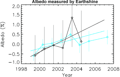
THE ESCALATOR

(free to republish)